Whitney Creek Topo Map Montana
To zoom in, hover over the map of Whitney Creek
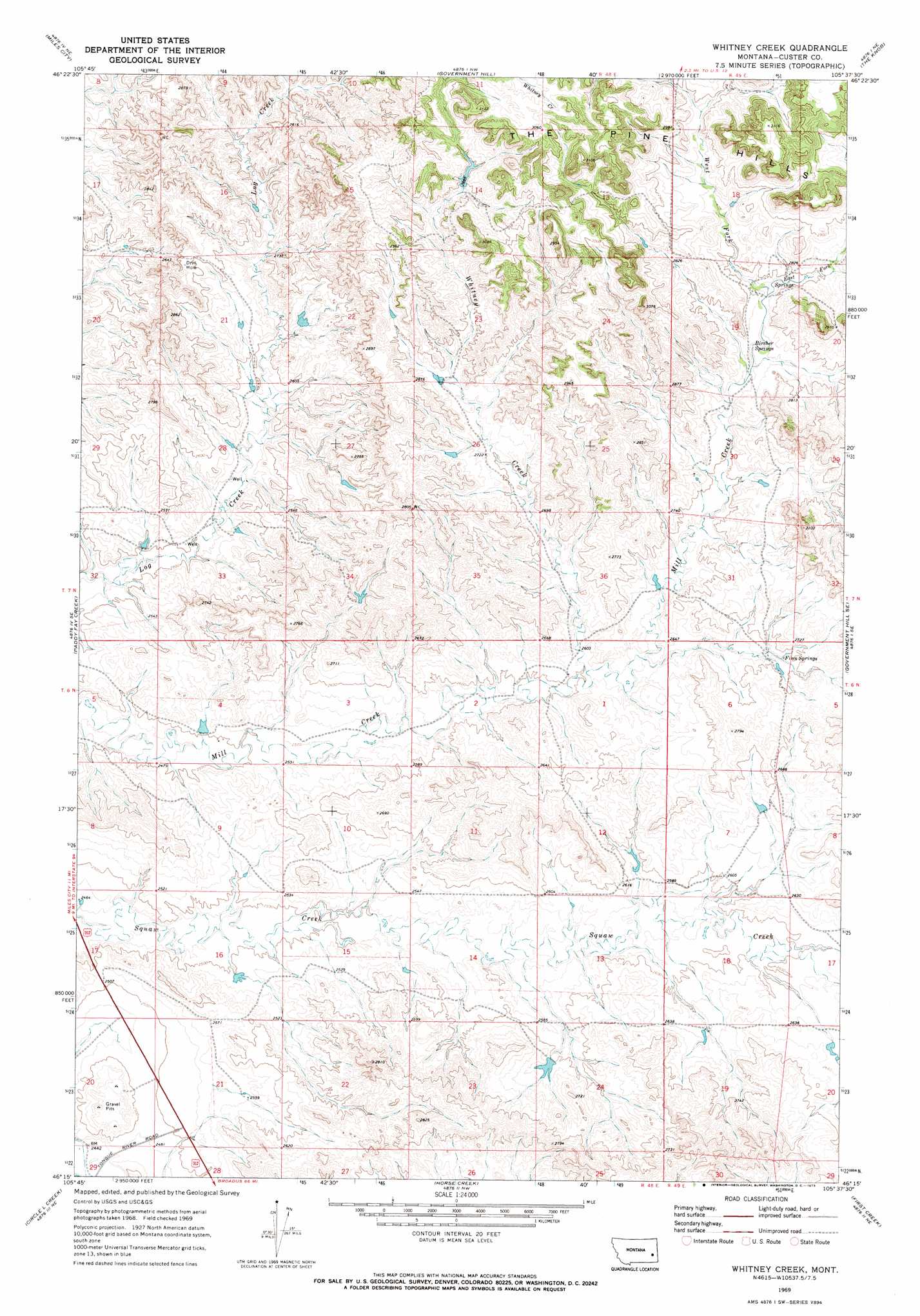
USGS Topo Quad 46105c6 - 1:24,000 scale
| Topo Map Name: | Whitney Creek |
| USGS Topo Quad ID: | 46105c6 |
| Print Size: | ca. 21 1/4" wide x 27" high |
| Southeast Coordinates: | 46.25° N latitude / 105.625° W longitude |
| Map Center Coordinates: | 46.3125° N latitude / 105.6875° W longitude |
| U.S. State: | MT |
| Filename: | o46105c6.jpg |
| Download Map JPG Image: | Whitney Creek topo map 1:24,000 scale |
| Map Type: | Topographic |
| Topo Series: | 7.5´ |
| Map Scale: | 1:24,000 |
| Source of Map Images: | United States Geological Survey (USGS) |
| Alternate Map Versions: |
Whitney Creek MT 1969, updated 1973 Download PDF Buy paper map Whitney Creek MT 2011 Download PDF Buy paper map Whitney Creek MT 2014 Download PDF Buy paper map |
1:24,000 Topo Quads surrounding Whitney Creek
Deadman Creek |
Noble Reservoir |
Kinsey |
Shirley |
Corral Butte |
Big Hill |
Miles City |
Government Hill |
The Knob |
Buck Mountain |
Lignite Creek |
Paddy Fay Creek |
Whitney Creek |
Government Hill Se |
Locate Sw |
Jack Creek Nw |
Circle L Creek |
Horse Creek |
First Creek |
Loaf Of Bread Butte |
Garland School |
Jack Creek |
Beebe Sw |
Beebe |
Miles City Creek |
> Back to 46105a1 at 1:100,000 scale
> Back to 46104a1 at 1:250,000 scale
> Back to U.S. Topo Maps home
Whitney Creek topo map: Gazetteer
Whitney Creek: Dams
Hirsch Number 1 Dam elevation 799m 2621′Murray Number 1 Dam elevation 882m 2893′
Whitney Creek: Springs
Bircher Springs elevation 834m 2736′Finn Springs elevation 815m 2673′
Whitney Creek: Streams
East Fork Mill Creek elevation 844m 2769′West Fork Mill Creek elevation 844m 2769′
Whitney Creek: Wells
06N48E14ABBB01 Well elevation 769m 2522′07N49E19ABC_01 Well elevation 852m 2795′
07N49E30CBAC01 Well elevation 834m 2736′
Whitney Creek digital topo map on disk
Buy this Whitney Creek topo map showing relief, roads, GPS coordinates and other geographical features, as a high-resolution digital map file on DVD:
Eastern Montana & Western North Dakota
Buy digital topo maps: Eastern Montana & Western North Dakota