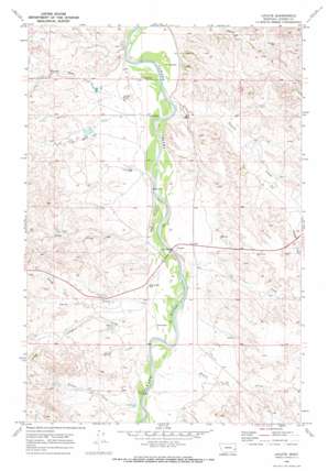
Locate Topo Map Montana
To zoom in, hover over the map of Locate
USGS Topo Quad 46105d3 - 1:24,000 scale
| Topo Map Name: | Locate |
| USGS Topo Quad ID: | 46105d3 |
| Print Size: | ca. 21 1/4" wide x 27" high |
| Southeast Coordinates: | 46.375° N latitude / 105.25° W longitude |
| Map Center Coordinates: | 46.4375° N latitude / 105.3125° W longitude |
| U.S. State: | MT |
| Filename: | o46105d3.jpg |
| Download Map JPG Image: | Locate topo map 1:24,000 scale |
| Map Type: | Topographic |
| Topo Series: | 7.5´ |
| Map Scale: | 1:24,000 |
| Source of Map Images: | United States Geological Survey (USGS) |
| Alternate Map Versions: |
Locate MT 1969, updated 1973 Download PDF Buy paper map Locate MT 2011 Download PDF Buy paper map Locate MT 2014 Download PDF Buy paper map |
1:24,000 Topo Quads surrounding Locate
> Back to 46105a1 at 1:100,000 scale
> Back to 46104a1 at 1:250,000 scale
> Back to U.S. Topo Maps home
Locate topo map: Gazetteer
Locate: Bridges
Locate Creek Bridge elevation 731m 2398′Powder River Bridge elevation 729m 2391′
Locate: Dams
Bixler Number 2 Dam elevation 762m 2500′Bixler Number 5 Dam elevation 802m 2631′
Griffin Number 2 Dam elevation 745m 2444′
Odegard Number 2 Dam elevation 758m 2486′
Locate: Parks
Powder River Historical Marker elevation 820m 2690′Locate: Post Offices
Locate Post Office (historical) elevation 754m 2473′Locate: Streams
Cox Creek elevation 729m 2391′Deep Creek elevation 728m 2388′
Fortyfour Creek elevation 742m 2434′
Holmes Creek elevation 733m 2404′
Locate Creek elevation 723m 2372′
Meyers Creek elevation 738m 2421′
North Fork Smith Creek elevation 769m 2522′
North Wolf Creek elevation 734m 2408′
Rabbidge Creek elevation 775m 2542′
Short Creek elevation 744m 2440′
Smith Creek elevation 732m 2401′
Wolf Creek elevation 723m 2372′
Locate: Wells
08N51E09ACAC01 Well elevation 758m 2486′08N51E10DDAA01 Well elevation 733m 2404′
08N51E10DDAD01 Well elevation 733m 2404′
08N51E14CBBD01 Well elevation 732m 2401′
08N51E14DC__01 Well elevation 733m 2404′
08N51E15ABDA01 Well elevation 734m 2408′
08N51E22DD__01 Well elevation 761m 2496′
08N51E23DD__01 Well elevation 744m 2440′
08N51E25BACA01 Well elevation 754m 2473′
08N51E26BBBA01 Well elevation 742m 2434′
08N51E26CC__01 Well elevation 742m 2434′
08N51E33CACB01 Well elevation 772m 2532′
08N53E33AABA01 Well elevation 777m 2549′
Holmes Flowing Well elevation 738m 2421′
Locate digital topo map on disk
Buy this Locate topo map showing relief, roads, GPS coordinates and other geographical features, as a high-resolution digital map file on DVD:
Eastern Montana & Western North Dakota
Buy digital topo maps: Eastern Montana & Western North Dakota


