Corral Butte Topo Map Montana
To zoom in, hover over the map of Corral Butte
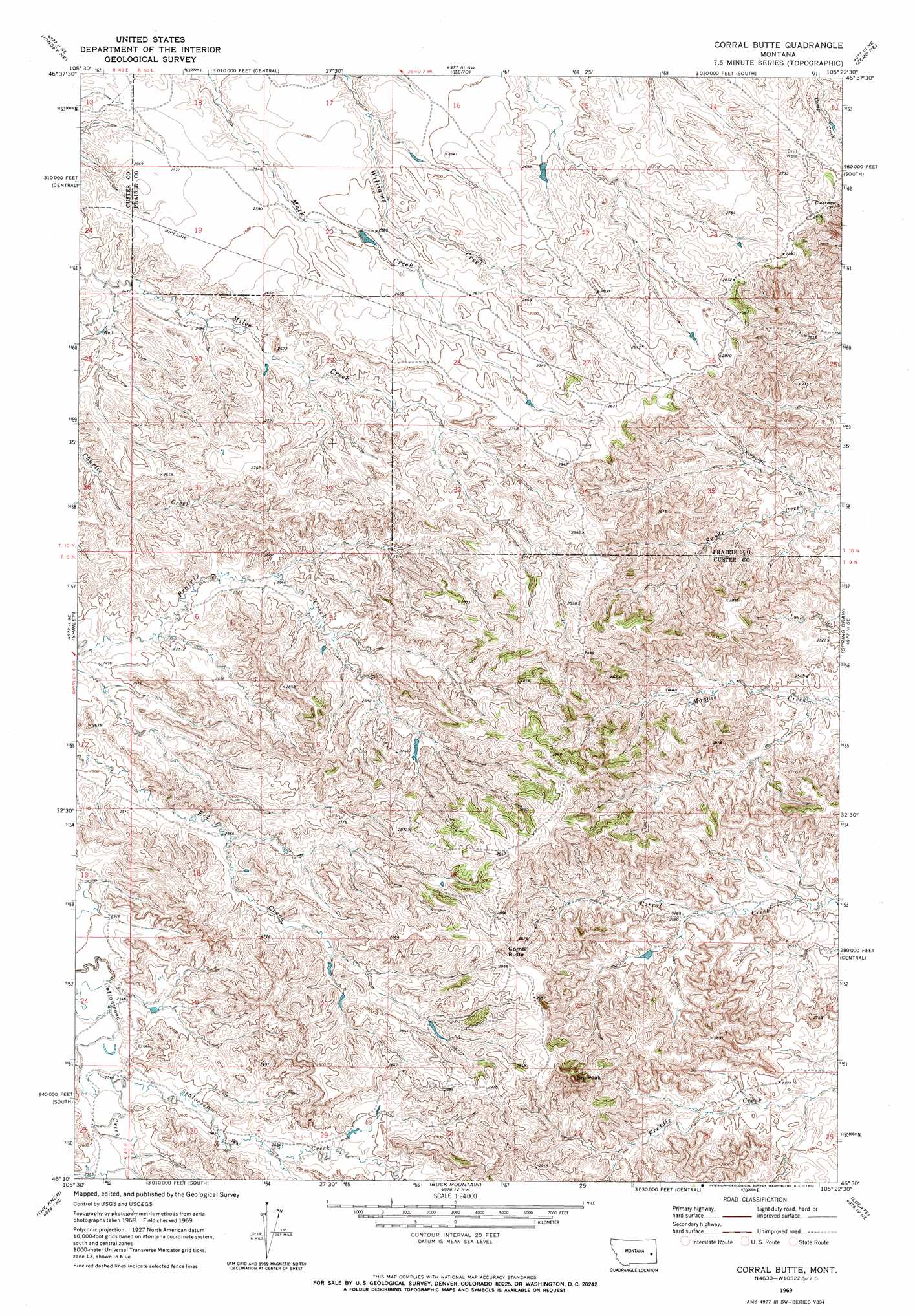
USGS Topo Quad 46105e4 - 1:24,000 scale
| Topo Map Name: | Corral Butte |
| USGS Topo Quad ID: | 46105e4 |
| Print Size: | ca. 21 1/4" wide x 27" high |
| Southeast Coordinates: | 46.5° N latitude / 105.375° W longitude |
| Map Center Coordinates: | 46.5625° N latitude / 105.4375° W longitude |
| U.S. State: | MT |
| Filename: | o46105e4.jpg |
| Download Map JPG Image: | Corral Butte topo map 1:24,000 scale |
| Map Type: | Topographic |
| Topo Series: | 7.5´ |
| Map Scale: | 1:24,000 |
| Source of Map Images: | United States Geological Survey (USGS) |
| Alternate Map Versions: |
Corral Butte MT 1969, updated 1972 Download PDF Buy paper map Corral Butte MT 2011 Download PDF Buy paper map Corral Butte MT 2014 Download PDF Buy paper map |
1:24,000 Topo Quads surrounding Corral Butte
Physic Creek |
Mcclure Reservoir |
Calypso |
Terry |
Fallon Sw |
Kinsey Nw |
Kinsey Ne |
Zero |
Zero Ne |
Flat Top Butte |
Kinsey |
Shirley |
Corral Butte |
Spring Draw |
Flat Top Butte Sw |
Government Hill |
The Knob |
Buck Mountain |
Locate |
Hogan Creek |
Whitney Creek |
Government Hill Se |
Locate Sw |
Locate Se |
Red Knob |
> Back to 46105e1 at 1:100,000 scale
> Back to 46104a1 at 1:250,000 scale
> Back to U.S. Topo Maps home
Corral Butte topo map: Gazetteer
Corral Butte: Streams
Schlosser Creek elevation 778m 2552′Threemile Creek elevation 788m 2585′
Corral Butte: Summits
Big Peak elevation 970m 3182′Corral Butte elevation 939m 3080′
Corral Butte digital topo map on disk
Buy this Corral Butte topo map showing relief, roads, GPS coordinates and other geographical features, as a high-resolution digital map file on DVD:
Eastern Montana & Western North Dakota
Buy digital topo maps: Eastern Montana & Western North Dakota