Kinsey Nw Topo Map Montana
To zoom in, hover over the map of Kinsey Nw
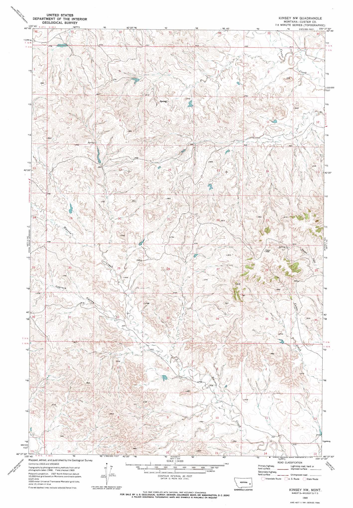
USGS Topo Quad 46105f6 - 1:24,000 scale
| Topo Map Name: | Kinsey Nw |
| USGS Topo Quad ID: | 46105f6 |
| Print Size: | ca. 21 1/4" wide x 27" high |
| Southeast Coordinates: | 46.625° N latitude / 105.625° W longitude |
| Map Center Coordinates: | 46.6875° N latitude / 105.6875° W longitude |
| U.S. State: | MT |
| Filename: | o46105f6.jpg |
| Download Map JPG Image: | Kinsey Nw topo map 1:24,000 scale |
| Map Type: | Topographic |
| Topo Series: | 7.5´ |
| Map Scale: | 1:24,000 |
| Source of Map Images: | United States Geological Survey (USGS) |
| Alternate Map Versions: |
Kinsey NW MT 1969, updated 1973 Download PDF Buy paper map Kinsey NW MT 2011 Download PDF Buy paper map Kinsey NW MT 2014 Download PDF Buy paper map |
1:24,000 Topo Quads surrounding Kinsey Nw
Combs Ranch |
Little Sheep Mountain |
South Fork Reservoir |
Mccloud |
Papps Reservoir |
Twin Buttes School |
Morehouse Creek |
Physic Creek |
Mcclure Reservoir |
Calypso |
Horse Creek Hill |
Coal Bank Spring |
Kinsey Nw |
Kinsey Ne |
Zero |
Deadman Creek |
Noble Reservoir |
Kinsey |
Shirley |
Corral Butte |
Big Hill |
Miles City |
Government Hill |
The Knob |
Buck Mountain |
> Back to 46105e1 at 1:100,000 scale
> Back to 46104a1 at 1:250,000 scale
> Back to U.S. Topo Maps home
Kinsey Nw topo map: Gazetteer
Kinsey Nw: Dams
Gumbo Number 3 Dam elevation 807m 2647′Gumbo Number 4 Dam elevation 837m 2746′
Haughian Number 10 Dam elevation 747m 2450′
Haughian Number 5 Dam elevation 801m 2627′
Kinsey Nw: Valleys
Caprock Coulee elevation 777m 2549′Kinsey Nw: Wells
10N48E03CCBA01 Well elevation 752m 2467′10N48E11DCCD01 Well elevation 732m 2401′
11N48E36CCC_01 Well elevation 810m 2657′
Kinsey Nw digital topo map on disk
Buy this Kinsey Nw topo map showing relief, roads, GPS coordinates and other geographical features, as a high-resolution digital map file on DVD:
Eastern Montana & Western North Dakota
Buy digital topo maps: Eastern Montana & Western North Dakota