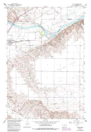
Fallon Topo Map Montana
To zoom in, hover over the map of Fallon
USGS Topo Quad 46105g1 - 1:24,000 scale
| Topo Map Name: | Fallon |
| USGS Topo Quad ID: | 46105g1 |
| Print Size: | ca. 21 1/4" wide x 27" high |
| Southeast Coordinates: | 46.75° N latitude / 105° W longitude |
| Map Center Coordinates: | 46.8125° N latitude / 105.0625° W longitude |
| U.S. State: | MT |
| Filename: | o46105g1.jpg |
| Download Map JPG Image: | Fallon topo map 1:24,000 scale |
| Map Type: | Topographic |
| Topo Series: | 7.5´ |
| Map Scale: | 1:24,000 |
| Source of Map Images: | United States Geological Survey (USGS) |
| Alternate Map Versions: |
Fallon MT 1966, updated 1970 Download PDF Buy paper map Fallon MT 1966, updated 1978 Download PDF Buy paper map Fallon MT 1966, updated 1985 Download PDF Buy paper map Fallon MT 2011 Download PDF Buy paper map Fallon MT 2014 Download PDF Buy paper map |
1:24,000 Topo Quads surrounding Fallon
> Back to 46105e1 at 1:100,000 scale
> Back to 46104a1 at 1:250,000 scale
> Back to U.S. Topo Maps home
Fallon topo map: Gazetteer
Fallon: Bridges
Yellowstone River Bridge elevation 647m 2122′Fallon: Cliffs
Barrs Bluffs elevation 703m 2306′Fallon: Dams
Saucer Number 1 Dam elevation 779m 2555′Fallon: Flats
Fallon Flat elevation 768m 2519′Fallon: Parks
Walther Park elevation 673m 2208′Fallon: Populated Places
Fallon elevation 673m 2208′Fallon: Post Offices
Danton Post Office (historical) elevation 658m 2158′Fallon Post Office elevation 672m 2204′
Fallon: Rapids
De Russys Rapids elevation 641m 2103′Fallon: Streams
Hatchet Creek elevation 641m 2103′Fallon: Valleys
Plum Coulee elevation 689m 2260′Fallon: Wells
12N52E25BA__01 Well elevation 688m 2257′12N53E04BB__01 Well elevation 695m 2280′
12N53E23CA__01 Well elevation 767m 2516′
12N53E23CA__02 Well elevation 767m 2516′
12N53E23CDBA01 Well elevation 769m 2522′
13N52E24DBCB01 Well elevation 686m 2250′
13N52E24DCA_01 Well elevation 680m 2230′
13N52E25BAAB01 Well elevation 680m 2230′
13N52E25BDA_01 Well elevation 660m 2165′
13N52E34CBDC01 Well elevation 674m 2211′
13N52E34CDAD01 Well elevation 674m 2211′
13N53E19CBA_01 Well elevation 683m 2240′
13N53E19DBA_01 Well elevation 680m 2230′
13N53E19DDC_01 Well elevation 674m 2211′
13N53E20AAC_01 Well elevation 675m 2214′
13N53E20DCA_01 Well elevation 668m 2191′
13N53E22BAA_03 Well elevation 658m 2158′
13N53E22BAC_01 Well elevation 658m 2158′
13N53E29ACB_01 Well elevation 662m 2171′
13N53E29ACC_01 Well elevation 661m 2168′
13N53E29BBC_01 Well elevation 674m 2211′
13N53E29BCD_01 Well elevation 667m 2188′
13N53E29BCD_02 Well elevation 667m 2188′
13N53E29BCD_03 Well elevation 667m 2188′
13N53E29BDA_01 Well elevation 662m 2171′
13N53E29BDB_01 Well elevation 665m 2181′
13N53E29CAB_01 Well elevation 664m 2178′
13N53E29CBB_01 Well elevation 661m 2168′
13N53E29CBC_01 Well elevation 662m 2171′
13N53E30ADD_01 Well elevation 671m 2201′
13N53E30BBB_01 Well elevation 677m 2221′
13N53E30DABC01 Well elevation 666m 2185′
13N53E30DDB_01 Well elevation 661m 2168′
Fallon digital topo map on disk
Buy this Fallon topo map showing relief, roads, GPS coordinates and other geographical features, as a high-resolution digital map file on DVD:
Eastern Montana & Western North Dakota
Buy digital topo maps: Eastern Montana & Western North Dakota


