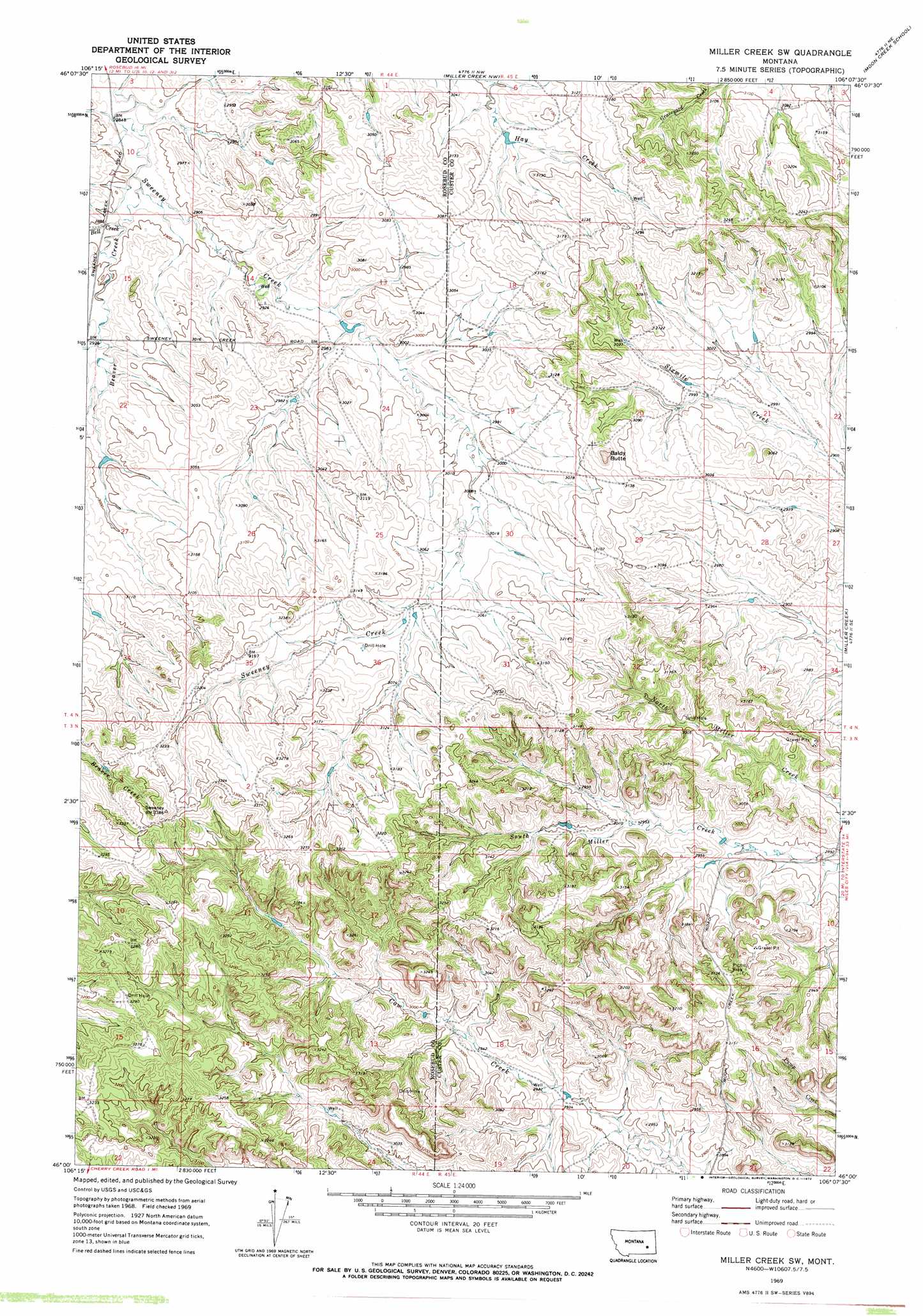
Miller Creek Sw Topo Map Montana
To zoom in, hover over the map of Miller Creek Sw
USGS Topo Quad 46106a2 - 1:24,000 scale
| Topo Map Name: | Miller Creek Sw |
| USGS Topo Quad ID: | 46106a2 |
| Print Size: | ca. 21 1/4" wide x 27" high |
| Southeast Coordinates: | 46° N latitude / 106.125° W longitude |
| Map Center Coordinates: | 46.0625° N latitude / 106.1875° W longitude |
| U.S. State: | MT |
| Filename: | o46106a2.jpg |
| Download Map JPG Image: | Miller Creek Sw topo map 1:24,000 scale |
| Map Type: | Topographic |
| Topo Series: | 7.5´ |
| Map Scale: | 1:24,000 |
| Source of Map Images: | United States Geological Survey (USGS) |
| Alternate Map Versions: |
Miller Creek SW MT 1969, updated 1972 Download PDF Buy paper map Miller Creek SW MT 2011 Download PDF Buy paper map Miller Creek SW MT 2014 Download PDF Buy paper map |
1:24,000 Topo Quads surrounding Miller Creek Sw
Rosebud |
Thurlow |
Hathaway |
Horton |
Lignite Creek |
Rosebud Buttes |
Indian Creek |
Miller Creek Nw |
Moon Creek School |
Jack Creek Nw |
Mitchell Coulee |
Crain Place |
Miller Creek Sw |
Miller Creek |
Garland School |
Hammond Draw Nw |
John Hen Creek |
Brandenberg Nw |
H S School |
Fourmile Creek |
Hammond Draw Sw |
Hammond Draw |
Brandenberg |
Hayes Point |
North Stacey School |
> Back to 46106a1 at 1:100,000 scale
> Back to 46106a1 at 1:250,000 scale
> Back to U.S. Topo Maps home
Miller Creek Sw topo map: Gazetteer
Miller Creek Sw: Streams
Bell Creek elevation 878m 2880′Miller Creek Sw: Summits
Baldy Butte elevation 986m 3234′Miller Creek Sw: Wells
03N44E01CACA01 Well elevation 976m 3202′03N44E02DBAA01 Well elevation 994m 3261′
03N44E24ACAC01 Well elevation 916m 3005′
03N44E24ACAC02 Well elevation 916m 3005′
03N44E24ACAC03 Well elevation 916m 3005′
03N44E24BBAA01 Well elevation 926m 3038′
04N44E23ADCC01 Well elevation 910m 2985′
04N44E24BADA01 Well elevation 902m 2959′
04N44E24BBAB01 Well elevation 900m 2952′
04N44E36AABA01 Well elevation 929m 3047′
Miller Creek Sw digital topo map on disk
Buy this Miller Creek Sw topo map showing relief, roads, GPS coordinates and other geographical features, as a high-resolution digital map file on DVD:
Eastern Montana & Western North Dakota
Buy digital topo maps: Eastern Montana & Western North Dakota