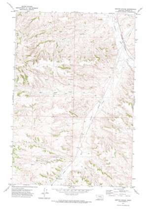
Griffin Coulee Topo Map Montana
To zoom in, hover over the map of Griffin Coulee
USGS Topo Quad 46106a7 - 1:24,000 scale
| Topo Map Name: | Griffin Coulee |
| USGS Topo Quad ID: | 46106a7 |
| Print Size: | ca. 21 1/4" wide x 27" high |
| Southeast Coordinates: | 46° N latitude / 106.75° W longitude |
| Map Center Coordinates: | 46.0625° N latitude / 106.8125° W longitude |
| U.S. State: | MT |
| Filename: | o46106a7.jpg |
| Download Map JPG Image: | Griffin Coulee topo map 1:24,000 scale |
| Map Type: | Topographic |
| Topo Series: | 7.5´ |
| Map Scale: | 1:24,000 |
| Source of Map Images: | United States Geological Survey (USGS) |
| Alternate Map Versions: |
Griffin Coulee MT 1971, updated 1974 Download PDF Buy paper map Griffin Coulee MT 2011 Download PDF Buy paper map Griffin Coulee MT 2014 Download PDF Buy paper map |
1:24,000 Topo Quads surrounding Griffin Coulee
> Back to 46106a1 at 1:100,000 scale
> Back to 46106a1 at 1:250,000 scale
> Back to U.S. Topo Maps home
Griffin Coulee topo map: Gazetteer
Griffin Coulee: Dams
Ashenhurst Number 1 Dam elevation 933m 3061′Griffin Coulee: Post Offices
Lisle Post Office (historical) elevation 882m 2893′Griffin Coulee: Streams
East Cromo Creek elevation 895m 2936′East Fork Armells Creek elevation 853m 2798′
West Cromo Creek elevation 894m 2933′
West Fork Armells Creek elevation 853m 2798′
West Sheep Creek elevation 866m 2841′
Griffin Coulee: Valleys
Griffin Coulee elevation 836m 2742′Griffin Coulee: Wells
04N40E09ADDC01 Well elevation 867m 2844′04N40E21C___01 Well elevation 856m 2808′
04N40E31DCAA01 Well elevation 888m 2913′
Griffin Coulee digital topo map on disk
Buy this Griffin Coulee topo map showing relief, roads, GPS coordinates and other geographical features, as a high-resolution digital map file on DVD:
Eastern Montana & Western North Dakota
Buy digital topo maps: Eastern Montana & Western North Dakota


