Smith Creek Topo Map Montana
To zoom in, hover over the map of Smith Creek
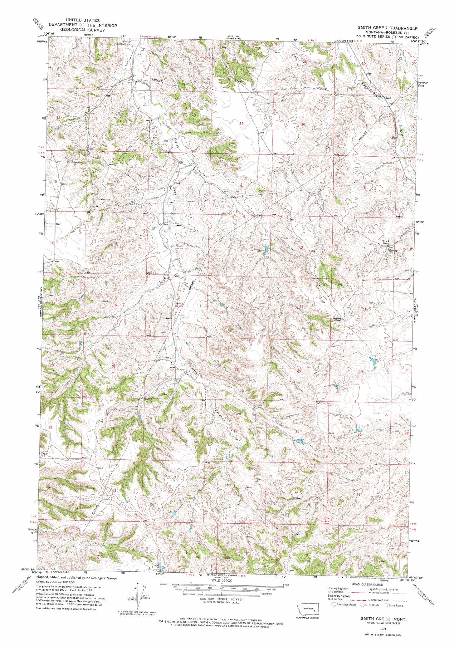
USGS Topo Quad 46106b6 - 1:24,000 scale
| Topo Map Name: | Smith Creek |
| USGS Topo Quad ID: | 46106b6 |
| Print Size: | ca. 21 1/4" wide x 27" high |
| Southeast Coordinates: | 46.125° N latitude / 106.625° W longitude |
| Map Center Coordinates: | 46.1875° N latitude / 106.6875° W longitude |
| U.S. State: | MT |
| Filename: | o46106b6.jpg |
| Download Map JPG Image: | Smith Creek topo map 1:24,000 scale |
| Map Type: | Topographic |
| Topo Series: | 7.5´ |
| Map Scale: | 1:24,000 |
| Source of Map Images: | United States Geological Survey (USGS) |
| Alternate Map Versions: |
Smith Creek MT 1971, updated 1974 Download PDF Buy paper map Smith Creek MT 2011 Download PDF Buy paper map Smith Creek MT 2014 Download PDF Buy paper map |
1:24,000 Topo Quads surrounding Smith Creek
Donleys Reservoir |
Finch Ne |
Black Coulee |
Schultz Coulee |
Box Canyon Coulee |
Finch |
Nichols |
Forsyth |
Orinoco |
Rosebud |
Griffin Coulee Nw |
Griffin Coulee Ne |
Smith Creek |
Smith Creek Ne |
Rosebud Buttes |
Griffin Coulee Sw |
Griffin Coulee |
Sheep Creek Camp |
Mckerlich Creek |
Mitchell Coulee |
Mcclure Creek |
Trail Creek School |
Colstrip West |
Colstrip East |
Hammond Draw Nw |
> Back to 46106a1 at 1:100,000 scale
> Back to 46106a1 at 1:250,000 scale
> Back to U.S. Topo Maps home
Smith Creek topo map: Gazetteer
Smith Creek: Dams
Friez Number 2 Dam elevation 971m 3185′Smith Creek: Streams
Long Prong elevation 817m 2680′Smith Creek: Wells
05N40E22BDAC01 Well elevation 884m 2900′05N40E28AADC01 Well elevation 921m 3021′
Smith Creek digital topo map on disk
Buy this Smith Creek topo map showing relief, roads, GPS coordinates and other geographical features, as a high-resolution digital map file on DVD:
Eastern Montana & Western North Dakota
Buy digital topo maps: Eastern Montana & Western North Dakota