South Bear Creek Topo Map Montana
To zoom in, hover over the map of South Bear Creek
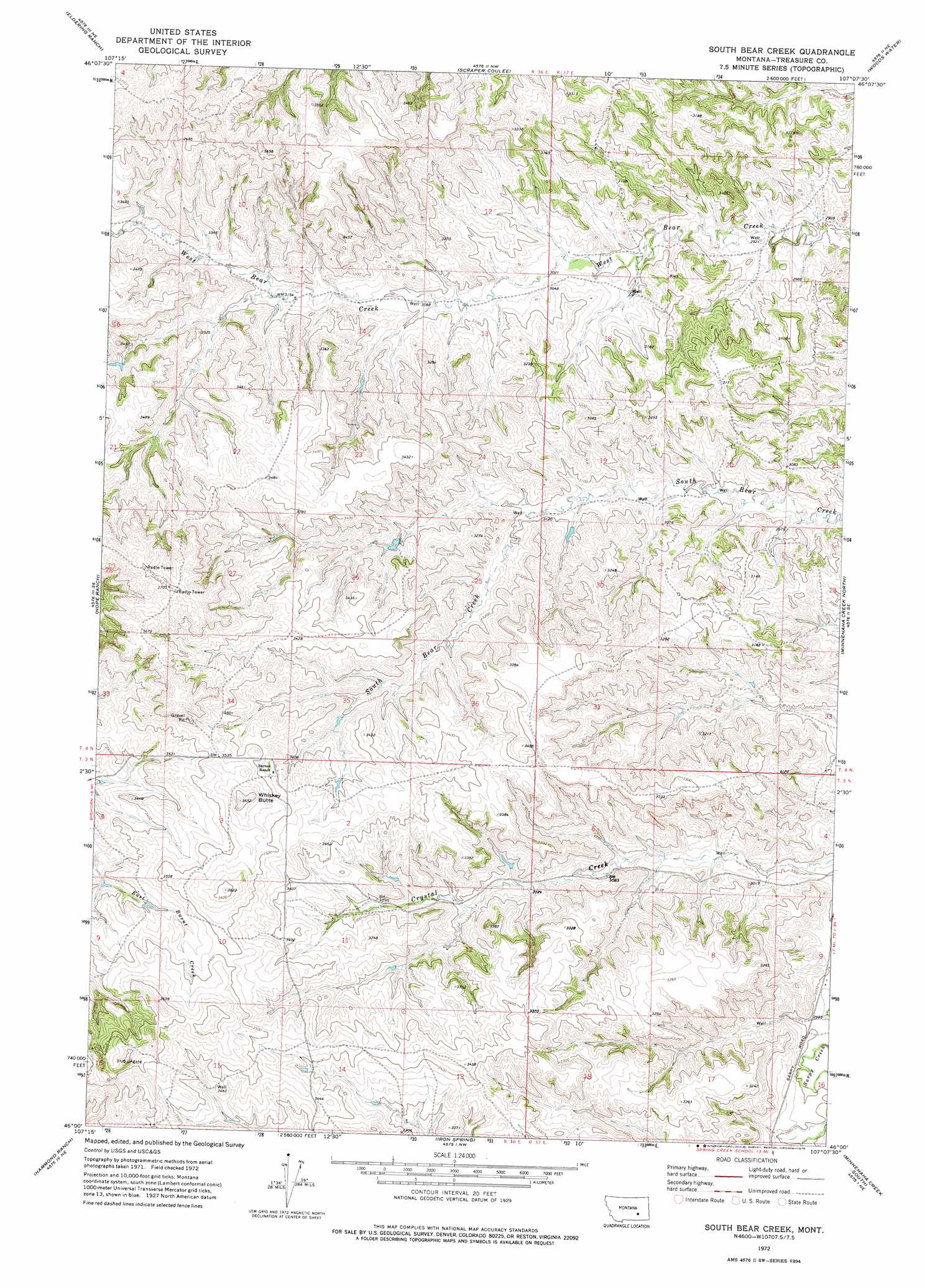
USGS Topo Quad 46107a2 - 1:24,000 scale
| Topo Map Name: | South Bear Creek |
| USGS Topo Quad ID: | 46107a2 |
| Print Size: | ca. 21 1/4" wide x 27" high |
| Southeast Coordinates: | 46° N latitude / 107.125° W longitude |
| Map Center Coordinates: | 46.0625° N latitude / 107.1875° W longitude |
| U.S. State: | MT |
| Filename: | o46107a2.jpg |
| Download Map JPG Image: | South Bear Creek topo map 1:24,000 scale |
| Map Type: | Topographic |
| Topo Series: | 7.5´ |
| Map Scale: | 1:24,000 |
| Source of Map Images: | United States Geological Survey (USGS) |
| Alternate Map Versions: |
South Bear Creek MT 1972, updated 1975 Download PDF Buy paper map South Bear Creek MT 2011 Download PDF Buy paper map South Bear Creek MT 2014 Download PDF Buy paper map |
1:24,000 Topo Quads surrounding South Bear Creek
Rancher Cemetery |
Myers |
Hysham |
Sanders |
Finch |
Bighorn |
Eldering Ranch |
Scraper Coulee |
Woods Water |
Griffin Coulee Nw |
Marsh Coulee |
Hope Ranch |
South Bear Creek |
Minnehaha Creek North |
Griffin Coulee Sw |
Dudley Spring |
Hammond Ranch |
Iron Spring |
Minnehaha Creek South |
Mcclure Creek |
The Dugout |
Padlock Ranch |
Iron Spring Sw |
Wolf School |
Sarpy School |
> Back to 46107a1 at 1:100,000 scale
> Back to 46106a1 at 1:250,000 scale
> Back to U.S. Topo Maps home
South Bear Creek topo map: Gazetteer
South Bear Creek: Populated Places
Burnt Creek (historical) elevation 1066m 3497′South Bear Creek: Summits
Bulldog Butte elevation 1040m 3412′Whiskey Butte elevation 1112m 3648′
South Bear Creek: Wells
03N36E11BDAA01 Well elevation 1001m 3284′03N37E08DB__01 Well elevation 994m 3261′
04N36E14ADAA01 Well elevation 942m 3090′
04N36E15ADDC01 Well elevation 961m 3152′
South Bear Creek digital topo map on disk
Buy this South Bear Creek topo map showing relief, roads, GPS coordinates and other geographical features, as a high-resolution digital map file on DVD:
Eastern Montana & Western North Dakota
Buy digital topo maps: Eastern Montana & Western North Dakota