Mission Creek Topo Map Montana
To zoom in, hover over the map of Mission Creek
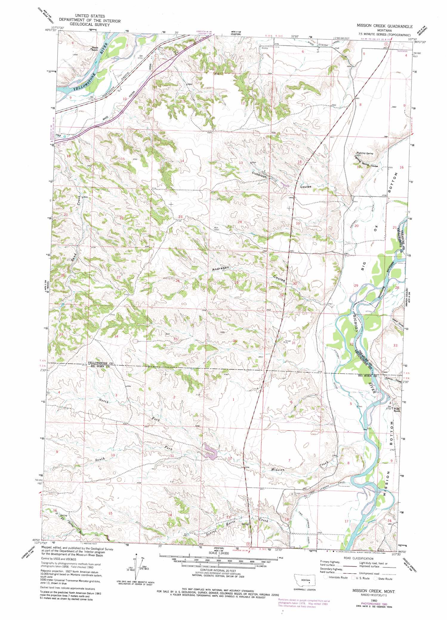
USGS Topo Quad 46107a5 - 1:24,000 scale
| Topo Map Name: | Mission Creek |
| USGS Topo Quad ID: | 46107a5 |
| Print Size: | ca. 21 1/4" wide x 27" high |
| Southeast Coordinates: | 46° N latitude / 107.5° W longitude |
| Map Center Coordinates: | 46.0625° N latitude / 107.5625° W longitude |
| U.S. State: | MT |
| Filename: | o46107a5.jpg |
| Download Map JPG Image: | Mission Creek topo map 1:24,000 scale |
| Map Type: | Topographic |
| Topo Series: | 7.5´ |
| Map Scale: | 1:24,000 |
| Source of Map Images: | United States Geological Survey (USGS) |
| Alternate Map Versions: |
Mission Creek MT 1960, updated 1962 Download PDF Buy paper map Mission Creek MT 1960, updated 1965 Download PDF Buy paper map Mission Creek MT 1960, updated 1980 Download PDF Buy paper map Mission Creek MT 2011 Download PDF Buy paper map Mission Creek MT 2014 Download PDF Buy paper map |
1:24,000 Topo Quads surrounding Mission Creek
Mailbox Hill |
Mexican Buttes |
Devils Kitchen |
Rancher Cemetery |
Myers |
Mud Butte |
Coal Bank Creek |
Custer |
Bighorn |
Eldering Ranch |
Bull Mountain |
Waco |
Mission Creek |
Marsh Coulee |
Hope Ranch |
Wagon Box Spring |
Lemon Ranch |
Foster |
Dudley Spring |
Hammond Ranch |
Blue Spring |
Chimney Creek |
Ninemile Point |
The Dugout |
Padlock Ranch |
> Back to 46107a1 at 1:100,000 scale
> Back to 46106a1 at 1:250,000 scale
> Back to U.S. Topo Maps home
Mission Creek topo map: Gazetteer
Mission Creek: Bends
Mission Bottom elevation 839m 2752′Mission Creek: Springs
Fighting Spring elevation 863m 2831′Mission Creek: Streams
Mission Creek elevation 842m 2762′North Fork Mission Creek elevation 883m 2896′
Sand Creek elevation 840m 2755′
Sorrel Horse Creek elevation 838m 2749′
South Fork Mission Creek elevation 883m 2896′
Mission Creek: Valleys
Andresen Coulee elevation 846m 2775′Cubbison Coulee elevation 835m 2739′
Eckman Coulee elevation 831m 2726′
Fighting Spring Coulee elevation 834m 2736′
Greene Coulee elevation 834m 2736′
Mission Creek: Wells
03N34E08BADB01 Well elevation 849m 2785′03N34E18DC__01 Well elevation 848m 2782′
03N34E18DC__02 Well elevation 848m 2782′
04N34E17CDDB01 Well elevation 866m 2841′
Mission Creek digital topo map on disk
Buy this Mission Creek topo map showing relief, roads, GPS coordinates and other geographical features, as a high-resolution digital map file on DVD:
Eastern Montana & Western North Dakota
Buy digital topo maps: Eastern Montana & Western North Dakota