Waco Topo Map Montana
To zoom in, hover over the map of Waco
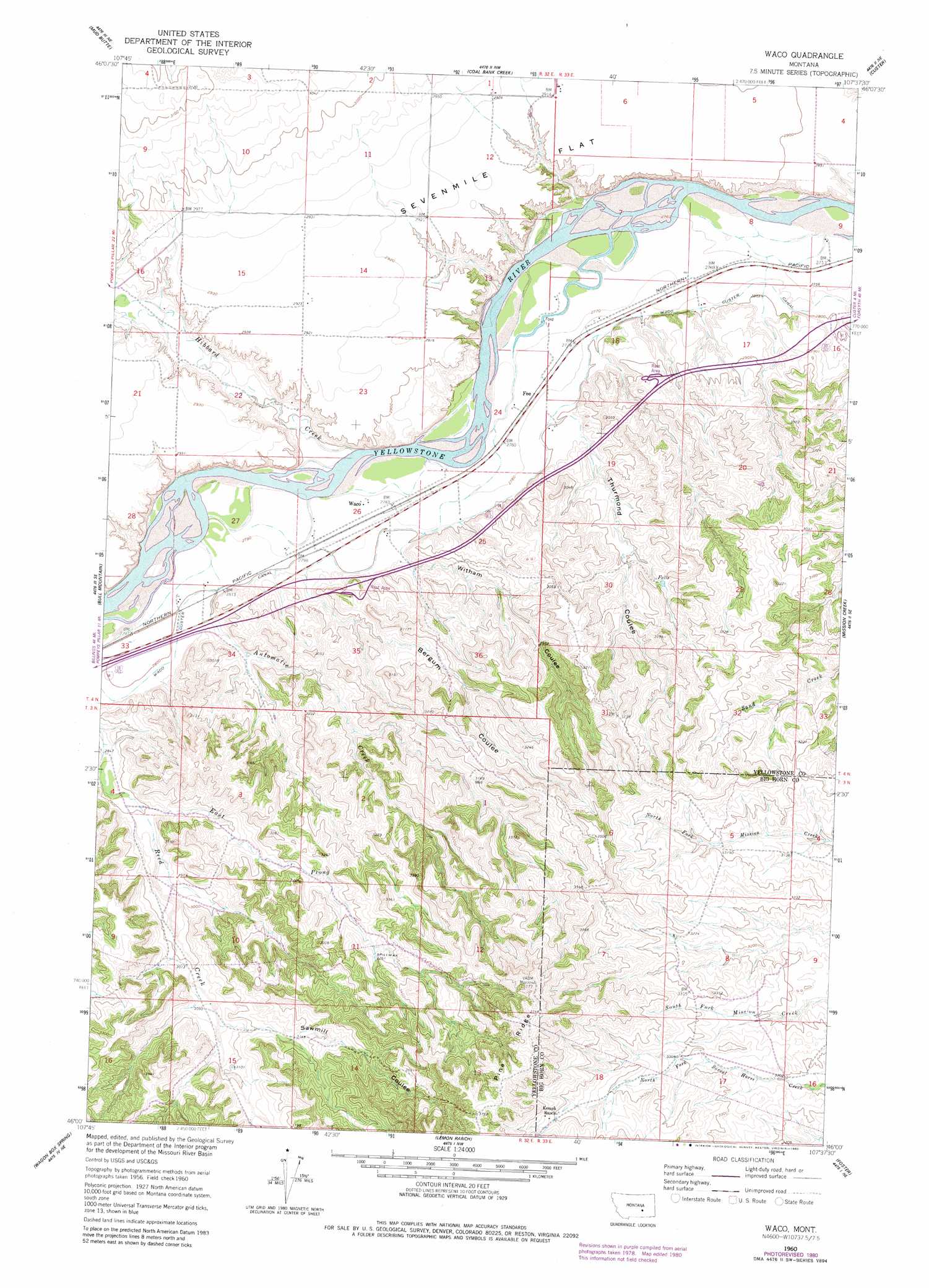
USGS Topo Quad 46107a6 - 1:24,000 scale
| Topo Map Name: | Waco |
| USGS Topo Quad ID: | 46107a6 |
| Print Size: | ca. 21 1/4" wide x 27" high |
| Southeast Coordinates: | 46° N latitude / 107.625° W longitude |
| Map Center Coordinates: | 46.0625° N latitude / 107.6875° W longitude |
| U.S. State: | MT |
| Filename: | o46107a6.jpg |
| Download Map JPG Image: | Waco topo map 1:24,000 scale |
| Map Type: | Topographic |
| Topo Series: | 7.5´ |
| Map Scale: | 1:24,000 |
| Source of Map Images: | United States Geological Survey (USGS) |
| Alternate Map Versions: |
Waco MT 1960, updated 1962 Download PDF Buy paper map Waco MT 1960, updated 1980 Download PDF Buy paper map Waco MT 2011 Download PDF Buy paper map Waco MT 2014 Download PDF Buy paper map |
1:24,000 Topo Quads surrounding Waco
Pine View |
Mailbox Hill |
Mexican Buttes |
Devils Kitchen |
Rancher Cemetery |
Bull Mountain Nw |
Mud Butte |
Coal Bank Creek |
Custer |
Bighorn |
Big Marys Island |
Bull Mountain |
Waco |
Mission Creek |
Marsh Coulee |
Pompeys Pillar |
Wagon Box Spring |
Lemon Ranch |
Foster |
Dudley Spring |
Corinth |
Blue Spring |
Chimney Creek |
Ninemile Point |
The Dugout |
> Back to 46107a1 at 1:100,000 scale
> Back to 46106a1 at 1:250,000 scale
> Back to U.S. Topo Maps home
Waco topo map: Gazetteer
Waco: Canals
Waco Custer Canal elevation 845m 2772′Waco: Flats
Sevenmile Flat elevation 888m 2913′Waco: Populated Places
Fee elevation 847m 2778′Waco elevation 849m 2785′
Waco: Streams
Automatic Creek elevation 851m 2791′East Prong Reed Creek elevation 884m 2900′
Hibbard Creek elevation 853m 2798′
Waco: Valleys
Bergum Coulee elevation 855m 2805′Sawmill Coulee elevation 931m 3054′
Thurmond Coulee elevation 854m 2801′
Witham Coulee elevation 845m 2772′
Waco: Wells
03N33E06AA__01 Well elevation 1023m 3356′04N32E14CCBA01 Well elevation 892m 2926′
04N32E26A___01 Well elevation 849m 2785′
04N32E35BABA01 Well elevation 898m 2946′
04N33E18DCAC01 Well elevation 899m 2949′
Waco digital topo map on disk
Buy this Waco topo map showing relief, roads, GPS coordinates and other geographical features, as a high-resolution digital map file on DVD:
Eastern Montana & Western North Dakota
Buy digital topo maps: Eastern Montana & Western North Dakota