Woods Water Topo Map Montana
To zoom in, hover over the map of Woods Water
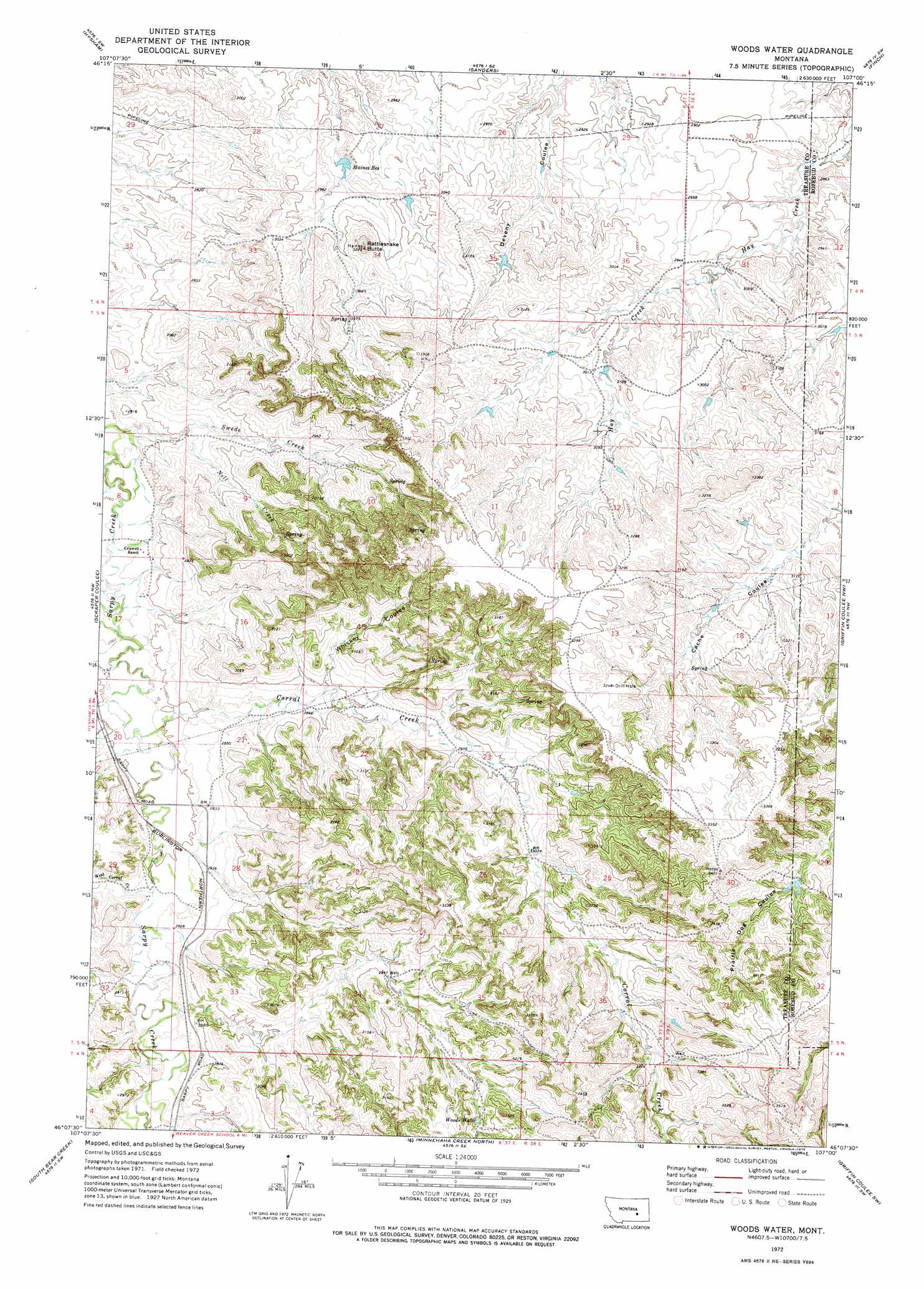
USGS Topo Quad 46107b1 - 1:24,000 scale
| Topo Map Name: | Woods Water |
| USGS Topo Quad ID: | 46107b1 |
| Print Size: | ca. 21 1/4" wide x 27" high |
| Southeast Coordinates: | 46.125° N latitude / 107° W longitude |
| Map Center Coordinates: | 46.1875° N latitude / 107.0625° W longitude |
| U.S. State: | MT |
| Filename: | o46107b1.jpg |
| Download Map JPG Image: | Woods Water topo map 1:24,000 scale |
| Map Type: | Topographic |
| Topo Series: | 7.5´ |
| Map Scale: | 1:24,000 |
| Source of Map Images: | United States Geological Survey (USGS) |
| Alternate Map Versions: |
Woods Water MT 1972, updated 1975 Download PDF Buy paper map Woods Water MT 2011 Download PDF Buy paper map Woods Water MT 2014 Download PDF Buy paper map |
1:24,000 Topo Quads surrounding Woods Water
Steie Ranch |
Ahles |
Vananda |
Donleys Reservoir |
Finch Ne |
Myers |
Hysham |
Sanders |
Finch |
Nichols |
Eldering Ranch |
Scraper Coulee |
Woods Water |
Griffin Coulee Nw |
Griffin Coulee Ne |
Hope Ranch |
South Bear Creek |
Minnehaha Creek North |
Griffin Coulee Sw |
Griffin Coulee |
Hammond Ranch |
Iron Spring |
Minnehaha Creek South |
Mcclure Creek |
Trail Creek School |
> Back to 46107a1 at 1:100,000 scale
> Back to 46106a1 at 1:250,000 scale
> Back to U.S. Topo Maps home
Woods Water topo map: Gazetteer
Woods Water: Dams
Haines Reservoir Dam elevation 893m 2929′Woods Water: Reservoirs
Haines Reservoir elevation 891m 2923′Woods Water: Springs
Woods Water elevation 957m 3139′Woods Water: Streams
Corral Creek elevation 848m 2782′Nell Creek elevation 855m 2805′
West Corral Creek elevation 857m 2811′
Woods Water: Summits
Rattlesnake Butte elevation 981m 3218′Woods Water: Valleys
Scraper Coulee elevation 837m 2746′Whiskey Coulee elevation 878m 2880′
Woods Water: Wells
05N37E08DCDC01 Well elevation 843m 2765′Woods Water digital topo map on disk
Buy this Woods Water topo map showing relief, roads, GPS coordinates and other geographical features, as a high-resolution digital map file on DVD:
Eastern Montana & Western North Dakota
Buy digital topo maps: Eastern Montana & Western North Dakota