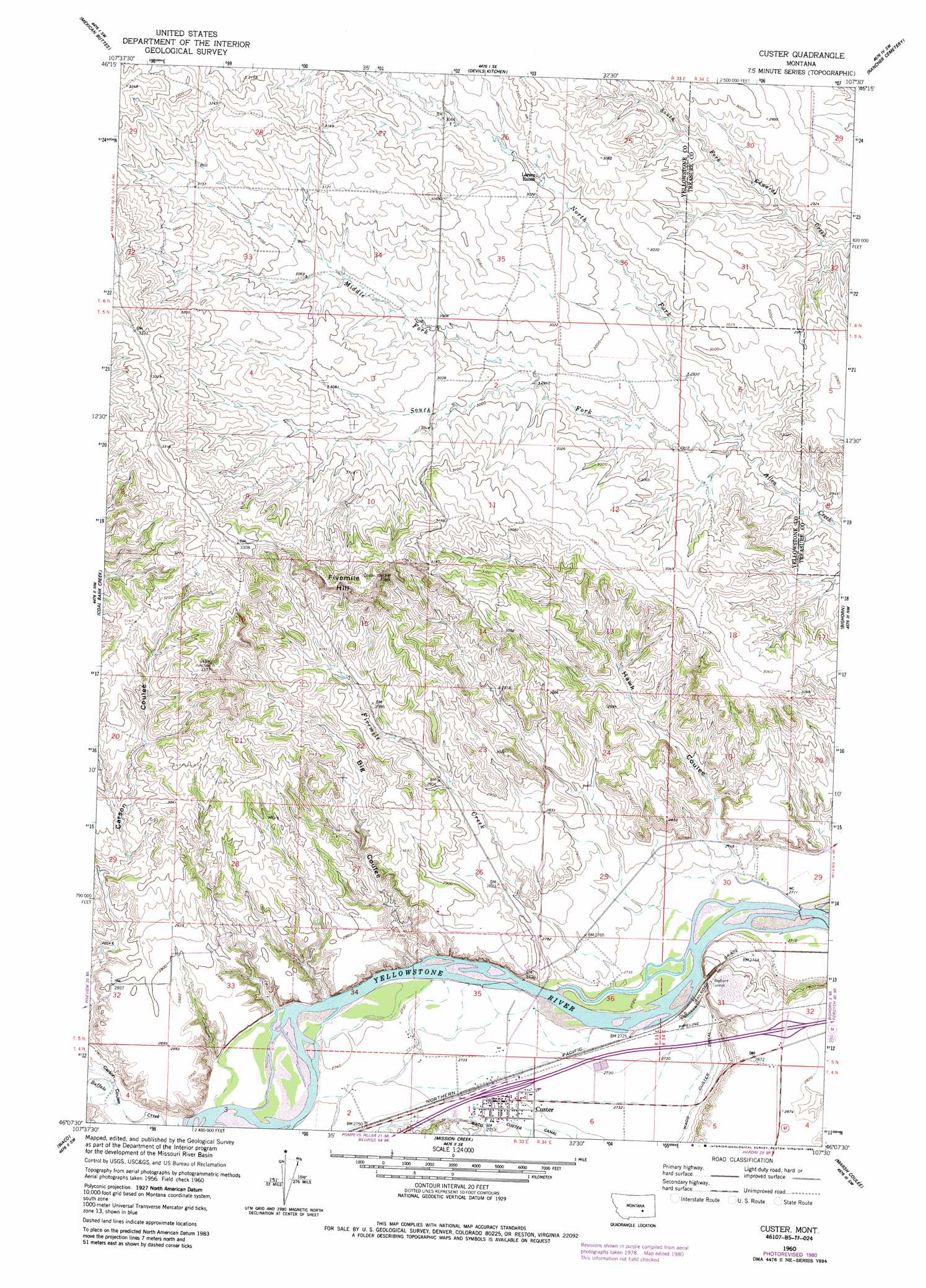
Custer Topo Map Montana
To zoom in, hover over the map of Custer
USGS Topo Quad 46107b5 - 1:24,000 scale
| Topo Map Name: | Custer |
| USGS Topo Quad ID: | 46107b5 |
| Print Size: | ca. 21 1/4" wide x 27" high |
| Southeast Coordinates: | 46.125° N latitude / 107.5° W longitude |
| Map Center Coordinates: | 46.1875° N latitude / 107.5625° W longitude |
| U.S. State: | MT |
| Filename: | o46107b5.jpg |
| Download Map JPG Image: | Custer topo map 1:24,000 scale |
| Map Type: | Topographic |
| Topo Series: | 7.5´ |
| Map Scale: | 1:24,000 |
| Source of Map Images: | United States Geological Survey (USGS) |
| Alternate Map Versions: |
Custer MT 1960, updated 1962 Download PDF Buy paper map Custer MT 1960, updated 1980 Download PDF Buy paper map Custer MT 1960, updated 1986 Download PDF Buy paper map Custer MT 2011 Download PDF Buy paper map Custer MT 2014 Download PDF Buy paper map |
1:24,000 Topo Quads surrounding Custer
Weed Creek West |
Weed Creek East |
Ruskosky Ridge |
Mckonkey Creek |
Steie Ranch |
Mailbox Hill |
Mexican Buttes |
Devils Kitchen |
Rancher Cemetery |
Myers |
Mud Butte |
Coal Bank Creek |
Custer |
Bighorn |
Eldering Ranch |
Bull Mountain |
Waco |
Mission Creek |
Marsh Coulee |
Hope Ranch |
Wagon Box Spring |
Lemon Ranch |
Foster |
Dudley Spring |
Hammond Ranch |
> Back to 46107a1 at 1:100,000 scale
> Back to 46106a1 at 1:250,000 scale
> Back to U.S. Topo Maps home
Custer topo map: Gazetteer
Custer: Airports
Ruff Airport elevation 834m 2736′Custer: Populated Places
Custer elevation 837m 2746′Custer: Streams
Buffalo Creek elevation 835m 2739′Fivemile Creek elevation 830m 2723′
Middle Fork Allen Creek elevation 903m 2962′
North Fork Allen Creek elevation 883m 2896′
South Fork Allen Creek elevation 882m 2893′
Custer: Summits
Fivemile Hill elevation 1025m 3362′Custer: Tunnels
Bighorn Tunnel elevation 864m 2834′Custer: Valleys
Big Coulee elevation 833m 2732′Hawk Coulee elevation 828m 2716′
Custer: Wells
05N33E10BBAC01 Well elevation 939m 3080′05N33E26D___01 Well elevation 855m 2805′
05N33E32ABCB01 Well elevation 874m 2867′
05N33E32DABC01 Well elevation 884m 2900′
Custer digital topo map on disk
Buy this Custer topo map showing relief, roads, GPS coordinates and other geographical features, as a high-resolution digital map file on DVD:
Eastern Montana & Western North Dakota
Buy digital topo maps: Eastern Montana & Western North Dakota