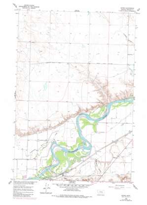
Myers Topo Map Montana
To zoom in, hover over the map of Myers
USGS Topo Quad 46107c3 - 1:24,000 scale
| Topo Map Name: | Myers |
| USGS Topo Quad ID: | 46107c3 |
| Print Size: | ca. 21 1/4" wide x 27" high |
| Southeast Coordinates: | 46.25° N latitude / 107.25° W longitude |
| Map Center Coordinates: | 46.3125° N latitude / 107.3125° W longitude |
| U.S. State: | MT |
| Filename: | o46107c3.jpg |
| Download Map JPG Image: | Myers topo map 1:24,000 scale |
| Map Type: | Topographic |
| Topo Series: | 7.5´ |
| Map Scale: | 1:24,000 |
| Source of Map Images: | United States Geological Survey (USGS) |
| Alternate Map Versions: |
Myers MT 1960, updated 1962 Download PDF Buy paper map Myers MT 1960, updated 1980 Download PDF Buy paper map Myers MT 2011 Download PDF Buy paper map Myers MT 2014 Download PDF Buy paper map |
1:24,000 Topo Quads surrounding Myers
> Back to 46107a1 at 1:100,000 scale
> Back to 46106a1 at 1:250,000 scale
> Back to U.S. Topo Maps home
Myers topo map: Gazetteer
Myers: Bridges
Buckingham Coulee Bridge elevation 835m 2739′Myers Bridge elevation 807m 2647′
Myers: Canals
Hysham Re-Lift Canal elevation 836m 2742′Myers: Dams
Decock Number 3 Dam elevation 862m 2828′Myers: Populated Places
Myers elevation 817m 2680′Myers: Post Offices
Myers Post Office (historical) elevation 817m 2680′Myers: Streams
Muggins Creek elevation 804m 2637′Myers: Valleys
Buckingham Coulee elevation 805m 2641′Myers: Wells
06N35E03C___01 Well elevation 862m 2828′06N35E05DAC_01 Well elevation 863m 2831′
06N36E07AD__01 Well elevation 805m 2641′
Myers digital topo map on disk
Buy this Myers topo map showing relief, roads, GPS coordinates and other geographical features, as a high-resolution digital map file on DVD:
Eastern Montana & Western North Dakota
Buy digital topo maps: Eastern Montana & Western North Dakota


