Devils Kitchen Topo Map Montana
To zoom in, hover over the map of Devils Kitchen
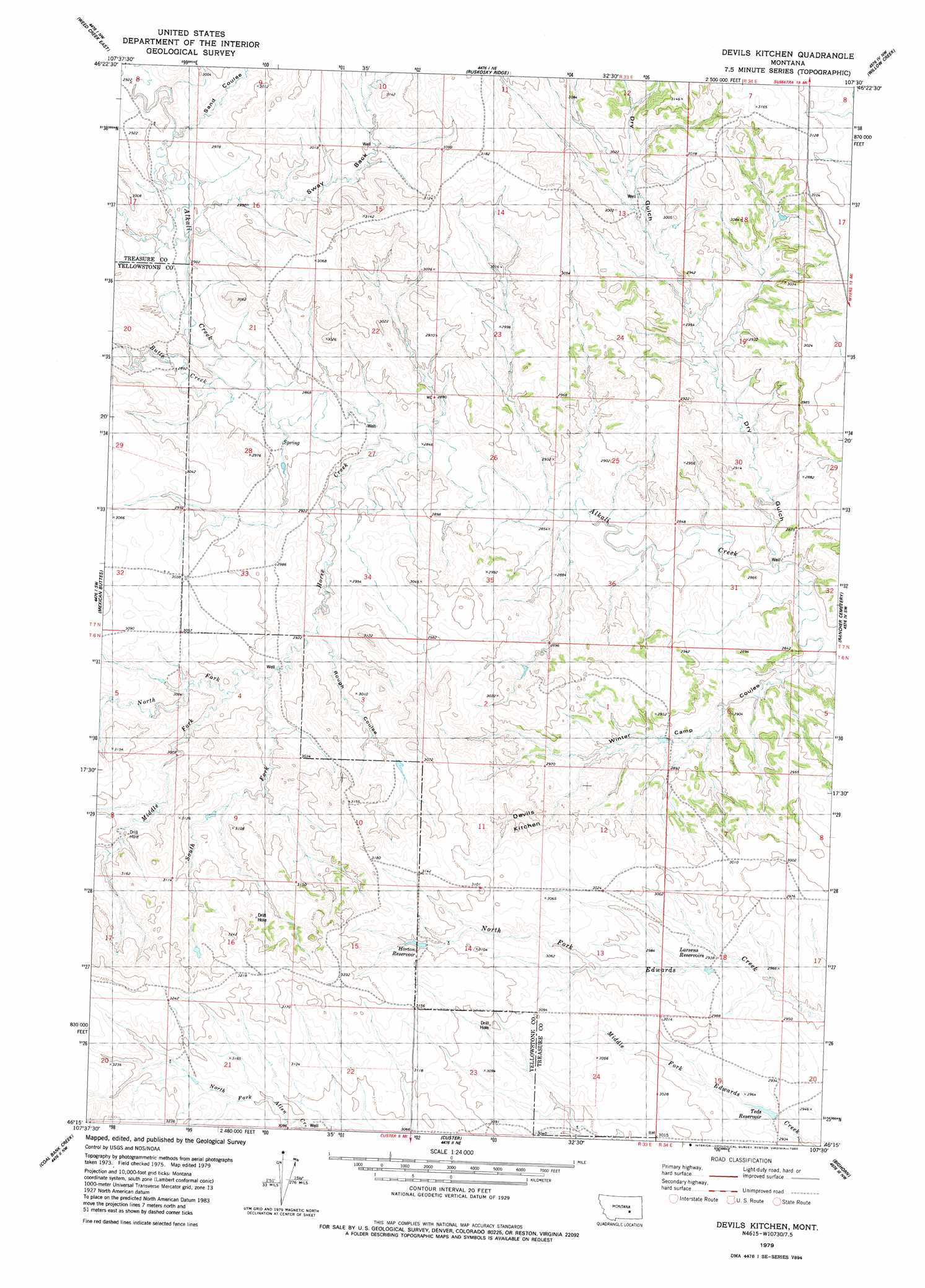
USGS Topo Quad 46107c5 - 1:24,000 scale
| Topo Map Name: | Devils Kitchen |
| USGS Topo Quad ID: | 46107c5 |
| Print Size: | ca. 21 1/4" wide x 27" high |
| Southeast Coordinates: | 46.25° N latitude / 107.5° W longitude |
| Map Center Coordinates: | 46.3125° N latitude / 107.5625° W longitude |
| U.S. State: | MT |
| Filename: | o46107c5.jpg |
| Download Map JPG Image: | Devils Kitchen topo map 1:24,000 scale |
| Map Type: | Topographic |
| Topo Series: | 7.5´ |
| Map Scale: | 1:24,000 |
| Source of Map Images: | United States Geological Survey (USGS) |
| Alternate Map Versions: |
Devils Kitchen MT 1979, updated 1980 Download PDF Buy paper map Devils Kitchen MT 2011 Download PDF Buy paper map Devils Kitchen MT 2014 Download PDF Buy paper map |
1:24,000 Topo Quads surrounding Devils Kitchen
Melstone |
Guthridge Ranch |
Sumatra |
Ingomar West |
Ingomar East |
Weed Creek West |
Weed Creek East |
Ruskosky Ridge |
Mckonkey Creek |
Steie Ranch |
Mailbox Hill |
Mexican Buttes |
Devils Kitchen |
Rancher Cemetery |
Myers |
Mud Butte |
Coal Bank Creek |
Custer |
Bighorn |
Eldering Ranch |
Bull Mountain |
Waco |
Mission Creek |
Marsh Coulee |
Hope Ranch |
> Back to 46107a1 at 1:100,000 scale
> Back to 46106a1 at 1:250,000 scale
> Back to U.S. Topo Maps home
Devils Kitchen topo map: Gazetteer
Devils Kitchen: Basins
Devils Kitchen elevation 915m 3001′Sway Back elevation 906m 2972′
Devils Kitchen: Dams
Yellow Haired Custer Dam elevation 958m 3143′Devils Kitchen: Reservoirs
Horton Reservoir elevation 943m 3093′Larsens Reservoir elevation 920m 3018′
Teds Reservoir elevation 898m 2946′
Devils Kitchen: Streams
Butte Creek elevation 873m 2864′Horse Creek elevation 865m 2837′
Middle Fork Horse Creek elevation 900m 2952′
North Fork Horse Creek elevation 903m 2962′
South Fork Horse Creek elevation 898m 2946′
Devils Kitchen: Valleys
Dry Gulch elevation 864m 2834′Rough Coulee elevation 892m 2926′
Sand Coulee elevation 885m 2903′
Winter Camp Coulee elevation 902m 2959′
Devils Kitchen: Wells
07N25E24DAC_01 Well elevation 905m 2969′Horse Creek Crossing Well elevation 894m 2933′
Rock Butte Well elevation 952m 3123′
Devils Kitchen digital topo map on disk
Buy this Devils Kitchen topo map showing relief, roads, GPS coordinates and other geographical features, as a high-resolution digital map file on DVD:
Eastern Montana & Western North Dakota
Buy digital topo maps: Eastern Montana & Western North Dakota