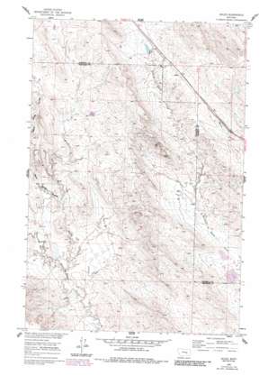
Ahles Topo Map Montana
To zoom in, hover over the map of Ahles
USGS Topo Quad 46107d2 - 1:24,000 scale
| Topo Map Name: | Ahles |
| USGS Topo Quad ID: | 46107d2 |
| Print Size: | ca. 21 1/4" wide x 27" high |
| Southeast Coordinates: | 46.375° N latitude / 107.125° W longitude |
| Map Center Coordinates: | 46.4375° N latitude / 107.1875° W longitude |
| U.S. State: | MT |
| Filename: | o46107d2.jpg |
| Download Map JPG Image: | Ahles topo map 1:24,000 scale |
| Map Type: | Topographic |
| Topo Series: | 7.5´ |
| Map Scale: | 1:24,000 |
| Source of Map Images: | United States Geological Survey (USGS) |
| Alternate Map Versions: |
Ahles MT 1960, updated 1962 Download PDF Buy paper map Ahles MT 1960, updated 1984 Download PDF Buy paper map Ahles MT 2011 Download PDF Buy paper map Ahles MT 2014 Download PDF Buy paper map |
1:24,000 Topo Quads surrounding Ahles
> Back to 46107a1 at 1:100,000 scale
> Back to 46106a1 at 1:250,000 scale
> Back to U.S. Topo Maps home
Ahles topo map: Gazetteer
Ahles: Dams
Ballard Number 1 Dam elevation 863m 2831′Big Timber Number 41 Dam elevation 879m 2883′
BN Number 9 Dam elevation 823m 2700′
JA Montgomery Number 1 Dam elevation 885m 2903′
Kniepp Number 1 Dam elevation 870m 2854′
Ahles: Mines
NW Starved to Death-24 Mine elevation 847m 2778′W Starved to Death SW Mine elevation 825m 2706′
W Starved to Death-5 Mine elevation 827m 2713′
West Starved to Death 31,32 Mine elevation 830m 2723′
Ahles: Populated Places
Ahles elevation 876m 2874′Ahles: Post Offices
Ahles Post Office (historical) elevation 875m 2870′Ahles: Valleys
Geyser Spring Coulee elevation 818m 2683′Ahles digital topo map on disk
Buy this Ahles topo map showing relief, roads, GPS coordinates and other geographical features, as a high-resolution digital map file on DVD:
Eastern Montana & Western North Dakota
Buy digital topo maps: Eastern Montana & Western North Dakota


