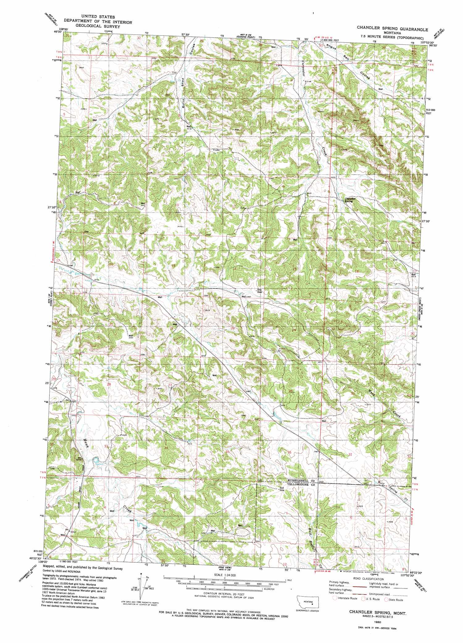
Chandler Spring Topo Map Montana
To zoom in, hover over the map of Chandler Spring
USGS Topo Quad 46107d8 - 1:24,000 scale
| Topo Map Name: | Chandler Spring |
| USGS Topo Quad ID: | 46107d8 |
| Print Size: | ca. 21 1/4" wide x 27" high |
| Southeast Coordinates: | 46.375° N latitude / 107.875° W longitude |
| Map Center Coordinates: | 46.4375° N latitude / 107.9375° W longitude |
| U.S. State: | MT |
| Filename: | o46107d8.jpg |
| Download Map JPG Image: | Chandler Spring topo map 1:24,000 scale |
| Map Type: | Topographic |
| Topo Series: | 7.5´ |
| Map Scale: | 1:24,000 |
| Source of Map Images: | United States Geological Survey (USGS) |
| Alternate Map Versions: |
Chandler Spring MT 1980, updated 1980 Download PDF Buy paper map Chandler Spring MT 2011 Download PDF Buy paper map Chandler Spring MT 2014 Download PDF Buy paper map |
1:24,000 Topo Quads surrounding Chandler Spring
Musselshell Nw |
Akers Ranch |
Melstone Nw |
Melstone Ne |
Grebe Ranch |
Delphia |
Musselshell |
Queens Point |
Melstone |
Guthridge Ranch |
Chimney Butte |
Corey Flat |
Chandler Spring |
Weed Creek West |
Weed Creek East |
Cherry Spring |
Steamboat Butte |
Pine View |
Mailbox Hill |
Mexican Buttes |
P K Ranch |
P K Ranch Ne |
Bull Mountain Nw |
Mud Butte |
Coal Bank Creek |
> Back to 46107a1 at 1:100,000 scale
> Back to 46106a1 at 1:250,000 scale
> Back to U.S. Topo Maps home
Chandler Spring topo map: Gazetteer
Chandler Spring: Springs
Chandler Spring elevation 996m 3267′Chandler Spring: Wells
07N30E12A___01 Well elevation 1061m 3480′08N30E04BBDB01 Well elevation 999m 3277′
08N30E08DBB_01 Well elevation 1041m 3415′
Chandler Spring digital topo map on disk
Buy this Chandler Spring topo map showing relief, roads, GPS coordinates and other geographical features, as a high-resolution digital map file on DVD:
Eastern Montana & Western North Dakota
Buy digital topo maps: Eastern Montana & Western North Dakota