Kincheloe Ranch Topo Map Montana
To zoom in, hover over the map of Kincheloe Ranch
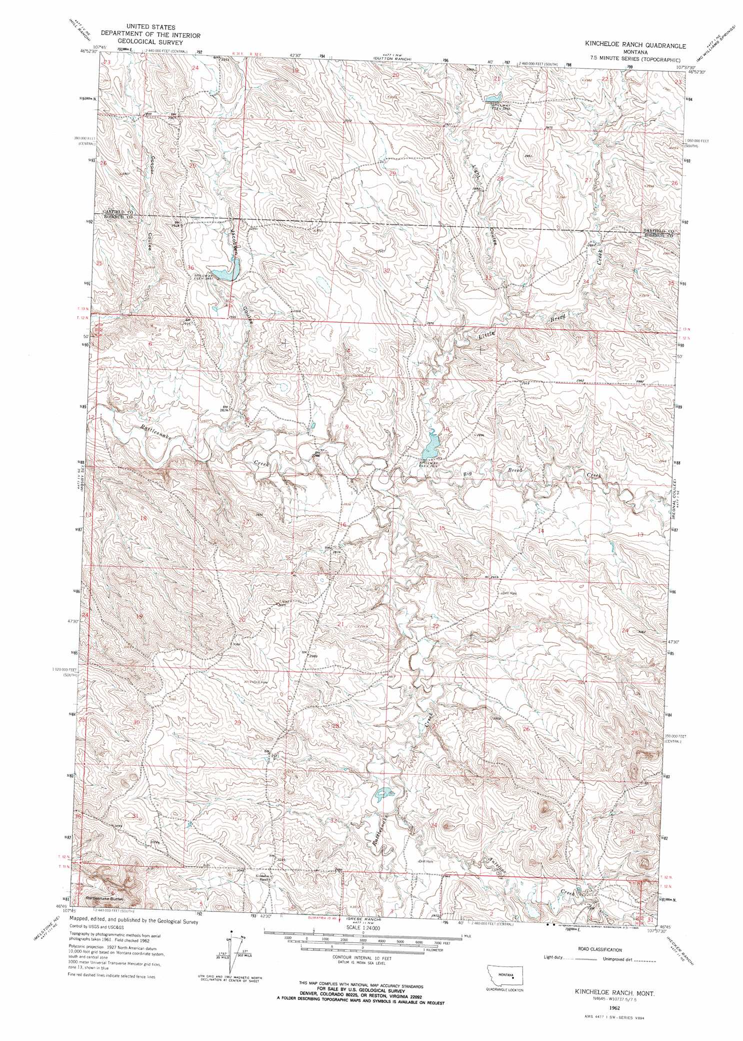
USGS Topo Quad 46107g6 - 1:24,000 scale
| Topo Map Name: | Kincheloe Ranch |
| USGS Topo Quad ID: | 46107g6 |
| Print Size: | ca. 21 1/4" wide x 27" high |
| Southeast Coordinates: | 46.75° N latitude / 107.625° W longitude |
| Map Center Coordinates: | 46.8125° N latitude / 107.6875° W longitude |
| U.S. State: | MT |
| Filename: | o46107g6.jpg |
| Download Map JPG Image: | Kincheloe Ranch topo map 1:24,000 scale |
| Map Type: | Topographic |
| Topo Series: | 7.5´ |
| Map Scale: | 1:24,000 |
| Source of Map Images: | United States Geological Survey (USGS) |
| Alternate Map Versions: |
Kincheloe Ranch MT 1962, updated 1965 Download PDF Buy paper map Kincheloe Ranch MT 2011 Download PDF Buy paper map Kincheloe Ranch MT 2014 Download PDF Buy paper map |
1:24,000 Topo Quads surrounding Kincheloe Ranch
Fail Ranch |
Barney Pinnacle |
Froehlich Butte |
Cox Butte |
Sand Springs |
Mosby |
Hill Ranch |
Dutton Ranch |
Mcwilliams Springs |
Mcginnis Butte |
Maxwell Ranch |
Mosby Se |
Kincheloe Ranch |
Regnal Coulee |
Mcginnis Butte Sw |
Melstone Nw |
Melstone Ne |
Grebe Ranch |
Hecker Ranch |
Yablonski Ranch |
Queens Point |
Melstone |
Guthridge Ranch |
Sumatra |
Ingomar West |
> Back to 46107e1 at 1:100,000 scale
> Back to 46106a1 at 1:250,000 scale
> Back to U.S. Topo Maps home
Kincheloe Ranch topo map: Gazetteer
Kincheloe Ranch: Dams
Bs Kincheloe Dam elevation 862m 2828′BS Kincheloe Number 1 Dam elevation 876m 2874′
Grebe Number 1 Dam elevation 882m 2893′
L Galt Number 25 Dam elevation 882m 2893′
Montana Number 10 Dam elevation 870m 2854′
Kincheloe Ranch: Post Offices
Sagedale Post Office (historical) elevation 862m 2828′Kincheloe Ranch: Streams
Antelope Creek elevation 884m 2900′Big Breed Creek elevation 853m 2798′
Little Breed Creek elevation 855m 2805′
Kincheloe Ranch: Summits
Rattlesnake Buttes elevation 962m 3156′Kincheloe Ranch: Valleys
Jacobsen Coulee elevation 843m 2765′Light Coulee elevation 876m 2874′
Kincheloe Ranch digital topo map on disk
Buy this Kincheloe Ranch topo map showing relief, roads, GPS coordinates and other geographical features, as a high-resolution digital map file on DVD:
Eastern Montana & Western North Dakota
Buy digital topo maps: Eastern Montana & Western North Dakota