Lake Mason Ne Topo Map Montana
To zoom in, hover over the map of Lake Mason Ne
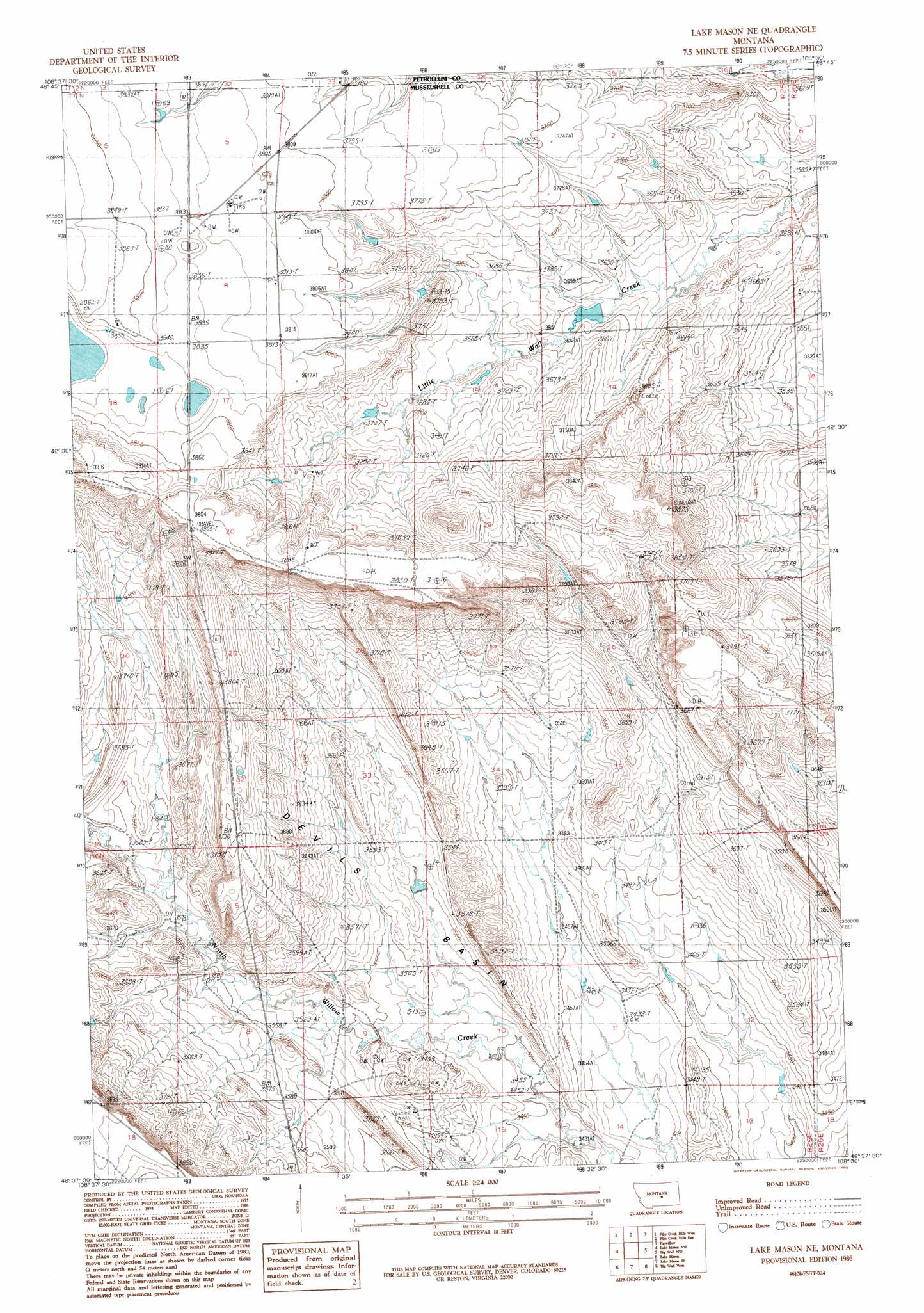
USGS Topo Quad 46108f5 - 1:24,000 scale
| Topo Map Name: | Lake Mason Ne |
| USGS Topo Quad ID: | 46108f5 |
| Print Size: | ca. 21 1/4" wide x 27" high |
| Southeast Coordinates: | 46.625° N latitude / 108.5° W longitude |
| Map Center Coordinates: | 46.6875° N latitude / 108.5625° W longitude |
| U.S. State: | MT |
| Filename: | o46108f5.jpg |
| Download Map JPG Image: | Lake Mason Ne topo map 1:24,000 scale |
| Map Type: | Topographic |
| Topo Series: | 7.5´ |
| Map Scale: | 1:24,000 |
| Source of Map Images: | United States Geological Survey (USGS) |
| Alternate Map Versions: |
Lake Mason NE MT 1986, updated 1986 Download PDF Buy paper map Lake Mason NE MT 2011 Download PDF Buy paper map Lake Mason NE MT 2014 Download PDF Buy paper map |
1:24,000 Topo Quads surrounding Lake Mason Ne
Becket Ne |
Milk Springs |
Snoose Creek |
Yellow Water Res. |
Winnett South |
Tyler |
Pike Creek Hills W. |
Pike Creek Hills E. |
Flatwillow |
Crowley Dam |
Pender Coulee |
Lake Mason Nw |
Lake Mason Ne |
Big Wall Nw |
Jim Coulee |
Timber Buttes North |
Lake Mason |
Lake Mason Se |
Big Wall West |
Big Wall East |
Timber Buttes South |
Horse Thief Creek |
Roundup |
Gage |
Gage Ne |
> Back to 46108e1 at 1:100,000 scale
> Back to 46108a1 at 1:250,000 scale
> Back to U.S. Topo Maps home
Lake Mason Ne topo map: Gazetteer
Lake Mason Ne: Basins
Devils Basin elevation 1053m 3454′Lake Mason Ne: Dams
Ivy Number 3 Dam elevation 1168m 3832′Lake Mason Ne: Wells
10N25E12DBA_01 Well elevation 1046m 3431′11N25E14C___01 Well elevation 1136m 3727′
11N25E21CC__01 Well elevation 1182m 3877′
11N25E34D___01 Well elevation 1064m 3490′
Lake Mason Ne digital topo map on disk
Buy this Lake Mason Ne topo map showing relief, roads, GPS coordinates and other geographical features, as a high-resolution digital map file on DVD: