Pender Coulee Topo Map Montana
To zoom in, hover over the map of Pender Coulee
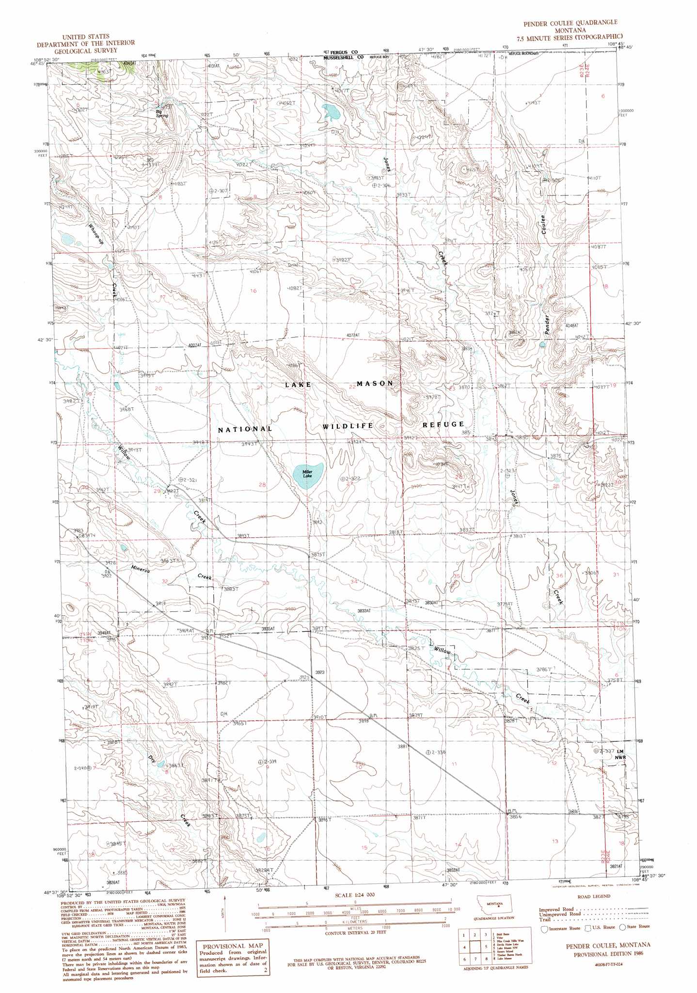
USGS Topo Quad 46108f7 - 1:24,000 scale
| Topo Map Name: | Pender Coulee |
| USGS Topo Quad ID: | 46108f7 |
| Print Size: | ca. 21 1/4" wide x 27" high |
| Southeast Coordinates: | 46.625° N latitude / 108.75° W longitude |
| Map Center Coordinates: | 46.6875° N latitude / 108.8125° W longitude |
| U.S. State: | MT |
| Filename: | o46108f7.jpg |
| Download Map JPG Image: | Pender Coulee topo map 1:24,000 scale |
| Map Type: | Topographic |
| Topo Series: | 7.5´ |
| Map Scale: | 1:24,000 |
| Source of Map Images: | United States Geological Survey (USGS) |
| Alternate Map Versions: |
Pender Coulee MT 1986, updated 1986 Download PDF Buy paper map Pender Coulee MT 2011 Download PDF Buy paper map Pender Coulee MT 2014 Download PDF Buy paper map |
1:24,000 Topo Quads surrounding Pender Coulee
Forestgrove |
Becket |
Becket Ne |
Milk Springs |
Snoose Creek |
South Bench |
Bald Butte |
Tyler |
Pike Creek Hills W. |
Pike Creek Hills E. |
Sahara Hill |
Devils Hole Lake |
Pender Coulee |
Lake Mason Nw |
Lake Mason Ne |
Sahara Hill Se |
Emory School |
Timber Buttes North |
Lake Mason |
Lake Mason Se |
Cushman Ne |
Lavina Nw |
Timber Buttes South |
Horse Thief Creek |
Roundup |
> Back to 46108e1 at 1:100,000 scale
> Back to 46108a1 at 1:250,000 scale
> Back to U.S. Topo Maps home
Pender Coulee topo map: Gazetteer
Pender Coulee: Dams
Joe Toe Dam elevation 1225m 4019′Pender Coulee: Lakes
Miller Lake elevation 1179m 3868′Pender Coulee: Post Offices
Highfield Post Office (historical) elevation 1161m 3809′Pender Coulee: Springs
Big Spring elevation 1274m 4179′Pender Coulee: Streams
Minerva Creek elevation 1182m 3877′Whoop-Up Creek elevation 1217m 3992′
Pender Coulee: Valleys
Pender Coulee elevation 1187m 3894′Pender Coulee: Wells
10N23E02BBC_01 Well elevation 1166m 3825′10N23E04ADA_01 Well elevation 1199m 3933′
10N23E10A___01 Well elevation 1187m 3894′
Pender Coulee digital topo map on disk
Buy this Pender Coulee topo map showing relief, roads, GPS coordinates and other geographical features, as a high-resolution digital map file on DVD: