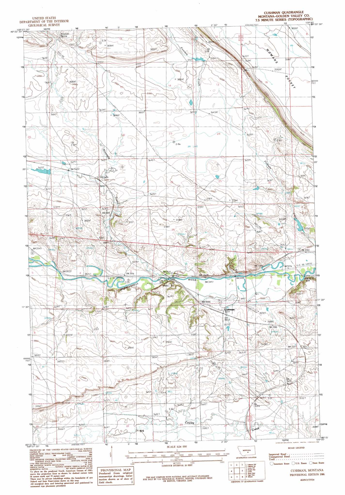
Cushman Topo Map Montana
To zoom in, hover over the map of Cushman
USGS Topo Quad 46109c1 - 1:24,000 scale
| Topo Map Name: | Cushman |
| USGS Topo Quad ID: | 46109c1 |
| Print Size: | ca. 21 1/4" wide x 27" high |
| Southeast Coordinates: | 46.25° N latitude / 109° W longitude |
| Map Center Coordinates: | 46.3125° N latitude / 109.0625° W longitude |
| U.S. State: | MT |
| Filename: | o46109c1.jpg |
| Download Map JPG Image: | Cushman topo map 1:24,000 scale |
| Map Type: | Topographic |
| Topo Series: | 7.5´ |
| Map Scale: | 1:24,000 |
| Source of Map Images: | United States Geological Survey (USGS) |
| Alternate Map Versions: |
Cushman MT 1986, updated 1986 Download PDF Buy paper map Cushman MT 2011 Download PDF Buy paper map Cushman MT 2014 Download PDF Buy paper map |
1:24,000 Topo Quads surrounding Cushman
Rothiemay |
Sahara Hill Sw |
Sahara Hill Se |
Emory School |
Timber Buttes North |
Vallum |
Cushman Nw |
Cushman Ne |
Lavina Nw |
Timber Buttes South |
Ryegate West |
Ryegate East |
Cushman |
Lavina |
Bundy |
Locomotive Butte |
Mount Sinai |
Eagle Point |
Belmont |
Broadview Ne |
Locomotive Butte Se |
Hailstone Basin |
Hailstone Basin Se |
Broadview West |
Broadview East |
> Back to 46109a1 at 1:100,000 scale
> Back to 46108a1 at 1:250,000 scale
> Back to U.S. Topo Maps home
Cushman topo map: Gazetteer
Cushman: Dams
Gerdts Dam elevation 1117m 3664′Cushman: Populated Places
Cushman elevation 1083m 3553′Slayton Junction (historical) elevation 1074m 3523′
Cushman: Post Offices
Burgoyne Post Office (historical) elevation 1078m 3536′Cushman Post Office (historical) elevation 1083m 3553′
Olden Post Office (historical) elevation 1075m 3526′
Slayton Post Office (historical) elevation 1071m 3513′
Cushman: Springs
Ninemile Spring elevation 1177m 3861′Cushman: Streams
Ninemile Creek elevation 1067m 3500′Cushman: Wells
06N21E22BDA_01 Well elevation 1098m 3602′06N21E24CAA_01 Well elevation 1087m 3566′
06N22E19CDAB01 Well elevation 1090m 3576′
Cushman digital topo map on disk
Buy this Cushman topo map showing relief, roads, GPS coordinates and other geographical features, as a high-resolution digital map file on DVD: