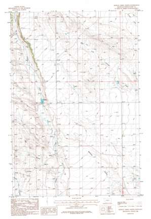
Hopley Creek North Topo Map Montana
To zoom in, hover over the map of Hopley Creek North
USGS Topo Quad 46109e8 - 1:24,000 scale
| Topo Map Name: | Hopley Creek North |
| USGS Topo Quad ID: | 46109e8 |
| Print Size: | ca. 21 1/4" wide x 27" high |
| Southeast Coordinates: | 46.5° N latitude / 109.875° W longitude |
| Map Center Coordinates: | 46.5625° N latitude / 109.9375° W longitude |
| U.S. State: | MT |
| Filename: | o46109e8.jpg |
| Download Map JPG Image: | Hopley Creek North topo map 1:24,000 scale |
| Map Type: | Topographic |
| Topo Series: | 7.5´ |
| Map Scale: | 1:24,000 |
| Source of Map Images: | United States Geological Survey (USGS) |
| Alternate Map Versions: |
Hopley Creek North MT 1986, updated 1986 Download PDF Buy paper map Hopley Creek North MT 2011 Download PDF Buy paper map Hopley Creek North MT 2014 Download PDF Buy paper map |
1:24,000 Topo Quads surrounding Hopley Creek North
> Back to 46109e1 at 1:100,000 scale
> Back to 46108a1 at 1:250,000 scale
> Back to U.S. Topo Maps home
Hopley Creek North topo map: Gazetteer
Hopley Creek North: Dams
Nelson Irrigation Dam elevation 1482m 4862′Hopley Creek North: Post Offices
Devee Post Office (historical) elevation 1481m 4858′Hopley Creek North: Reservoirs
Nelson Reservoir elevation 1455m 4773′Hopley Creek North: Streams
East Fork Hopley Creek elevation 1493m 4898′Hopley Creek North: Valleys
Big Coulee elevation 1404m 4606′Hopley Creek North: Wells
09N14E12ADB_01 Well elevation 1448m 4750′09N15E07C___01 Well elevation 1435m 4708′
09N15E07DDD_01 Well elevation 1422m 4665′
10N14E20____01 Well elevation 1597m 5239′
10N14E20C___01 Well elevation 1522m 4993′
10N14E28B___01 Well elevation 1567m 5141′
10N14E28C___01 Well elevation 1555m 5101′
10N14E32B___01 Well elevation 1552m 5091′
Hopley Creek North digital topo map on disk
Buy this Hopley Creek North topo map showing relief, roads, GPS coordinates and other geographical features, as a high-resolution digital map file on DVD:


