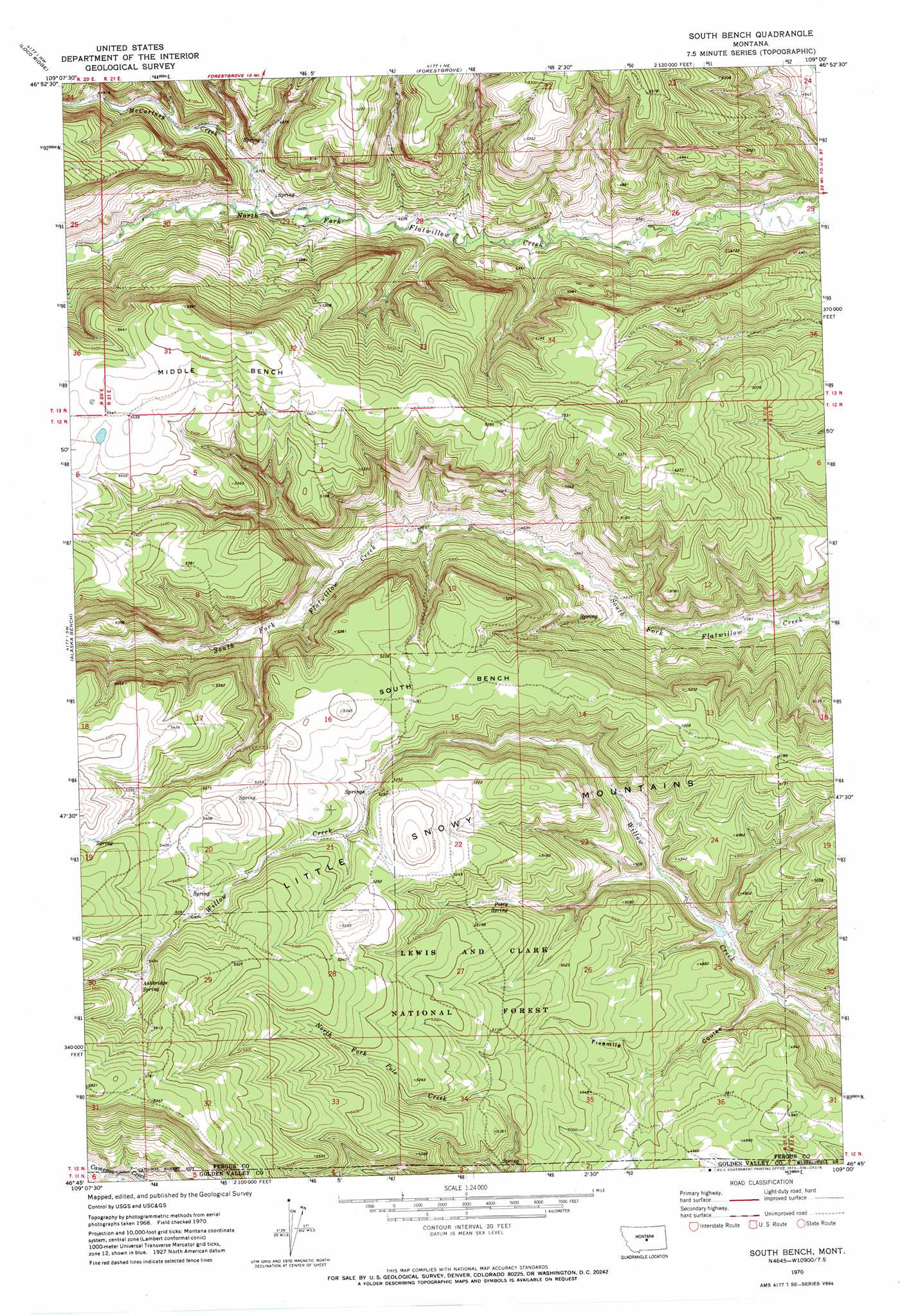
South Bench Topo Map Montana
To zoom in, hover over the map of South Bench
USGS Topo Quad 46109g1 - 1:24,000 scale
| Topo Map Name: | South Bench |
| USGS Topo Quad ID: | 46109g1 |
| Print Size: | ca. 21 1/4" wide x 27" high |
| Southeast Coordinates: | 46.75° N latitude / 109° W longitude |
| Map Center Coordinates: | 46.8125° N latitude / 109.0625° W longitude |
| U.S. State: | MT |
| Filename: | o46109g1.jpg |
| Download Map JPG Image: | South Bench topo map 1:24,000 scale |
| Map Type: | Topographic |
| Topo Series: | 7.5´ |
| Map Scale: | 1:24,000 |
| Source of Map Images: | United States Geological Survey (USGS) |
| Alternate Map Versions: |
South Bench MT 1970, updated 1973 Download PDF Buy paper map South Bench MT 1995, updated 1997 Download PDF Buy paper map South Bench MT 2011 Download PDF Buy paper map South Bench MT 2014 Download PDF Buy paper map |
| FStopo: | US Forest Service topo South Bench is available: Download FStopo PDF Download FStopo TIF |
1:24,000 Topo Quads surrounding South Bench
Pike Creek |
Horsethief Coulee W. |
Horsethief Coulee E. |
Fish Dam |
Grass Range |
Heath |
Loco Ridge |
Forestgrove |
Becket |
Becket Ne |
Half Moon Canyon |
Alaska Bench |
South Bench |
Bald Butte |
Tyler |
Green Ashly Gulch |
Patterson Canyon |
Sahara Hill |
Devils Hole Lake |
Pender Coulee |
Rothiemay |
Sahara Hill Sw |
Sahara Hill Se |
Emory School |
Timber Buttes North |
> Back to 46109e1 at 1:100,000 scale
> Back to 46108a1 at 1:250,000 scale
> Back to U.S. Topo Maps home
South Bench topo map: Gazetteer
South Bench: Benches
South Bench elevation 1601m 5252′South Bench: Post Offices
Pinegrove Post Office (historical) elevation 1454m 4770′South Bench: Springs
Ashbridge Spring elevation 1671m 5482′Posey Spring elevation 1528m 5013′
South Bench: Streams
McCartney Creek elevation 1435m 4708′South Bench: Valleys
Fivemile Coulee elevation 1405m 4609′South Bench digital topo map on disk
Buy this South Bench topo map showing relief, roads, GPS coordinates and other geographical features, as a high-resolution digital map file on DVD: