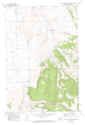
West Fork Beaver Creek Topo Map Montana
To zoom in, hover over the map of West Fork Beaver Creek
USGS Topo Quad 46109h5 - 1:24,000 scale
| Topo Map Name: | West Fork Beaver Creek |
| USGS Topo Quad ID: | 46109h5 |
| Print Size: | ca. 21 1/4" wide x 27" high |
| Southeast Coordinates: | 46.875° N latitude / 109.5° W longitude |
| Map Center Coordinates: | 46.9375° N latitude / 109.5625° W longitude |
| U.S. State: | MT |
| Filename: | o46109h5.jpg |
| Download Map JPG Image: | West Fork Beaver Creek topo map 1:24,000 scale |
| Map Type: | Topographic |
| Topo Series: | 7.5´ |
| Map Scale: | 1:24,000 |
| Source of Map Images: | United States Geological Survey (USGS) |
| Alternate Map Versions: |
West Fork Beaver Creek MT 1970, updated 1973 Download PDF Buy paper map West Fork Beaver Creek MT 2011 Download PDF Buy paper map West Fork Beaver Creek MT 2014 Download PDF Buy paper map |
1:24,000 Topo Quads surrounding West Fork Beaver Creek
> Back to 46109e1 at 1:100,000 scale
> Back to 46108a1 at 1:250,000 scale
> Back to U.S. Topo Maps home
West Fork Beaver Creek topo map: Gazetteer
West Fork Beaver Creek: Airports
Beacon Star Antique Airfield elevation 1316m 4317′West Fork Beaver Creek: Populated Places
Beaver Creek elevation 1395m 4576′Rockford (historical) elevation 1351m 4432′
West Fork Beaver Creek: Post Offices
Brassey Post Office (historical) elevation 1283m 4209′Rockford Post Office (historical) elevation 1351m 4432′
West Fork Beaver Creek: Streams
Middle Fork Beaver Creek elevation 1317m 4320′West Fork Beaver Creek elevation 1295m 4248′
West Fork Big Rock Creek elevation 1413m 4635′
West Fork Beaver Creek: Wells
13N17E05CCDD01 Well elevation 1395m 4576′13N17E05CDC_01 Well elevation 1395m 4576′
14N17E12ABAC01 Well elevation 1303m 4274′
14N17E15CDA_01 Well elevation 1284m 4212′
14N17E18DCD_01 Well elevation 1319m 4327′
14N17E18DCDC01 Well elevation 1318m 4324′
14N17E22AAAA01 Well elevation 1291m 4235′
14N17E34BDB_01 Well elevation 1339m 4393′
West Fork Beaver Creek digital topo map on disk
Buy this West Fork Beaver Creek topo map showing relief, roads, GPS coordinates and other geographical features, as a high-resolution digital map file on DVD:


