Loco Mountain Topo Map Montana
To zoom in, hover over the map of Loco Mountain
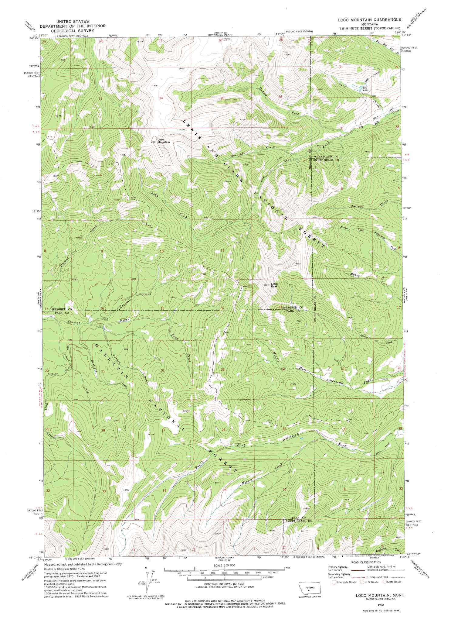
USGS Topo Quad 46110b3 - 1:24,000 scale
| Topo Map Name: | Loco Mountain |
| USGS Topo Quad ID: | 46110b3 |
| Print Size: | ca. 21 1/4" wide x 27" high |
| Southeast Coordinates: | 46.125° N latitude / 110.25° W longitude |
| Map Center Coordinates: | 46.1875° N latitude / 110.3125° W longitude |
| U.S. State: | MT |
| Filename: | o46110b3.jpg |
| Download Map JPG Image: | Loco Mountain topo map 1:24,000 scale |
| Map Type: | Topographic |
| Topo Series: | 7.5´ |
| Map Scale: | 1:24,000 |
| Source of Map Images: | United States Geological Survey (USGS) |
| Alternate Map Versions: |
Loco Mountain MT 1972, updated 1976 Download PDF Buy paper map Loco Mountain MT 1995, updated 1997 Download PDF Buy paper map Loco Mountain MT 1995, updated 1997 Download PDF Buy paper map Loco Mountain MT 2011 Download PDF Buy paper map Loco Mountain MT 2014 Download PDF Buy paper map |
| FStopo: | US Forest Service topo Loco Mountain is available: Download FStopo PDF Download FStopo TIF |
1:24,000 Topo Quads surrounding Loco Mountain
Lennep |
Groveland |
Martinsdale |
Twodot Nw |
Twodot |
Rimrock Divide |
Lebo |
Cinnamon Peak |
Cinnamon Spring |
Lebo Lake |
Scab Rock Mountain |
Virginia Peak |
Loco Mountain |
Rein Lake |
Porcupine Butte |
Lena Creek |
Campfire Lake |
Crazy Peak |
Amelong Creek |
Battleship Butte |
Clyde Park |
Ibex Mountain |
Fairview Peak |
Raspberry Butte |
Grosfield Ranch |
> Back to 46110a1 at 1:100,000 scale
> Back to 46110a1 at 1:250,000 scale
> Back to U.S. Topo Maps home
Loco Mountain topo map: Gazetteer
Loco Mountain: Lakes
Elk Lake elevation 2092m 6863′Loco Mountain: Streams
Blacktail Creek elevation 2010m 6594′Clear Creek elevation 1997m 6551′
Fawn Creek elevation 2103m 6899′
Lebo Fork elevation 1949m 6394′
Lodgepole Creek elevation 2014m 6607′
Middle Fork Big Elk Creek elevation 1949m 6394′
Miners Creek elevation 2048m 6719′
Park Creek elevation 1918m 6292′
Scofield Creek elevation 2005m 6578′
Turkey Creek elevation 2026m 6646′
Loco Mountain: Summits
Lebo Peak elevation 2743m 8999′Loco Mountain elevation 2817m 9242′
Loco Mountain digital topo map on disk
Buy this Loco Mountain topo map showing relief, roads, GPS coordinates and other geographical features, as a high-resolution digital map file on DVD: