Virginia Peak Topo Map Montana
To zoom in, hover over the map of Virginia Peak
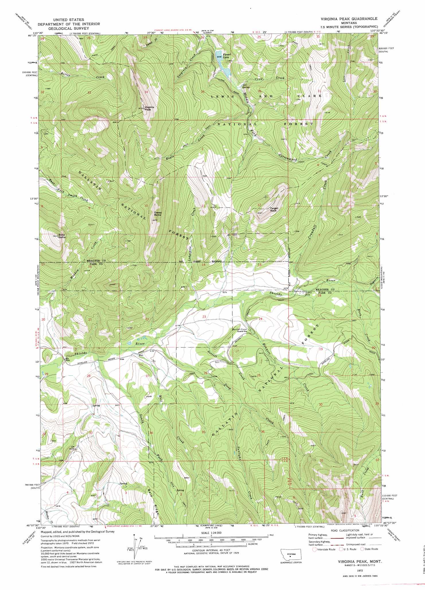
USGS Topo Quad 46110b4 - 1:24,000 scale
| Topo Map Name: | Virginia Peak |
| USGS Topo Quad ID: | 46110b4 |
| Print Size: | ca. 21 1/4" wide x 27" high |
| Southeast Coordinates: | 46.125° N latitude / 110.375° W longitude |
| Map Center Coordinates: | 46.1875° N latitude / 110.4375° W longitude |
| U.S. State: | MT |
| Filename: | o46110b4.jpg |
| Download Map JPG Image: | Virginia Peak topo map 1:24,000 scale |
| Map Type: | Topographic |
| Topo Series: | 7.5´ |
| Map Scale: | 1:24,000 |
| Source of Map Images: | United States Geological Survey (USGS) |
| Alternate Map Versions: |
Virginia Peak MT 1972, updated 1975 Download PDF Buy paper map Virginia Peak MT 2000, updated 2005 Download PDF Buy paper map Virginia Peak MT 2011 Download PDF Buy paper map Virginia Peak MT 2014 Download PDF Buy paper map |
| FStopo: | US Forest Service topo Virginia Peak is available: Download FStopo PDF Download FStopo TIF |
1:24,000 Topo Quads surrounding Virginia Peak
Castle Town |
Lennep |
Groveland |
Martinsdale |
Twodot Nw |
Hamen |
Rimrock Divide |
Lebo |
Cinnamon Peak |
Cinnamon Spring |
Wolf Hill |
Scab Rock Mountain |
Virginia Peak |
Loco Mountain |
Rein Lake |
Cotttonwood Reservoir |
Lena Creek |
Campfire Lake |
Crazy Peak |
Amelong Creek |
Wilsall |
Clyde Park |
Ibex Mountain |
Fairview Peak |
Raspberry Butte |
> Back to 46110a1 at 1:100,000 scale
> Back to 46110a1 at 1:250,000 scale
> Back to U.S. Topo Maps home
Virginia Peak topo map: Gazetteer
Virginia Peak: Lakes
Forest Lake elevation 1980m 6496′Virginia Peak: Streams
Bennett Creek elevation 1907m 6256′Buck Creek elevation 1971m 6466′
Crandall Creek elevation 1934m 6345′
Crow Creek elevation 1984m 6509′
Deep Creek elevation 1864m 6115′
Dugout Creek elevation 1983m 6505′
Eagle Creek elevation 2002m 6568′
Lodgepole Creek elevation 1885m 6184′
Mill Creek elevation 1855m 6085′
Serrett Creek elevation 1868m 6128′
South Fork Shields River elevation 1841m 6040′
Sunlight Creek elevation 1983m 6505′
Virginia Creek elevation 1953m 6407′
Virginia Peak: Summits
Billie Butte elevation 2377m 7798′Davey Butte elevation 2508m 8228′
Target Rock elevation 2451m 8041′
Virginia Peak elevation 2673m 8769′
Virginia Peak digital topo map on disk
Buy this Virginia Peak topo map showing relief, roads, GPS coordinates and other geographical features, as a high-resolution digital map file on DVD: