Groveland Topo Map Montana
To zoom in, hover over the map of Groveland
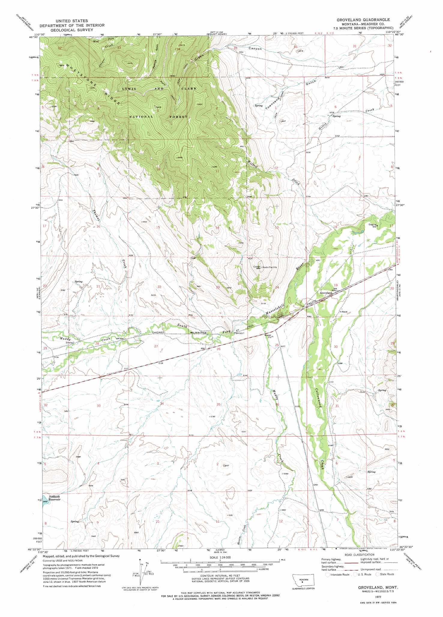
USGS Topo Quad 46110d4 - 1:24,000 scale
| Topo Map Name: | Groveland |
| USGS Topo Quad ID: | 46110d4 |
| Print Size: | ca. 21 1/4" wide x 27" high |
| Southeast Coordinates: | 46.375° N latitude / 110.375° W longitude |
| Map Center Coordinates: | 46.4375° N latitude / 110.4375° W longitude |
| U.S. State: | MT |
| Filename: | o46110d4.jpg |
| Download Map JPG Image: | Groveland topo map 1:24,000 scale |
| Map Type: | Topographic |
| Topo Series: | 7.5´ |
| Map Scale: | 1:24,000 |
| Source of Map Images: | United States Geological Survey (USGS) |
| Alternate Map Versions: |
Groveland MT 1972, updated 1976 Download PDF Buy paper map Groveland MT 1995, updated 1997 Download PDF Buy paper map Groveland MT 2011 Download PDF Buy paper map Groveland MT 2014 Download PDF Buy paper map |
| FStopo: | US Forest Service topo Groveland is available: Download FStopo PDF Download FStopo TIF |
1:24,000 Topo Quads surrounding Groveland
Volcano Butte |
Hoover Spring |
Russian Flat |
Daisy Peak |
Haymaker Narrows |
Fourmile Spring |
Checkerboard |
Mount Howe |
Mud Creek |
Haymaker Ranch Sw |
Castle Town |
Lennep |
Groveland |
Martinsdale |
Twodot Nw |
Hamen |
Rimrock Divide |
Lebo |
Cinnamon Peak |
Cinnamon Spring |
Wolf Hill |
Scab Rock Mountain |
Virginia Peak |
Loco Mountain |
Rein Lake |
> Back to 46110a1 at 1:100,000 scale
> Back to 46110a1 at 1:250,000 scale
> Back to U.S. Topo Maps home
Groveland topo map: Gazetteer
Groveland: Dams
Voldseth East Dam elevation 1677m 5501′Groveland: Populated Places
Groveland elevation 1524m 5000′Groveland: Streams
Cottonwood Creek elevation 1513m 4963′Hereim Creek elevation 1615m 5298′
Muddy Creek elevation 1525m 5003′
Muddy Creek elevation 1551m 5088′
Thomas Creek elevation 1549m 5082′
Willow Creek elevation 1503m 4931′
Groveland: Valleys
Green Canyon elevation 1519m 4983′Townsend Gulch elevation 1519m 4983′
Groveland digital topo map on disk
Buy this Groveland topo map showing relief, roads, GPS coordinates and other geographical features, as a high-resolution digital map file on DVD: