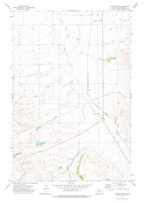
Catlin Spring Topo Map Montana
To zoom in, hover over the map of Catlin Spring
USGS Topo Quad 46110d8 - 1:24,000 scale
| Topo Map Name: | Catlin Spring |
| USGS Topo Quad ID: | 46110d8 |
| Print Size: | ca. 21 1/4" wide x 27" high |
| Southeast Coordinates: | 46.375° N latitude / 110.875° W longitude |
| Map Center Coordinates: | 46.4375° N latitude / 110.9375° W longitude |
| U.S. State: | MT |
| Filename: | o46110d8.jpg |
| Download Map JPG Image: | Catlin Spring topo map 1:24,000 scale |
| Map Type: | Topographic |
| Topo Series: | 7.5´ |
| Map Scale: | 1:24,000 |
| Source of Map Images: | United States Geological Survey (USGS) |
| Alternate Map Versions: |
Catlin Spring MT 1971, updated 1975 Download PDF Buy paper map Catlin Spring MT 2011 Download PDF Buy paper map Catlin Spring MT 2014 Download PDF Buy paper map |
1:24,000 Topo Quads surrounding Catlin Spring
> Back to 46110a1 at 1:100,000 scale
> Back to 46110a1 at 1:250,000 scale
> Back to U.S. Topo Maps home
Catlin Spring topo map: Gazetteer
Catlin Spring: Dams
Mayns Dam elevation 1616m 5301′Sterret Dam elevation 1633m 5357′
Catlin Spring: Parks
Smith River Valley Historical Marker elevation 1563m 5127′Catlin Spring: Populated Places
Calkins (historical) elevation 1547m 5075′Catlin Spring: Post Offices
Calkins Post Office (historical) elevation 1547m 5075′Catlin Spring: Reservoirs
Wertz Reservoir elevation 1633m 5357′Wertz Reservoir elevation 1633m 5357′
Catlin Spring: Springs
Catlin Spring elevation 1572m 5157′Catlin Spring: Streams
Cottonwood Creek elevation 1544m 5065′Fords Creek elevation 1523m 4996′
Hussey Creek elevation 1544m 5065′
Mayns Creek elevation 1561m 5121′
Potter Creek elevation 1569m 5147′
Prairie Creek elevation 1588m 5209′
Spring Creek elevation 1526m 5006′
Catlin Spring: Wells
07N06E11BD__01 Well elevation 1608m 5275′07N07E06BA__01 Well elevation 1567m 5141′
08N06E01A___01 Well elevation 1540m 5052′
08N06E04AC__01 Well elevation 1548m 5078′
08N06E14BB__01 Well elevation 1537m 5042′
08N06E14CB__01 Well elevation 1554m 5098′
08N06E16AD__01 Well elevation 1554m 5098′
08N06E27CC__01 Well elevation 1617m 5305′
08N06E27DB__01 Well elevation 1587m 5206′
08N06E34DD__01 Well elevation 1624m 5328′
08N06E36BB__01 Well elevation 1572m 5157′
Catlin Spring digital topo map on disk
Buy this Catlin Spring topo map showing relief, roads, GPS coordinates and other geographical features, as a high-resolution digital map file on DVD:


