Jellison Place Topo Map Montana
To zoom in, hover over the map of Jellison Place
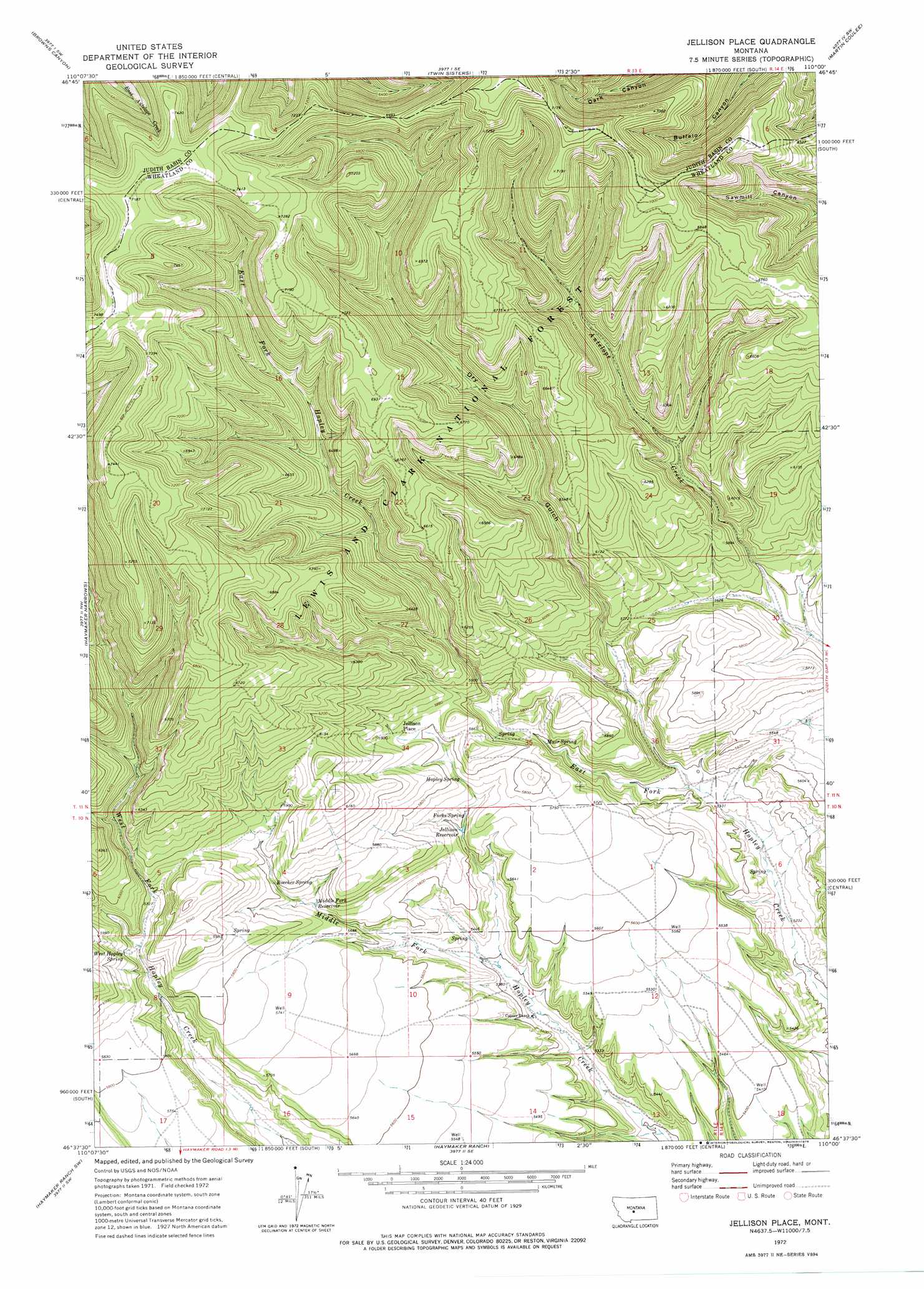
USGS Topo Quad 46110f1 - 1:24,000 scale
| Topo Map Name: | Jellison Place |
| USGS Topo Quad ID: | 46110f1 |
| Print Size: | ca. 21 1/4" wide x 27" high |
| Southeast Coordinates: | 46.625° N latitude / 110° W longitude |
| Map Center Coordinates: | 46.6875° N latitude / 110.0625° W longitude |
| U.S. State: | MT |
| Filename: | o46110f1.jpg |
| Download Map JPG Image: | Jellison Place topo map 1:24,000 scale |
| Map Type: | Topographic |
| Topo Series: | 7.5´ |
| Map Scale: | 1:24,000 |
| Source of Map Images: | United States Geological Survey (USGS) |
| Alternate Map Versions: |
Jellison Place MT 1972, updated 1976 Download PDF Buy paper map Jellison Place MT 1995, updated 1997 Download PDF Buy paper map Jellison Place MT 2011 Download PDF Buy paper map Jellison Place MT 2014 Download PDF Buy paper map |
| FStopo: | US Forest Service topo Jellison Place is available: Download FStopo PDF Download FStopo TIF |
1:24,000 Topo Quads surrounding Jellison Place
Woodhurst Mountain |
Red Hill |
Utica |
Ackley Lake |
Sipple |
Indian Hill |
Browns Canyon |
Twin Sisters |
Martin Coulee |
Buffalo |
Daisy Peak |
Haymaker Narrows |
Jellison Place |
Mead Creek |
Judith Gap |
Mud Creek |
Haymaker Ranch Sw |
Haymaker Ranch |
Hopley Creek North |
Oka |
Martinsdale |
Twodot Nw |
Twodot |
Hopley Creek South |
Harlowton |
> Back to 46110e1 at 1:100,000 scale
> Back to 46110a1 at 1:250,000 scale
> Back to U.S. Topo Maps home
Jellison Place topo map: Gazetteer
Jellison Place: Populated Places
Jellison Place elevation 1781m 5843′Jellison Place: Reservoirs
Jellison Reservoir elevation 1714m 5623′Middle Fork Reservoir elevation 1725m 5659′
Jellison Place: Springs
Boecher Spring elevation 1770m 5807′Forks Spring elevation 1715m 5626′
Hopley Spring elevation 1751m 5744′
Muir Spring elevation 1706m 5597′
West Hopley Spring elevation 1755m 5757′
Jellison Place: Valleys
Dry Gulch elevation 1634m 5360′Jellison Place: Wells
10N13E12ABBA01 Well elevation 1703m 5587′Jellison Place digital topo map on disk
Buy this Jellison Place topo map showing relief, roads, GPS coordinates and other geographical features, as a high-resolution digital map file on DVD: