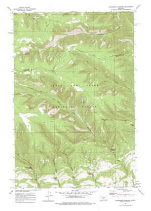
Haymaker Narrows Topo Map Montana
To zoom in, hover over the map of Haymaker Narrows
USGS Topo Quad 46110f2 - 1:24,000 scale
| Topo Map Name: | Haymaker Narrows |
| USGS Topo Quad ID: | 46110f2 |
| Print Size: | ca. 21 1/4" wide x 27" high |
| Southeast Coordinates: | 46.625° N latitude / 110.125° W longitude |
| Map Center Coordinates: | 46.6875° N latitude / 110.1875° W longitude |
| U.S. State: | MT |
| Filename: | o46110f2.jpg |
| Download Map JPG Image: | Haymaker Narrows topo map 1:24,000 scale |
| Map Type: | Topographic |
| Topo Series: | 7.5´ |
| Map Scale: | 1:24,000 |
| Source of Map Images: | United States Geological Survey (USGS) |
| Alternate Map Versions: |
Haymaker Narrows MT 1972, updated 1976 Download PDF Buy paper map Haymaker Narrows MT 1995, updated 1997 Download PDF Buy paper map Haymaker Narrows MT 2011 Download PDF Buy paper map Haymaker Narrows MT 2014 Download PDF Buy paper map |
| FStopo: | US Forest Service topo Haymaker Narrows is available: Download FStopo PDF Download FStopo TIF |
1:24,000 Topo Quads surrounding Haymaker Narrows
> Back to 46110e1 at 1:100,000 scale
> Back to 46110a1 at 1:250,000 scale
> Back to U.S. Topo Maps home
Haymaker Narrows topo map: Gazetteer
Haymaker Narrows: Dams
Haymaker Dam elevation 1731m 5679′Haymaker Narrows: Gaps
Haymaker Narrows elevation 1802m 5912′Morrisy Coulee Narrows elevation 1878m 6161′
Haymaker Narrows: Springs
Clarks Desert Spring elevation 1871m 6138′Iron Springs elevation 1839m 6033′
Morrisy Coulee Spring elevation 1796m 5892′
Sixshooter Spring elevation 2077m 6814′
Trombone Spring elevation 1788m 5866′
Haymaker Narrows: Streams
Sixshooter Creek elevation 2077m 6814′Haymaker Narrows: Summits
Bartleson Peak elevation 2288m 7506′Elephant Rock elevation 2028m 6653′
Haymaker Narrows digital topo map on disk
Buy this Haymaker Narrows topo map showing relief, roads, GPS coordinates and other geographical features, as a high-resolution digital map file on DVD:


