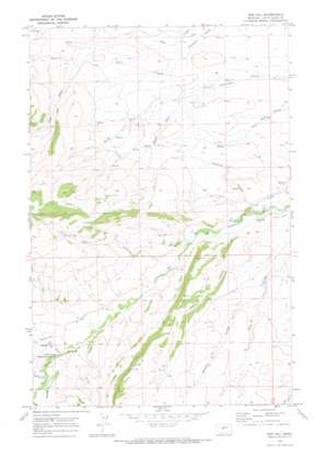
Red Hill Topo Map Montana
To zoom in, hover over the map of Red Hill
USGS Topo Quad 46110h2 - 1:24,000 scale
| Topo Map Name: | Red Hill |
| USGS Topo Quad ID: | 46110h2 |
| Print Size: | ca. 21 1/4" wide x 27" high |
| Southeast Coordinates: | 46.875° N latitude / 110.125° W longitude |
| Map Center Coordinates: | 46.9375° N latitude / 110.1875° W longitude |
| U.S. State: | MT |
| Filename: | o46110h2.jpg |
| Download Map JPG Image: | Red Hill topo map 1:24,000 scale |
| Map Type: | Topographic |
| Topo Series: | 7.5´ |
| Map Scale: | 1:24,000 |
| Source of Map Images: | United States Geological Survey (USGS) |
| Alternate Map Versions: |
Red Hill MT 1970, updated 1973 Download PDF Buy paper map Red Hill MT 2011 Download PDF Buy paper map Red Hill MT 2014 Download PDF Buy paper map |
1:24,000 Topo Quads surrounding Red Hill
> Back to 46110e1 at 1:100,000 scale
> Back to 46110a1 at 1:250,000 scale
> Back to U.S. Topo Maps home
Red Hill topo map: Gazetteer
Red Hill: Canals
Belden Ditch elevation 1391m 4563′Waite Ditch elevation 1413m 4635′
Red Hill: Springs
13N12E02DC__01 Spring elevation 1572m 5157′13N12E03AA__01 Spring elevation 1446m 4744′
13N12E03AA__02 Spring elevation 1446m 4744′
13N12E03AD__01 Spring elevation 1499m 4917′
13N12E04BB__01 Spring elevation 1594m 5229′
13N12E05CD__01 Spring elevation 1553m 5095′
13N12E06AA__01 Spring elevation 1714m 5623′
13N12E07DA__01 Spring elevation 1479m 4852′
13N12E09DD__01 Spring elevation 1596m 5236′
13N12E09DD__02 Spring elevation 1596m 5236′
13N12E15AB__01 Spring elevation 1658m 5439′
13N12E15DB__01 Spring elevation 1695m 5561′
13N12E16AB__01 Spring elevation 1615m 5298′
13N12E17BC__02 Spring elevation 1469m 4819′
13N12E18AA__01 Spring elevation 1469m 4819′
13N12E18AC__01 Spring elevation 1479m 4852′
13N12E18DA__01 Spring elevation 1472m 4829′
14N12E02DD__01 Spring elevation 1434m 4704′
14N12E07AB__01 Spring elevation 1622m 5321′
14N12E07DB__01 Spring elevation 1675m 5495′
14N12E08BC__01 Spring elevation 1551m 5088′
14N12E08CA__01 Spring elevation 1543m 5062′
14N12E09DC__01 Spring elevation 1517m 4977′
14N12E10CC__01 Spring elevation 1499m 4917′
14N12E10CD__01 Spring elevation 1487m 4878′
14N12E10DC__01 Spring elevation 1480m 4855′
14N12E11BC__01 Spring elevation 1441m 4727′
14N12E14AB__01 Spring elevation 1447m 4747′
14N12E14BA__01 Spring elevation 1451m 4760′
14N12E14BC__01 Spring elevation 1477m 4845′
14N12E15BC__01 Spring elevation 1507m 4944′
14N12E17AD__01 Spring elevation 1624m 5328′
14N12E20CA__01 Spring elevation 1677m 5501′
14N12E21AC__01 Spring elevation 1570m 5150′
14N12E21AD__01 Spring elevation 1561m 5121′
14N12E21DA__01 Spring elevation 1582m 5190′
14N12E22BD__01 Spring elevation 1530m 5019′
14N12E26DA__01 Spring elevation 1463m 4799′
14N12E27BD__01 Spring elevation 1588m 5209′
14N12E29CC__01 Spring elevation 1889m 6197′
14N12E29CD__01 Spring elevation 1865m 6118′
14N12E31AC__01 Spring elevation 1843m 6046′
14N12E31AC__02 Spring elevation 1843m 6046′
14N12E31AD__01 Spring elevation 1809m 5935′
14N12E32DB__01 Spring elevation 1706m 5597′
14N12E34BC__01 Spring elevation 1567m 5141′
14N12E35BC__01 Spring elevation 1441m 4727′
14N13E19CC__01 Spring elevation 1428m 4685′
Red Hill: Streams
Carr Creek elevation 1424m 4671′North Fork Courtneys Creek elevation 1461m 4793′
South Fork Courtneys Creek elevation 1461m 4793′
Spring Creek elevation 1459m 4786′
Red Hill: Summits
Red Hill elevation 1821m 5974′Red Hill: Valleys
Abbott Coulee elevation 1406m 4612′Alice Coulee elevation 1564m 5131′
Deadman Coulee elevation 1405m 4609′
Dipping Vat Coulee elevation 1462m 4796′
Hopkins Coulee elevation 1677m 5501′
Missouri Coulee elevation 1471m 4826′
Windmill Coulee elevation 1465m 4806′
Red Hill: Wells
13N12E12BC__01 Well elevation 1544m 5065′13N12E13BA__01 Well elevation 1544m 5065′
13N12E14AB__01 Well elevation 1573m 5160′
13N12E17BB__01 Well elevation 1464m 4803′
13N12E17BB__02 Well elevation 1464m 4803′
13N12E17BC__01 Well elevation 1469m 4819′
13N12E17CA__01 Well elevation 1499m 4917′
13N12E18AA__02 Well elevation 1469m 4819′
13N12E18DB__01 Well elevation 1477m 4845′
13N12E18DB__02 Well elevation 1477m 4845′
13N12E18DC__01 Well elevation 1476m 4842′
13N12E18DC__02 Well elevation 1476m 4842′
13N12E19AB__01 Well elevation 1479m 4852′
13N13E06BD__01 Well elevation 1457m 4780′
14N12E02CC__01 Well elevation 1433m 4701′
14N12E02DC__01 Well elevation 1420m 4658′
14N12E02DC__02 Well elevation 1420m 4658′
14N12E02DD__02 Well elevation 1434m 4704′
14N12E08DB__01 Well elevation 1504m 4934′
14N12E10AA__01 Well elevation 1441m 4727′
14N12E11DC__01 Well elevation 1456m 4776′
14N12E14BC__02 Well elevation 1477m 4845′
14N12E15BD__01 Well elevation 1486m 4875′
14N12E22AD__01 Well elevation 1530m 5019′
14N12E23AA__01 Well elevation 1474m 4835′
14N12E23AB__01 Well elevation 1490m 4888′
14N12E34DA__01 Well elevation 1452m 4763′
14N13E30BC__01 Well elevation 1401m 4596′
14N13E30BCD_01 Well elevation 1401m 4596′
Red Hill digital topo map on disk
Buy this Red Hill topo map showing relief, roads, GPS coordinates and other geographical features, as a high-resolution digital map file on DVD:


