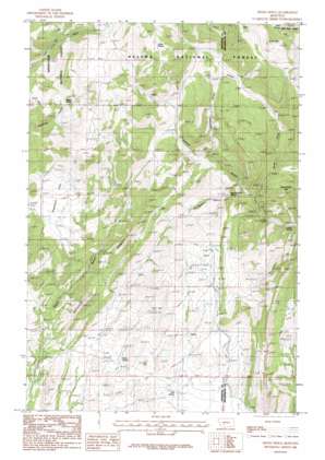
Devils Fence Topo Map Montana
To zoom in, hover over the map of Devils Fence
USGS Topo Quad 46111b7 - 1:24,000 scale
| Topo Map Name: | Devils Fence |
| USGS Topo Quad ID: | 46111b7 |
| Print Size: | ca. 21 1/4" wide x 27" high |
| Southeast Coordinates: | 46.125° N latitude / 111.75° W longitude |
| Map Center Coordinates: | 46.1875° N latitude / 111.8125° W longitude |
| U.S. State: | MT |
| Filename: | o46111b7.jpg |
| Download Map JPG Image: | Devils Fence topo map 1:24,000 scale |
| Map Type: | Topographic |
| Topo Series: | 7.5´ |
| Map Scale: | 1:24,000 |
| Source of Map Images: | United States Geological Survey (USGS) |
| Alternate Map Versions: |
Devils Fence MT 1986, updated 1986 Download PDF Buy paper map Devils Fence MT 2001, updated 2004 Download PDF Buy paper map Devils Fence MT 2011 Download PDF Buy paper map Devils Fence MT 2014 Download PDF Buy paper map |
| FStopo: | US Forest Service topo Devils Fence is available: Download FStopo PDF Download FStopo TIF |
1:24,000 Topo Quads surrounding Devils Fence
> Back to 46111a1 at 1:100,000 scale
> Back to 46110a1 at 1:250,000 scale
> Back to U.S. Topo Maps home
Devils Fence topo map: Gazetteer
Devils Fence: Flats
Sagebrush Park elevation 1782m 5846′Devils Fence: Mines
SE NE Section 18 Mine elevation 1751m 5744′SE NE Section 31 Mine elevation 1738m 5702′
SE SE Section 31 Mine elevation 1696m 5564′
Spar Mine elevation 2001m 6564′
Spar Mine elevation 2009m 6591′
Devils Fence: Ridges
Devils Fence elevation 1804m 5918′Devils Fence: Springs
Boyd Spring elevation 1588m 5209′Hope Spring elevation 2199m 7214′
Lower Spring elevation 1631m 5351′
Rogers Spring elevation 1949m 6394′
Silver Spring elevation 2049m 6722′
Spears Gulch Spring elevation 1741m 5711′
Trail Spring elevation 1621m 5318′
Devils Fence: Streams
Sand Creek elevation 1887m 6190′Turman Creek elevation 1917m 6289′
Devils Fence: Summits
Frenchman Hill elevation 1955m 6414′Devils Fence: Valleys
Dahlman Gulch elevation 1818m 5964′North Fork Johnny Gulch elevation 1706m 5597′
Saddle Gulch elevation 1939m 6361′
Spears Gulch elevation 1691m 5547′
Devils Fence digital topo map on disk
Buy this Devils Fence topo map showing relief, roads, GPS coordinates and other geographical features, as a high-resolution digital map file on DVD:


