Whitetail Reservoir Topo Map Montana
To zoom in, hover over the map of Whitetail Reservoir
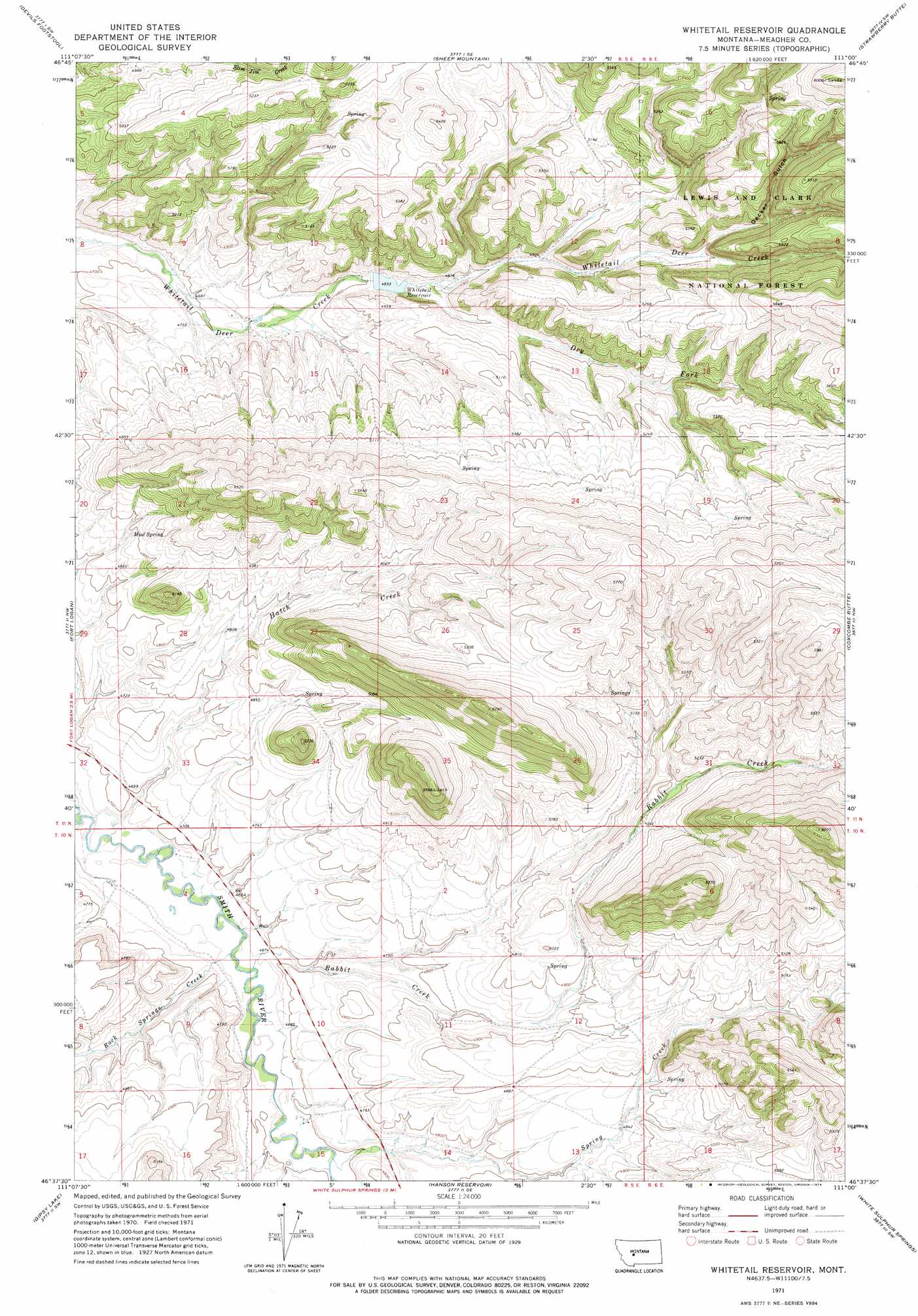
USGS Topo Quad 46111f1 - 1:24,000 scale
| Topo Map Name: | Whitetail Reservoir |
| USGS Topo Quad ID: | 46111f1 |
| Print Size: | ca. 21 1/4" wide x 27" high |
| Southeast Coordinates: | 46.625° N latitude / 111° W longitude |
| Map Center Coordinates: | 46.6875° N latitude / 111.0625° W longitude |
| U.S. State: | MT |
| Filename: | o46111f1.jpg |
| Download Map JPG Image: | Whitetail Reservoir topo map 1:24,000 scale |
| Map Type: | Topographic |
| Topo Series: | 7.5´ |
| Map Scale: | 1:24,000 |
| Source of Map Images: | United States Geological Survey (USGS) |
| Alternate Map Versions: |
Whitetail Reservoir MT 1971, updated 1974 Download PDF Buy paper map Whitetail Reservoir MT 1995, updated 1997 Download PDF Buy paper map Whitetail Reservoir MT 2011 Download PDF Buy paper map Whitetail Reservoir MT 2014 Download PDF Buy paper map |
| FStopo: | US Forest Service topo Whitetail Reservoir is available: Download FStopo PDF Download FStopo TIF |
1:24,000 Topo Quads surrounding Whitetail Reservoir
Lingshire Ne |
Bald Hills |
Monument Peak |
Bubbling Springs |
Belt Park Butte |
Ellis Canyon |
Devils Footstool |
Sheep Mountain |
Strawberry Butte |
Moose Mountain |
Watson |
Fort Logan |
Whitetail Reservoir |
Coxcombe Butte |
Charcoal Gulch |
Boulder Baldy |
Gipsy Lake |
Hanson Reservoir |
White Sulphur Springs |
Pinchout Creek |
Gurnett Creek East |
Mount Edith |
Alkali Lake |
Catlin Spring |
Manger Park |
> Back to 46111e1 at 1:100,000 scale
> Back to 46110a1 at 1:250,000 scale
> Back to U.S. Topo Maps home
Whitetail Reservoir topo map: Gazetteer
Whitetail Reservoir: Dams
Whitetail Dam elevation 1472m 4829′Whitetail Reservoir: Reservoirs
Whitetail Reservoir elevation 1471m 4826′Whitetail Reservoir: Springs
Mud Spring elevation 1481m 4858′Whitetail Reservoir: Streams
Dry Fork Whitetail Deer Creek elevation 1480m 4855′Hatch Creek elevation 1418m 4652′
Rabbit Creek elevation 1418m 4652′
Rabbit Creek elevation 1420m 4658′
Rock Springs Creek elevation 1421m 4662′
Spring Creek elevation 1429m 4688′
Whitetail Reservoir: Valleys
Decker Gulch elevation 1553m 5095′Whitetail Reservoir: Wells
10N05E02C___01 Well elevation 1462m 4796′10N05E04BA__01 Well elevation 1415m 4642′
10N05E05AD__01 Well elevation 1432m 4698′
Whitetail Reservoir digital topo map on disk
Buy this Whitetail Reservoir topo map showing relief, roads, GPS coordinates and other geographical features, as a high-resolution digital map file on DVD: