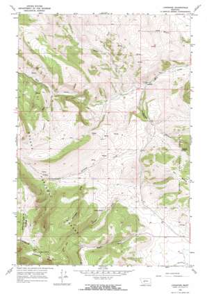
Lingshire Topo Map Montana
To zoom in, hover over the map of Lingshire
USGS Topo Quad 46111g4 - 1:24,000 scale
| Topo Map Name: | Lingshire |
| USGS Topo Quad ID: | 46111g4 |
| Print Size: | ca. 21 1/4" wide x 27" high |
| Southeast Coordinates: | 46.75° N latitude / 111.375° W longitude |
| Map Center Coordinates: | 46.8125° N latitude / 111.4375° W longitude |
| U.S. State: | MT |
| Filename: | o46111g4.jpg |
| Download Map JPG Image: | Lingshire topo map 1:24,000 scale |
| Map Type: | Topographic |
| Topo Series: | 7.5´ |
| Map Scale: | 1:24,000 |
| Source of Map Images: | United States Geological Survey (USGS) |
| Alternate Map Versions: |
Lingshire MT 1966, updated 1970 Download PDF Buy paper map Lingshire MT 1966, updated 1970 Download PDF Buy paper map Lingshire MT 2001, updated 2004 Download PDF Buy paper map Lingshire MT 2011 Download PDF Buy paper map Lingshire MT 2014 Download PDF Buy paper map |
| FStopo: | US Forest Service topo Lingshire is available: Download FStopo PDF Download FStopo TIF |
1:24,000 Topo Quads surrounding Lingshire
> Back to 46111e1 at 1:100,000 scale
> Back to 46110a1 at 1:250,000 scale
> Back to U.S. Topo Maps home
Lingshire topo map: Gazetteer
Lingshire: Populated Places
Lingshire elevation 1426m 4678′Lingshire: Post Offices
Lingshire Post Office (historical) elevation 1426m 4678′Lingshire: Springs
Ashford Spring elevation 1653m 5423′Crystal Spring elevation 1734m 5688′
Lingshire: Streams
Antelope Creek elevation 1427m 4681′East Fork Indian Creek elevation 1531m 5022′
Indian Creek elevation 1441m 4727′
Lingshire: Summits
Avalanche Butte elevation 2344m 7690′Lingshire: Valleys
Buffalo Canyon elevation 1436m 4711′Calamity Gulch elevation 1549m 5082′
Moonshine Gulch elevation 1654m 5426′
Rubison Gulch elevation 1635m 5364′
Wagner Gulch elevation 1683m 5521′
Lingshire digital topo map on disk
Buy this Lingshire topo map showing relief, roads, GPS coordinates and other geographical features, as a high-resolution digital map file on DVD:


