Lingshire Nw Topo Map Montana
To zoom in, hover over the map of Lingshire Nw
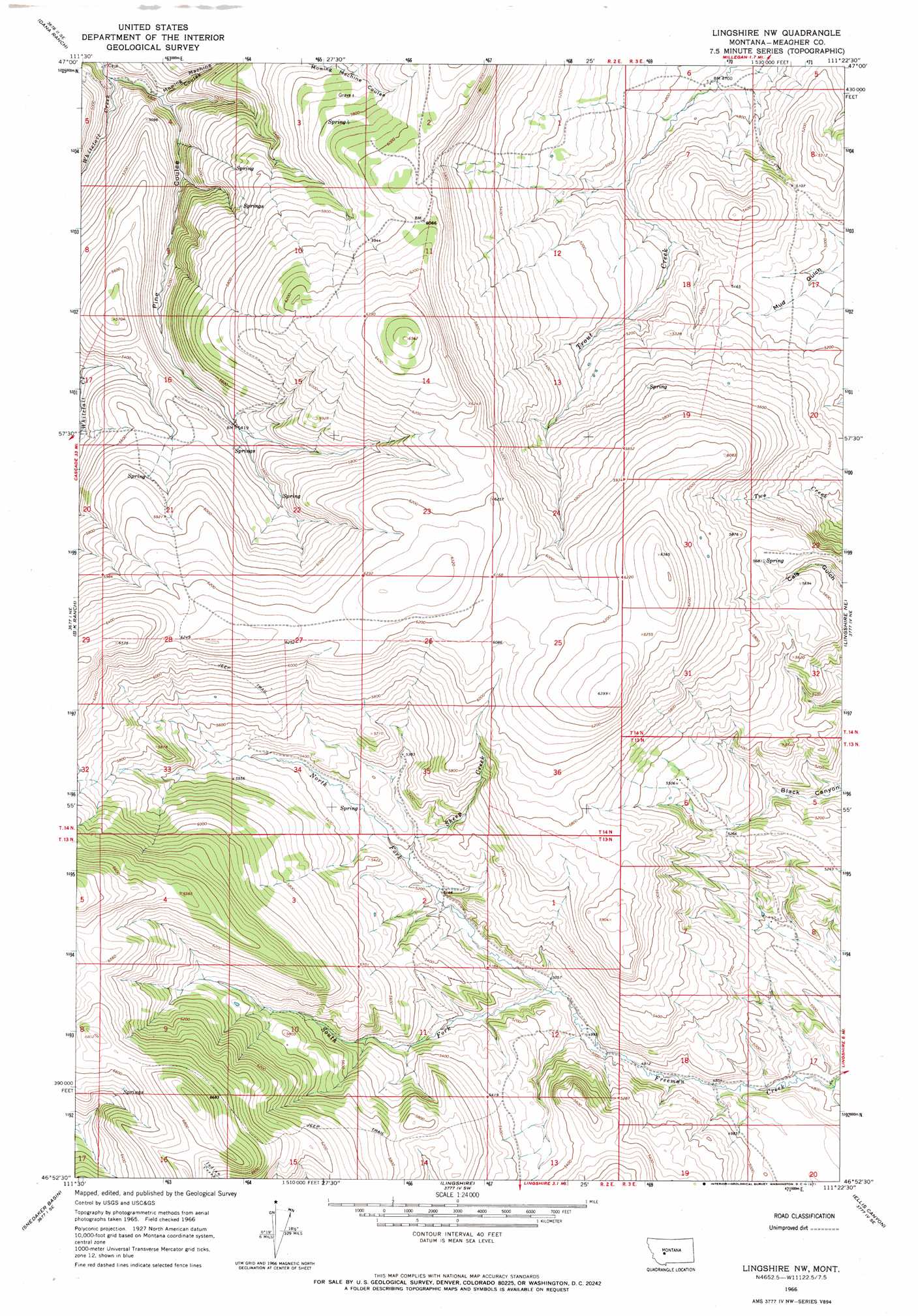
USGS Topo Quad 46111h4 - 1:24,000 scale
| Topo Map Name: | Lingshire Nw |
| USGS Topo Quad ID: | 46111h4 |
| Print Size: | ca. 21 1/4" wide x 27" high |
| Southeast Coordinates: | 46.875° N latitude / 111.375° W longitude |
| Map Center Coordinates: | 46.9375° N latitude / 111.4375° W longitude |
| U.S. State: | MT |
| Filename: | o46111h4.jpg |
| Download Map JPG Image: | Lingshire Nw topo map 1:24,000 scale |
| Map Type: | Topographic |
| Topo Series: | 7.5´ |
| Map Scale: | 1:24,000 |
| Source of Map Images: | United States Geological Survey (USGS) |
| Alternate Map Versions: |
Lingshire NW MT 1966, updated 1971 Download PDF Buy paper map Lingshire NW MT 2011 Download PDF Buy paper map Lingshire NW MT 2014 Download PDF Buy paper map |
1:24,000 Topo Quads surrounding Lingshire Nw
Rocky Reef |
Schrammeck Lake |
Spanish Coulee School |
Boston Coulee School |
Calvert |
Hound Creek Reservoir |
Dana Ranch |
Conway Ridge |
Millegan |
Deep Creek Park |
Middle Creek Lake |
B K Ranch |
Lingshire Nw |
Lingshire Ne |
Bald Hills |
Hogback Mountain |
Snedaker Basin |
Lingshire |
Ellis Canyon |
Devils Footstool |
Canyon Ferry |
Hellgate Gulch |
Whites City |
Watson |
Fort Logan |
> Back to 46111e1 at 1:100,000 scale
> Back to 46110a1 at 1:250,000 scale
> Back to U.S. Topo Maps home
Lingshire Nw topo map: Gazetteer
Lingshire Nw: Post Offices
Flint Post Office (historical) elevation 1768m 5800′Lingshire Nw: Streams
North Fork Freeman Creek elevation 1530m 5019′Sheep Creek elevation 1581m 5187′
South Fork Freeman Creek elevation 1531m 5022′
Whitetail Creek elevation 1414m 4639′
Lingshire Nw: Valleys
Mowing Machine Coulee elevation 1551m 5088′Lingshire Nw digital topo map on disk
Buy this Lingshire Nw topo map showing relief, roads, GPS coordinates and other geographical features, as a high-resolution digital map file on DVD: