Candle Mountain Topo Map Montana
To zoom in, hover over the map of Candle Mountain
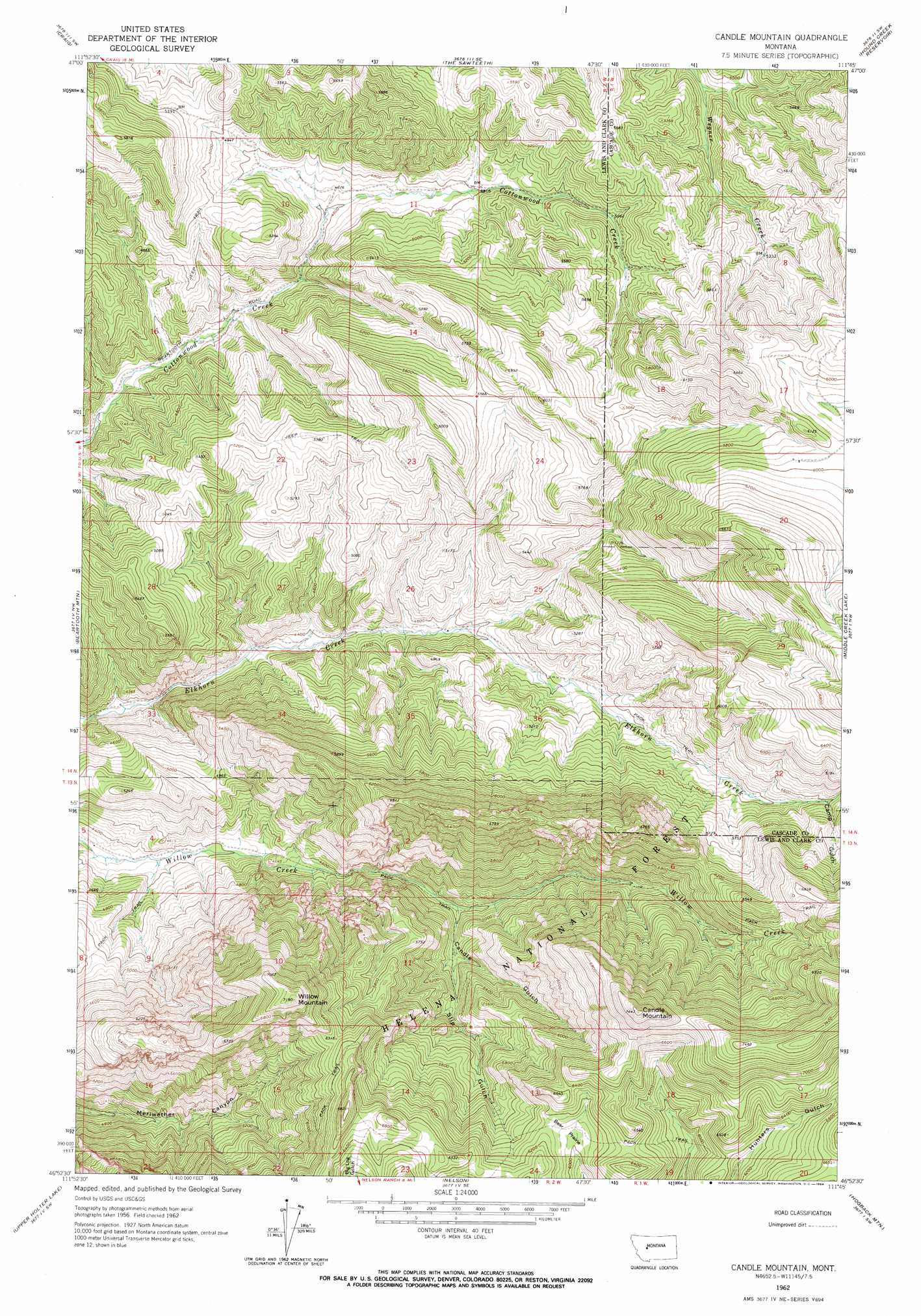
USGS Topo Quad 46111h7 - 1:24,000 scale
| Topo Map Name: | Candle Mountain |
| USGS Topo Quad ID: | 46111h7 |
| Print Size: | ca. 21 1/4" wide x 27" high |
| Southeast Coordinates: | 46.875° N latitude / 111.75° W longitude |
| Map Center Coordinates: | 46.9375° N latitude / 111.8125° W longitude |
| U.S. State: | MT |
| Filename: | o46111h7.jpg |
| Download Map JPG Image: | Candle Mountain topo map 1:24,000 scale |
| Map Type: | Topographic |
| Topo Series: | 7.5´ |
| Map Scale: | 1:24,000 |
| Source of Map Images: | United States Geological Survey (USGS) |
| Alternate Map Versions: |
Candle Mountain MT 1962, updated 1964 Download PDF Buy paper map Candle Mountain MT 2011 Download PDF Buy paper map Candle Mountain MT 2014 Download PDF Buy paper map |
| FStopo: | US Forest Service topo Candle Mountain is available: Download FStopo PDF Download FStopo TIF |
1:24,000 Topo Quads surrounding Candle Mountain
Coburn Mountain |
Mid Canon |
Hardy |
Rocky Reef |
Schrammeck Lake |
Wolf Creek |
Craig |
The Sawteeth |
Hound Creek Reservoir |
Dana Ranch |
Sheep Creek |
Beartooth Mountain |
Candle Mountain |
Middle Creek Lake |
B K Ranch |
Rattlesnake Mountain |
Upper Holter Lake |
Nelson |
Hogback Mountain |
Snedaker Basin |
Scratchgravel Hill |
Lake Helena |
Hauser Lake |
Canyon Ferry |
Hellgate Gulch |
> Back to 46111e1 at 1:100,000 scale
> Back to 46110a1 at 1:250,000 scale
> Back to U.S. Topo Maps home
Candle Mountain topo map: Gazetteer
Candle Mountain: Flats
Bear Prairie elevation 1848m 6062′Candle Mountain: Parks
Beartooth Game Management Area elevation 1625m 5331′Candle Mountain: Springs
Kennedy Spring elevation 1929m 6328′Candle Mountain: Summits
Candle Mountain elevation 2258m 7408′Willow Mountain elevation 2185m 7168′
Candle Mountain: Valleys
Camp Gulch elevation 1705m 5593′Candle Gulch elevation 1458m 4783′
Slip Gulch elevation 1486m 4875′
Candle Mountain digital topo map on disk
Buy this Candle Mountain topo map showing relief, roads, GPS coordinates and other geographical features, as a high-resolution digital map file on DVD: