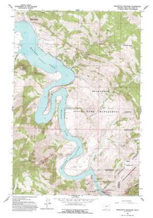
Beartooth Mountain Topo Map Montana
To zoom in, hover over the map of Beartooth Mountain
USGS Topo Quad 46111h8 - 1:24,000 scale
| Topo Map Name: | Beartooth Mountain |
| USGS Topo Quad ID: | 46111h8 |
| Print Size: | ca. 21 1/4" wide x 27" high |
| Southeast Coordinates: | 46.875° N latitude / 111.875° W longitude |
| Map Center Coordinates: | 46.9375° N latitude / 111.9375° W longitude |
| U.S. State: | MT |
| Filename: | o46111h8.jpg |
| Download Map JPG Image: | Beartooth Mountain topo map 1:24,000 scale |
| Map Type: | Topographic |
| Topo Series: | 7.5´ |
| Map Scale: | 1:24,000 |
| Source of Map Images: | United States Geological Survey (USGS) |
| Alternate Map Versions: |
Beartooth Mountain MT 1962, updated 1964 Download PDF Buy paper map Beartooth Mountain MT 1962, updated 1972 Download PDF Buy paper map Beartooth Mountain MT 1962, updated 1984 Download PDF Buy paper map Beartooth Mountain MT 1962, updated 1993 Download PDF Buy paper map Beartooth Mountain MT 1962, updated 1993 Download PDF Buy paper map Beartooth Mountain MT 2001, updated 2004 Download PDF Buy paper map Beartooth Mountain MT 2011 Download PDF Buy paper map Beartooth Mountain MT 2014 Download PDF Buy paper map |
| FStopo: | US Forest Service topo Beartooth Mountain is available: Download FStopo PDF Download FStopo TIF |
1:24,000 Topo Quads surrounding Beartooth Mountain
> Back to 46111e1 at 1:100,000 scale
> Back to 46110a1 at 1:250,000 scale
> Back to U.S. Topo Maps home
Beartooth Mountain topo map: Gazetteer
Beartooth Mountain: Airports
Ming Bar Landing Strip elevation 1192m 3910′Beartooth Mountain: Bars
Ming Bar elevation 1169m 3835′Beartooth Mountain: Bends
Oxbow Bend elevation 1176m 3858′Beartooth Mountain: Gaps
Gates of the Rocky Mountains elevation 1092m 3582′Beartooth Mountain: Parks
Holter Lake State Recreation Area elevation 1098m 3602′Log Gulch Recreation Area elevation 1098m 3602′
Beartooth Mountain: Populated Places
Dennison (historical) elevation 1152m 3779′Beartooth Mountain: Streams
Burke Creek elevation 1092m 3582′Cottonwood Creek elevation 1092m 3582′
Elkhorn Creek elevation 1145m 3756′
Willow Creek elevation 1093m 3585′
Beartooth Mountain: Summits
Beartooth Mountain elevation 1839m 6033′Jackson Peak elevation 1555m 5101′
Beartooth Mountain: Valleys
Falls Gulch elevation 1092m 3582′Log Gulch elevation 1092m 3582′
Mann Gulch elevation 1098m 3602′
Beartooth Mountain digital topo map on disk
Buy this Beartooth Mountain topo map showing relief, roads, GPS coordinates and other geographical features, as a high-resolution digital map file on DVD:


