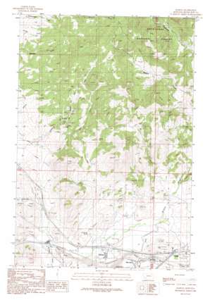
Ramsay Topo Map Montana
To zoom in, hover over the map of Ramsay
USGS Topo Quad 46112a6 - 1:24,000 scale
| Topo Map Name: | Ramsay |
| USGS Topo Quad ID: | 46112a6 |
| Print Size: | ca. 21 1/4" wide x 27" high |
| Southeast Coordinates: | 46° N latitude / 112.625° W longitude |
| Map Center Coordinates: | 46.0625° N latitude / 112.6875° W longitude |
| U.S. State: | MT |
| Filename: | o46112a6.jpg |
| Download Map JPG Image: | Ramsay topo map 1:24,000 scale |
| Map Type: | Topographic |
| Topo Series: | 7.5´ |
| Map Scale: | 1:24,000 |
| Source of Map Images: | United States Geological Survey (USGS) |
| Alternate Map Versions: |
Ramsay MT 1989, updated 1989 Download PDF Buy paper map Ramsay MT 1996, updated 1998 Download PDF Buy paper map Ramsay MT 2011 Download PDF Buy paper map Ramsay MT 2014 Download PDF Buy paper map |
| FStopo: | US Forest Service topo Ramsay is available: Download FStopo PDF Download FStopo TIF |
1:24,000 Topo Quads surrounding Ramsay
> Back to 46112a1 at 1:100,000 scale
> Back to 46112a1 at 1:250,000 scale
> Back to U.S. Topo Maps home
Ramsay topo map: Gazetteer
Ramsay: Bridges
Silver Bow Creek Bridge elevation 1631m 5351′Ramsay: Crossings
Interchange 121 elevation 1636m 5367′Interchange 216 elevation 1634m 5360′
Ramsay: Mines
Butte and Zenith Mine elevation 1675m 5495′NE SW Section 22 Mine elevation 1900m 6233′
Tuxedo Mine elevation 1845m 6053′
Ramsay: Populated Places
Miles Crossing elevation 1611m 5285′Nissler elevation 1636m 5367′
Ramsay elevation 1627m 5337′
Silver Bow elevation 1624m 5328′
Ramsay: Post Offices
Ramsay Post Office elevation 1629m 5344′Ramsay: Springs
Chinamans Spring elevation 1646m 5400′Ramsay: Streams
Sand Creek elevation 1623m 5324′Ramsay: Valleys
Browns Gulch elevation 1623m 5324′McCleery Gulch elevation 1611m 5285′
Oro Fino Gulch elevation 1678m 5505′
Sheep Gulch elevation 1611m 5285′
Telegraph Gulch elevation 1757m 5764′
Ramsay: Wells
03N10W02CDAB01 Well elevation 1671m 5482′04N09W04DD__01 Well elevation 1812m 5944′
04N09W05CD__01 Well elevation 1676m 5498′
Ramsay digital topo map on disk
Buy this Ramsay topo map showing relief, roads, GPS coordinates and other geographical features, as a high-resolution digital map file on DVD:


