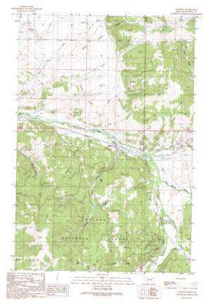
Elliston Topo Map Montana
To zoom in, hover over the map of Elliston
USGS Topo Quad 46112e4 - 1:24,000 scale
| Topo Map Name: | Elliston |
| USGS Topo Quad ID: | 46112e4 |
| Print Size: | ca. 21 1/4" wide x 27" high |
| Southeast Coordinates: | 46.5° N latitude / 112.375° W longitude |
| Map Center Coordinates: | 46.5625° N latitude / 112.4375° W longitude |
| U.S. State: | MT |
| Filename: | o46112e4.jpg |
| Download Map JPG Image: | Elliston topo map 1:24,000 scale |
| Map Type: | Topographic |
| Topo Series: | 7.5´ |
| Map Scale: | 1:24,000 |
| Source of Map Images: | United States Geological Survey (USGS) |
| Alternate Map Versions: |
Elliston MT 1989, updated 1989 Download PDF Buy paper map Elliston MT 2001, updated 2004 Download PDF Buy paper map Elliston MT 2011 Download PDF Buy paper map Elliston MT 2014 Download PDF Buy paper map |
| FStopo: | US Forest Service topo Elliston is available: Download FStopo PDF Download FStopo TIF |
1:24,000 Topo Quads surrounding Elliston
> Back to 46112e1 at 1:100,000 scale
> Back to 46112a1 at 1:250,000 scale
> Back to U.S. Topo Maps home
Elliston topo map: Gazetteer
Elliston: Lakes
Lilly Lake elevation 1656m 5433′Slate Lake elevation 1831m 6007′
Elliston: Mines
Carbonate King Mine elevation 1829m 6000′Carbonate King Mine elevation 1833m 6013′
Elliston: Populated Places
Elliston elevation 1542m 5059′Elliston: Post Offices
Elliston Post Office elevation 1542m 5059′Sweetland Post Office (historical) elevation 1590m 5216′
Elliston: Streams
Dog Creek elevation 1551m 5088′Elliston Creek elevation 1539m 5049′
Gold Canyon Creek elevation 1529m 5016′
MacDonald Creek elevation 1583m 5193′
Slate Creek elevation 1623m 5324′
Telegraph Creek elevation 1579m 5180′
Elliston: Valleys
Kinney Gulch elevation 1533m 5029′Logan Gulch elevation 1575m 5167′
Mike Renig Gulch elevation 1584m 5196′
Elliston: Wells
09N06W05ACCD01 Well elevation 1604m 5262′09N06W06DCDA01 Well elevation 1563m 5127′
09N06W18BAAC01 Well elevation 1579m 5180′
09N06W18BBBA01 Well elevation 1608m 5275′
09N06W19AABC01 Well elevation 1593m 5226′
09N06W30CABA01 Well elevation 1619m 5311′
09N07W02ADDB01 Well elevation 1540m 5052′
09N07W02DABA01 Well elevation 1546m 5072′
10N07W17ADCD01 Well elevation 1506m 4940′
10N07W17DABB01 Well elevation 1505m 4937′
Elliston digital topo map on disk
Buy this Elliston topo map showing relief, roads, GPS coordinates and other geographical features, as a high-resolution digital map file on DVD:


