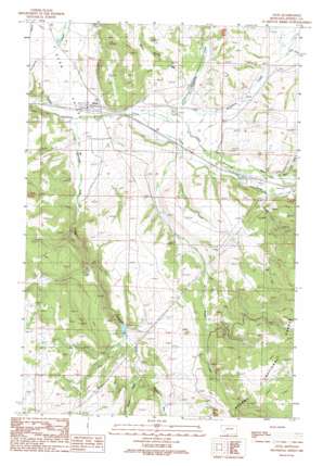
Avon Topo Map Montana
To zoom in, hover over the map of Avon
USGS Topo Quad 46112e5 - 1:24,000 scale
| Topo Map Name: | Avon |
| USGS Topo Quad ID: | 46112e5 |
| Print Size: | ca. 21 1/4" wide x 27" high |
| Southeast Coordinates: | 46.5° N latitude / 112.5° W longitude |
| Map Center Coordinates: | 46.5625° N latitude / 112.5625° W longitude |
| U.S. State: | MT |
| Filename: | o46112e5.jpg |
| Download Map JPG Image: | Avon topo map 1:24,000 scale |
| Map Type: | Topographic |
| Topo Series: | 7.5´ |
| Map Scale: | 1:24,000 |
| Source of Map Images: | United States Geological Survey (USGS) |
| Alternate Map Versions: |
Avon MT 1989, updated 1989 Download PDF Buy paper map Avon MT 2001, updated 2004 Download PDF Buy paper map Avon MT 2011 Download PDF Buy paper map Avon MT 2014 Download PDF Buy paper map |
| FStopo: | US Forest Service topo Avon is available: Download FStopo PDF Download FStopo TIF |
1:24,000 Topo Quads surrounding Avon
> Back to 46112e1 at 1:100,000 scale
> Back to 46112a1 at 1:250,000 scale
> Back to U.S. Topo Maps home
Avon topo map: Gazetteer
Avon: Bridges
Little Blackfoot River Bridge elevation 1434m 4704′Avon: Dams
Dog Creek Reservoir Dam elevation 1567m 5141′Avon: Mines
Buffalo Mine elevation 1712m 5616′Avon: Populated Places
Avon elevation 1430m 4691′Avon: Post Offices
Avon Post Office elevation 1430m 4691′Keene Post Office (historical) elevation 1487m 4878′
Avon: Streams
Carpenter Creek elevation 1451m 4760′Hurd Creek elevation 1475m 4839′
Middle Fork Spotted Dog Creek elevation 1596m 5236′
North Trout Creek elevation 1487m 4878′
Snowshoe Creek elevation 1451m 4760′
South Fork Spotted Dog Creek elevation 1556m 5104′
Spotted Dog Creek elevation 1428m 4685′
Spring Creek elevation 1495m 4904′
Trout Creek elevation 1438m 4717′
Warm Spring Creek elevation 1461m 4793′
Avon: Wells
10N07W30BBC_01 Well elevation 1476m 4842′10N07W31CAAC01 Well elevation 1485m 4872′
10N08W21ABDB01 Well elevation 1451m 4760′
10N08W27BAAB01 Well elevation 1435m 4708′
10N08W27BABA01 Well elevation 1435m 4708′
10N08W27BABA02 Well elevation 1435m 4708′
10N08W28AAA_03 Well elevation 1432m 4698′
Avon digital topo map on disk
Buy this Avon topo map showing relief, roads, GPS coordinates and other geographical features, as a high-resolution digital map file on DVD:


