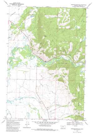
Marcum Mountain Topo Map Montana
To zoom in, hover over the map of Marcum Mountain
USGS Topo Quad 46112h8 - 1:24,000 scale
| Topo Map Name: | Marcum Mountain |
| USGS Topo Quad ID: | 46112h8 |
| Print Size: | ca. 21 1/4" wide x 27" high |
| Southeast Coordinates: | 46.875° N latitude / 112.875° W longitude |
| Map Center Coordinates: | 46.9375° N latitude / 112.9375° W longitude |
| U.S. State: | MT |
| Filename: | o46112h8.jpg |
| Download Map JPG Image: | Marcum Mountain topo map 1:24,000 scale |
| Map Type: | Topographic |
| Topo Series: | 7.5´ |
| Map Scale: | 1:24,000 |
| Source of Map Images: | United States Geological Survey (USGS) |
| Alternate Map Versions: |
Marcum Mountain MT 1968, updated 1971 Download PDF Buy paper map Marcum Mountain MT 1968, updated 1980 Download PDF Buy paper map Marcum Mountain MT 2001, updated 2004 Download PDF Buy paper map Marcum Mountain MT 2011 Download PDF Buy paper map Marcum Mountain MT 2014 Download PDF Buy paper map |
| FStopo: | US Forest Service topo Marcum Mountain is available: Download FStopo PDF Download FStopo TIF |
1:24,000 Topo Quads surrounding Marcum Mountain
> Back to 46112e1 at 1:100,000 scale
> Back to 46112a1 at 1:250,000 scale
> Back to U.S. Topo Maps home
Marcum Mountain topo map: Gazetteer
Marcum Mountain: Canals
North Helmville Canal elevation 1338m 4389′Marcum Mountain: Dams
Copenhagen Dam elevation 1362m 4468′Marcum Mountain: Lakes
Deadmans Lake elevation 1334m 4376′Marcum Mountain: Mines
French Town Mine elevation 1304m 4278′Hungry Hill Mine elevation 1606m 5269′
Nevada Mine elevation 1471m 4826′
NW NE Section 17 Mine elevation 1534m 5032′
NW SE Section 9 Mine elevation 1312m 4304′
Republican Mine elevation 1363m 4471′
Marcum Mountain: Populated Places
Coughlin elevation 1313m 4307′Marcum Mountain: Streams
Arrastra Creek elevation 1318m 4324′Cottonwood Creek elevation 1299m 4261′
Lincoln Slough elevation 1305m 4281′
Shores Creek elevation 1551m 5088′
Spring Creek elevation 1299m 4261′
Wasson Creek elevation 1305m 4281′
Marcum Mountain: Summits
Marcum Mountain elevation 1878m 6161′Mineral Hill elevation 1690m 5544′
Trapper Mountain elevation 1809m 5935′
Marcum Mountain: Wells
13N11W02ADCA01 Well elevation 1340m 4396′13N11W15DCDC01 Well elevation 1307m 4288′
14N11W16AAAD01 Well elevation 1326m 4350′
14N11W33BDD_01 Well elevation 1306m 4284′
14N11W33CDAC01 Well elevation 1306m 4284′
14N11W34ACCA01 Well elevation 1311m 4301′
14N11W35BAAA01 Well elevation 1312m 4304′
Marcum Mountain digital topo map on disk
Buy this Marcum Mountain topo map showing relief, roads, GPS coordinates and other geographical features, as a high-resolution digital map file on DVD:


