Gird Point Topo Map Montana
To zoom in, hover over the map of Gird Point
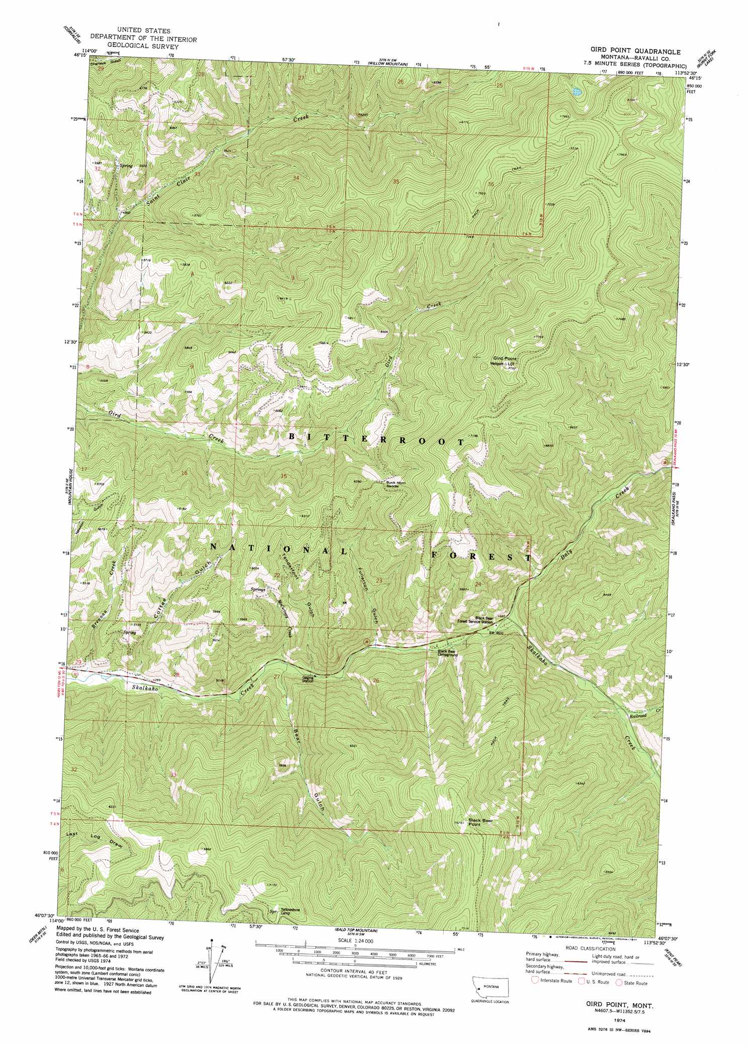
USGS Topo Quad 46113b8 - 1:24,000 scale
| Topo Map Name: | Gird Point |
| USGS Topo Quad ID: | 46113b8 |
| Print Size: | ca. 21 1/4" wide x 27" high |
| Southeast Coordinates: | 46.125° N latitude / 113.875° W longitude |
| Map Center Coordinates: | 46.1875° N latitude / 113.9375° W longitude |
| U.S. State: | MT |
| Filename: | o46113b8.jpg |
| Download Map JPG Image: | Gird Point topo map 1:24,000 scale |
| Map Type: | Topographic |
| Topo Series: | 7.5´ |
| Map Scale: | 1:24,000 |
| Source of Map Images: | United States Geological Survey (USGS) |
| Alternate Map Versions: |
Gird Point MT 1974, updated 1977 Download PDF Buy paper map Gird Point MT 1998, updated 2002 Download PDF Buy paper map Gird Point MT 2011 Download PDF Buy paper map Gird Point MT 2014 Download PDF Buy paper map |
| FStopo: | US Forest Service topo Gird Point is available: Download FStopo PDF Download FStopo TIF |
1:24,000 Topo Quads surrounding Gird Point
Victor |
Bing |
Corley Gulch |
Sawmill Saddle |
Quigg Peak |
Hamilton North |
Corvallis |
Willow Mountain |
Burnt Fork Lake |
Stony Creek |
Hamilton South |
Mountain House |
Gird Point |
Skalkaho Pass |
Mount Emerine |
Darby |
Deer Mountain |
Bald Top Mountain |
Kent Peak |
Whetstone Ridge |
Burnt Ridge |
Robbins Gulch |
French Basin |
Jennings Camp Creek |
Lick Creek |
> Back to 46113a1 at 1:100,000 scale
> Back to 46112a1 at 1:250,000 scale
> Back to U.S. Topo Maps home
Gird Point topo map: Gazetteer
Gird Point: Gaps
Buck Horn Saddle elevation 1832m 6010′Gird Point: Populated Places
Gird Point elevation 2346m 7696′Gird Point: Streams
Brennan Creek elevation 1288m 4225′Daly Creek elevation 1411m 4629′
McCurtney Creek elevation 1350m 4429′
Railroad Creek elevation 1469m 4819′
Gird Point: Summits
Black Bear Point elevation 2295m 7529′Gird Point: Valleys
Bear Gulch elevation 1354m 4442′Coffee Gulch elevation 1314m 4311′
Fullerton Gulch elevation 1394m 4573′
Tenderfoot Gulch elevation 1369m 4491′
Gird Point: Wells
05N19W26BC__01 Well elevation 1420m 4658′Gird Point digital topo map on disk
Buy this Gird Point topo map showing relief, roads, GPS coordinates and other geographical features, as a high-resolution digital map file on DVD: