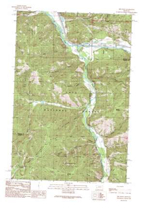
Iris Point Topo Map Montana
To zoom in, hover over the map of Iris Point
USGS Topo Quad 46113f6 - 1:24,000 scale
| Topo Map Name: | Iris Point |
| USGS Topo Quad ID: | 46113f6 |
| Print Size: | ca. 21 1/4" wide x 27" high |
| Southeast Coordinates: | 46.625° N latitude / 113.625° W longitude |
| Map Center Coordinates: | 46.6875° N latitude / 113.6875° W longitude |
| U.S. State: | MT |
| Filename: | o46113f6.jpg |
| Download Map JPG Image: | Iris Point topo map 1:24,000 scale |
| Map Type: | Topographic |
| Topo Series: | 7.5´ |
| Map Scale: | 1:24,000 |
| Source of Map Images: | United States Geological Survey (USGS) |
| Alternate Map Versions: |
Iris Point MT 1989, updated 1989 Download PDF Buy paper map Iris Point MT 1999, updated 2003 Download PDF Buy paper map Iris Point MT 2011 Download PDF Buy paper map Iris Point MT 2014 Download PDF Buy paper map |
| FStopo: | US Forest Service topo Iris Point is available: Download FStopo PDF Download FStopo TIF |
1:24,000 Topo Quads surrounding Iris Point
> Back to 46113e1 at 1:100,000 scale
> Back to 46112a1 at 1:250,000 scale
> Back to U.S. Topo Maps home
Iris Point topo map: Gazetteer
Iris Point: Airports
Elliot Airstrip elevation 1080m 3543′Iris Point: Crossings
Interchange 126 elevation 1078m 3536′Iris Point: Dams
Pollocks JH Valley of the Moon Dam elevation 1450m 4757′Iris Point: Parks
Welcome Creek Wilderness Historical Marker elevation 1084m 3556′Iris Point: Populated Places
Iris elevation 1085m 3559′Iris Point: Post Offices
Pineland Post Office (historical) elevation 1061m 3480′Iris Point: Ridges
Solomon Ridge elevation 2037m 6683′Iris Point: Springs
Colma Spring elevation 1561m 5121′Iris Point: Streams
Babcock Creek elevation 1143m 3750′Gilbert Creek elevation 1106m 3628′
Goat Creek elevation 1147m 3763′
North Fork Gilbert Creek elevation 1237m 4058′
Rock Creek elevation 1073m 3520′
Solomon Creek elevation 1133m 3717′
South Fork Gilbert Creek elevation 1238m 4061′
Spring Creek elevation 1118m 3667′
Starvation Creek elevation 1063m 3487′
Iris Point: Summits
Babcock Mountain elevation 1939m 6361′Iris Point elevation 1957m 6420′
Solomon Mountain elevation 2101m 6893′
Iris Point: Trails
Iris Point Trail elevation 1810m 5938′Solomon Ridge Trail elevation 1986m 6515′
Iris Point: Valleys
Burn Gulch elevation 1318m 4324′Colma Gulch elevation 1250m 4101′
Fiddler Gulch elevation 1120m 3674′
Ione Gulch elevation 1143m 3750′
Kitchen Gulch elevation 1096m 3595′
Matt Gulch elevation 1098m 3602′
Mecca Gulch elevation 1156m 3792′
Moe Gulch elevation 1081m 3546′
Rickard Gulch elevation 1121m 3677′
Tamarack Gulch elevation 1127m 3697′
West Gulch elevation 1163m 3815′
Iris Point: Wells
11N16W06CCDD01 Well elevation 1082m 3549′11N16W06CCDD02 Well elevation 1083m 3553′
11N16W06CDCD01 Well elevation 1080m 3543′
11N16W06CDCD02 Well elevation 1082m 3549′
11N16W07AAAA01 Well elevation 1083m 3553′
11N16W07AAAA02 Well elevation 1083m 3553′
11N16W08ABBA01 Well elevation 1094m 3589′
11N16W08ABBA02 Well elevation 1089m 3572′
11N16W08ADAB01 Well elevation 1096m 3595′
11N16W08BAD_01 Well elevation 1084m 3556′
11N16W08BDA_01 Well elevation 1084m 3556′
11N17W02ABB_01 Well elevation 1069m 3507′
11N17W02ABCB01 Well elevation 1072m 3517′
11N17W02ACBA01 Well elevation 1072m 3517′
11N17W02ACBD01 Well elevation 1072m 3517′
11N17W02ACDC01 Well elevation 1071m 3513′
11N17W02CADA01 Well elevation 1064m 3490′
11N17W12ADDD01 Well elevation 1079m 3540′
11N17W12ADDD02 Well elevation 1077m 3533′
12N17W34DCAD01 Well elevation 1058m 3471′
12N17W34DDAC01 Well elevation 1061m 3480′
12N17W34DDBD01 Well elevation 1060m 3477′
12N17W34DDCB01 Well elevation 1059m 3474′
Iris Point digital topo map on disk
Buy this Iris Point topo map showing relief, roads, GPS coordinates and other geographical features, as a high-resolution digital map file on DVD:


