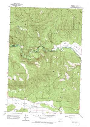
Potomac Topo Map Montana
To zoom in, hover over the map of Potomac
USGS Topo Quad 46113h5 - 1:24,000 scale
| Topo Map Name: | Potomac |
| USGS Topo Quad ID: | 46113h5 |
| Print Size: | ca. 21 1/4" wide x 27" high |
| Southeast Coordinates: | 46.875° N latitude / 113.5° W longitude |
| Map Center Coordinates: | 46.9375° N latitude / 113.5625° W longitude |
| U.S. State: | MT |
| Filename: | o46113h5.jpg |
| Download Map JPG Image: | Potomac topo map 1:24,000 scale |
| Map Type: | Topographic |
| Topo Series: | 7.5´ |
| Map Scale: | 1:24,000 |
| Source of Map Images: | United States Geological Survey (USGS) |
| Alternate Map Versions: |
Potomac MT 1965, updated 1967 Download PDF Buy paper map Potomac MT 1965, updated 1967 Download PDF Buy paper map Potomac MT 1999, updated 2003 Download PDF Buy paper map Potomac MT 2011 Download PDF Buy paper map Potomac MT 2014 Download PDF Buy paper map |
| FStopo: | US Forest Service topo Potomac is available: Download FStopo PDF Download FStopo TIF |
1:24,000 Topo Quads surrounding Potomac
> Back to 46113e1 at 1:100,000 scale
> Back to 46112a1 at 1:250,000 scale
> Back to U.S. Topo Maps home
Potomac topo map: Gazetteer
Potomac: Bridges
Whitaker Bridge elevation 1069m 3507′Potomac: Dams
R Wills Dam elevation 1113m 3651′Potomac: Flats
Camas Prairie elevation 1086m 3562′Goose Rock Flat elevation 1118m 3667′
Red Rock Flat elevation 1106m 3628′
Potomac: Gaps
Steves Pass elevation 1472m 4829′Potomac: Mines
SW Section 23 Mine elevation 1241m 4071′Potomac: Pillars
Goose Rock elevation 1075m 3526′Red Rock elevation 1087m 3566′
Potomac: Populated Places
Potomac elevation 1103m 3618′Potomac: Post Offices
Potomac Post Office elevation 1096m 3595′Potomac: Rapids
Thibideau Rapids elevation 1060m 3477′Potomac: Streams
Ashby Creek elevation 1094m 3589′Belmont Creek elevation 1080m 3543′
Blixit Creek elevation 1095m 3592′
Buck Creek elevation 1060m 3477′
Camas Creek elevation 1087m 3566′
Little Belmont Creek elevation 1064m 3490′
Potomac: Summits
Little Belmont Point elevation 1602m 5255′Morrison Peak elevation 1715m 5626′
Potomac: Valleys
Dunnigan Gulch elevation 1096m 3595′Potomac digital topo map on disk
Buy this Potomac topo map showing relief, roads, GPS coordinates and other geographical features, as a high-resolution digital map file on DVD:


