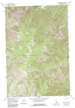
Moose Ridge Topo Map Idaho
To zoom in, hover over the map of Moose Ridge
USGS Topo Quad 46114a8 - 1:24,000 scale
| Topo Map Name: | Moose Ridge |
| USGS Topo Quad ID: | 46114a8 |
| Print Size: | ca. 21 1/4" wide x 27" high |
| Southeast Coordinates: | 46° N latitude / 114.875° W longitude |
| Map Center Coordinates: | 46.0625° N latitude / 114.9375° W longitude |
| U.S. State: | ID |
| Filename: | o46114a8.jpg |
| Download Map JPG Image: | Moose Ridge topo map 1:24,000 scale |
| Map Type: | Topographic |
| Topo Series: | 7.5´ |
| Map Scale: | 1:24,000 |
| Source of Map Images: | United States Geological Survey (USGS) |
| Alternate Map Versions: |
Moose Ridge ID 1966, updated 1968 Download PDF Buy paper map Moose Ridge ID 1966, updated 1987 Download PDF Buy paper map Moose Ridge ID 1995, updated 1999 Download PDF Buy paper map Moose Ridge ID 2011 Download PDF Buy paper map Moose Ridge ID 2013 Download PDF Buy paper map |
| FStopo: | US Forest Service topo Moose Ridge is available: Download FStopo PDF Download FStopo TIF |
1:24,000 Topo Quads surrounding Moose Ridge
> Back to 46114a1 at 1:100,000 scale
> Back to 46114a1 at 1:250,000 scale
> Back to U.S. Topo Maps home
Moose Ridge topo map: Gazetteer
Moose Ridge: Airports
Moose Creek Airport elevation 730m 2395′Moose Ridge: Cliffs
Tony Point elevation 1867m 6125′Moose Ridge: Flats
Cedar Flats elevation 648m 2125′Fox Park elevation 1419m 4655′
Moose Ridge: Gaps
Grizzly Saddle elevation 1560m 5118′Moose Ridge: Lakes
Bitch Lake elevation 1862m 6108′Moose Ridge: Rapids
Double Drop Rapids elevation 663m 2175′Moose Ridge: Ridges
Moose Ridge elevation 2137m 7011′Moose Ridge: Streams
Bitch Creek elevation 1864m 6115′Clamp Creek elevation 698m 2290′
Divide Creek elevation 665m 2181′
Dog Creek elevation 715m 2345′
Fox Creek elevation 1585m 5200′
Halfway Creek elevation 632m 2073′
Hell Creek elevation 706m 2316′
Hopwood Creek elevation 693m 2273′
Jake Creek elevation 661m 2168′
Lonesome Creek elevation 1454m 4770′
Magkpie Creek elevation 708m 2322′
Moose Creek elevation 666m 2185′
Puzzle Creek elevation 648m 2125′
Tony Creek elevation 673m 2208′
Moose Ridge: Summits
Patrol Point elevation 1786m 5859′Puzzle Point elevation 1838m 6030′
Shearer Peak elevation 1894m 6213′
Moose Ridge digital topo map on disk
Buy this Moose Ridge topo map showing relief, roads, GPS coordinates and other geographical features, as a high-resolution digital map file on DVD:


