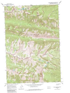
Ward Mountain Topo Map Montana
To zoom in, hover over the map of Ward Mountain
USGS Topo Quad 46114b3 - 1:24,000 scale
| Topo Map Name: | Ward Mountain |
| USGS Topo Quad ID: | 46114b3 |
| Print Size: | ca. 21 1/4" wide x 27" high |
| Southeast Coordinates: | 46.125° N latitude / 114.25° W longitude |
| Map Center Coordinates: | 46.1875° N latitude / 114.3125° W longitude |
| U.S. State: | MT |
| Filename: | o46114b3.jpg |
| Download Map JPG Image: | Ward Mountain topo map 1:24,000 scale |
| Map Type: | Topographic |
| Topo Series: | 7.5´ |
| Map Scale: | 1:24,000 |
| Source of Map Images: | United States Geological Survey (USGS) |
| Alternate Map Versions: |
Ward Mountain MT 1964, updated 1968 Download PDF Buy paper map Ward Mountain MT 1964, updated 1984 Download PDF Buy paper map Ward Mountain MT 1964, updated 1984 Download PDF Buy paper map Ward Mountain MT 1998, updated 2002 Download PDF Buy paper map Ward Mountain MT 2011 Download PDF Buy paper map Ward Mountain MT 2014 Download PDF Buy paper map |
| FStopo: | US Forest Service topo Ward Mountain is available: Download FStopo PDF Download FStopo TIF |
1:24,000 Topo Quads surrounding Ward Mountain
> Back to 46114a1 at 1:100,000 scale
> Back to 46114a1 at 1:250,000 scale
> Back to U.S. Topo Maps home
Ward Mountain topo map: Gazetteer
Ward Mountain: Dams
Canyon Lake Dam elevation 2226m 7303′Wyant Lake Dam elevation 2335m 7660′
Ward Mountain: Falls
Canyon Falls elevation 2150m 7053′Ward Mountain: Lakes
Camas Lake elevation 2114m 6935′Canyon Lake elevation 2226m 7303′
East Lake elevation 2203m 7227′
Kidney Lake elevation 2239m 7345′
Ward Mountain: Reservoirs
Canyon Lake elevation 2226m 7303′Wyant Lake elevation 2335m 7660′
Ward Mountain: Summits
Canyon Peak elevation 2775m 9104′Downing Mountain elevation 2634m 8641′
Ward Mountain elevation 2776m 9107′
Ward Mountain digital topo map on disk
Buy this Ward Mountain topo map showing relief, roads, GPS coordinates and other geographical features, as a high-resolution digital map file on DVD:


