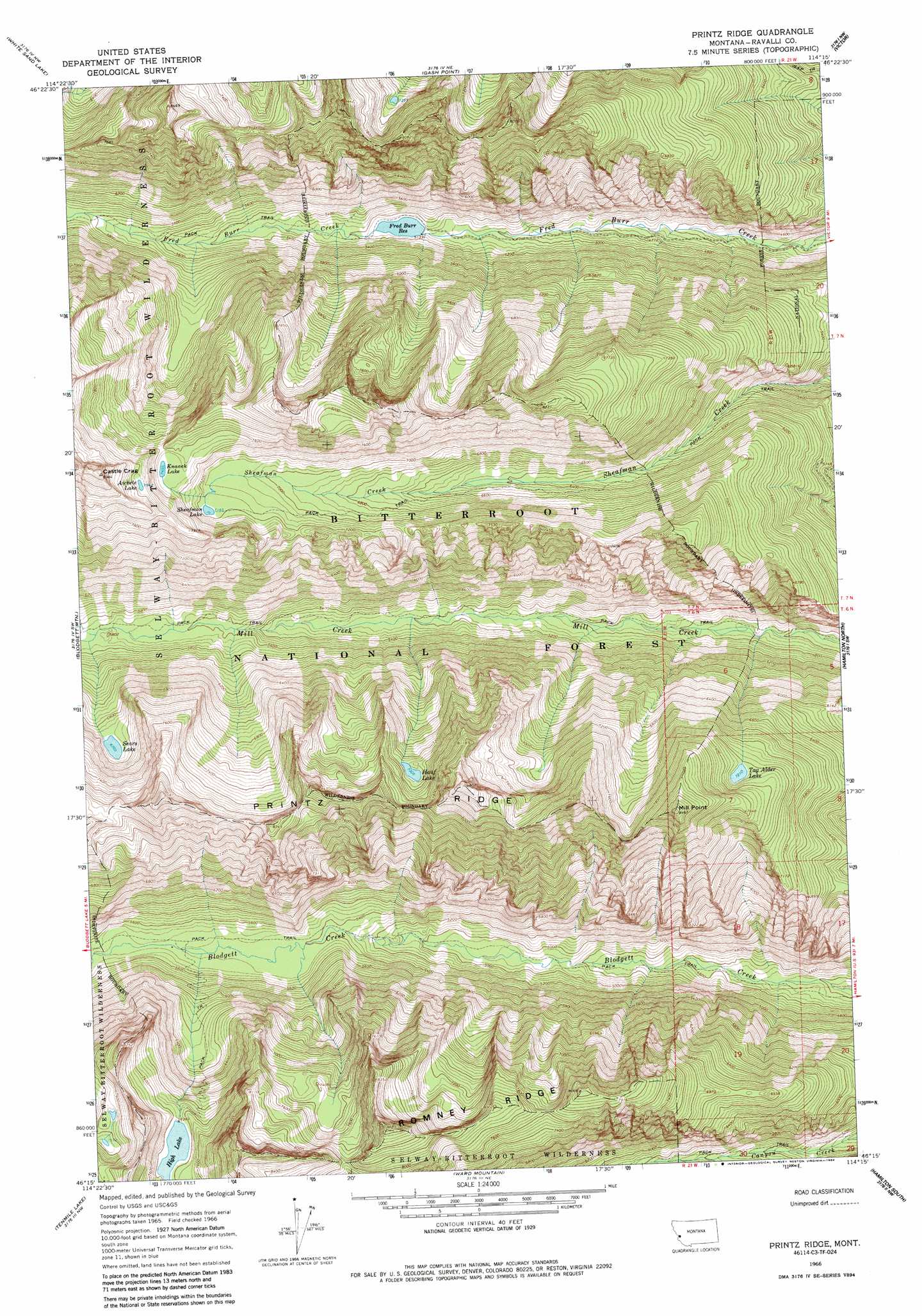
Printz Ridge Topo Map Montana
To zoom in, hover over the map of Printz Ridge
USGS Topo Quad 46114c3 - 1:24,000 scale
| Topo Map Name: | Printz Ridge |
| USGS Topo Quad ID: | 46114c3 |
| Print Size: | ca. 21 1/4" wide x 27" high |
| Southeast Coordinates: | 46.25° N latitude / 114.25° W longitude |
| Map Center Coordinates: | 46.3125° N latitude / 114.3125° W longitude |
| U.S. State: | MT |
| Filename: | o46114c3.jpg |
| Download Map JPG Image: | Printz Ridge topo map 1:24,000 scale |
| Map Type: | Topographic |
| Topo Series: | 7.5´ |
| Map Scale: | 1:24,000 |
| Source of Map Images: | United States Geological Survey (USGS) |
| Alternate Map Versions: |
Printz Ridge MT 1966, updated 1969 Download PDF Buy paper map Printz Ridge MT 1966, updated 1984 Download PDF Buy paper map Printz Ridge MT 1998, updated 2002 Download PDF Buy paper map Printz Ridge MT 2011 Download PDF Buy paper map Printz Ridge MT 2014 Download PDF Buy paper map |
| FStopo: | US Forest Service topo Printz Ridge is available: Download FStopo PDF Download FStopo TIF |
1:24,000 Topo Quads surrounding Printz Ridge
Roundtop |
Ranger Peak |
Saint Joseph Peak |
Saint Mary Peak |
Stevensville |
Savage Ridge |
White Sand Lake |
Gash Point |
Victor |
Bing |
Jeanette Mountain |
Blodgett Mountain |
Printz Ridge |
Hamilton North |
Corvallis |
Saddle Mountain |
Tenmile Lake |
Ward Mountain |
Hamilton South |
Mountain House |
Hunter Peak |
El Capitan |
Como Peaks |
Darby |
Deer Mountain |
> Back to 46114a1 at 1:100,000 scale
> Back to 46114a1 at 1:250,000 scale
> Back to U.S. Topo Maps home
Printz Ridge topo map: Gazetteer
Printz Ridge: Cliffs
Castle Crag elevation 2738m 8982′Printz Ridge: Dams
Fred Burr Reservoir Dam elevation 1587m 5206′Hauf Lake Dam elevation 2293m 7522′
High Lake Dam elevation 2250m 7381′
Sears Dam elevation 2044m 6706′
Printz Ridge: Lakes
Aichele Lake elevation 2424m 7952′Garrard Lake elevation 2193m 7194′
Hauf Lake elevation 2228m 7309′
Knaack Lake elevation 2290m 7513′
Tag Alder Lake elevation 2199m 7214′
Printz Ridge: Reservoirs
Fred Burr Reservoir elevation 1567m 5141′Hauf Lake elevation 2293m 7522′
High Lake elevation 2250m 7381′
Sears Lake elevation 2044m 6706′
Printz Ridge: Ridges
Printz Ridge elevation 2515m 8251′Printz Ridge: Summits
Mill Point elevation 2565m 8415′Printz Ridge digital topo map on disk
Buy this Printz Ridge topo map showing relief, roads, GPS coordinates and other geographical features, as a high-resolution digital map file on DVD: