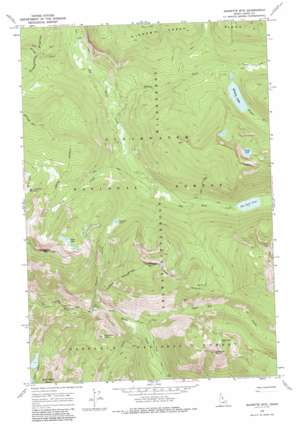
Jeanette Mountain Topo Map Idaho
To zoom in, hover over the map of Jeanette Mountain
USGS Topo Quad 46114c5 - 1:24,000 scale
| Topo Map Name: | Jeanette Mountain |
| USGS Topo Quad ID: | 46114c5 |
| Print Size: | ca. 21 1/4" wide x 27" high |
| Southeast Coordinates: | 46.25° N latitude / 114.5° W longitude |
| Map Center Coordinates: | 46.3125° N latitude / 114.5625° W longitude |
| U.S. State: | ID |
| Filename: | o46114c5.jpg |
| Download Map JPG Image: | Jeanette Mountain topo map 1:24,000 scale |
| Map Type: | Topographic |
| Topo Series: | 7.5´ |
| Map Scale: | 1:24,000 |
| Source of Map Images: | United States Geological Survey (USGS) |
| Alternate Map Versions: |
Jeanette Mtn. ID 1966, updated 1969 Download PDF Buy paper map Jeanette Mountain ID 1966, updated 1986 Download PDF Buy paper map Jeanette Mountain ID 1994, updated 1997 Download PDF Buy paper map Jeanette Mountain ID 2011 Download PDF Buy paper map Jeanette Mountain ID 2013 Download PDF Buy paper map |
| FStopo: | US Forest Service topo Jeanette Mountain is available: Download FStopo PDF Download FStopo TIF |
1:24,000 Topo Quads surrounding Jeanette Mountain
> Back to 46114a1 at 1:100,000 scale
> Back to 46114a1 at 1:250,000 scale
> Back to U.S. Topo Maps home
Jeanette Mountain topo map: Gazetteer
Jeanette Mountain: Cliffs
Dead Elk Point elevation 2036m 6679′Footstool Point elevation 1483m 4865′
Jeanette Mountain: Lakes
Big Sand Lake elevation 1858m 6095′Boyd Lake elevation 1858m 6095′
Corky Lake elevation 2134m 7001′
Duck Lake elevation 2034m 6673′
Goat Lakes elevation 1795m 5889′
Hidden Lake elevation 1856m 6089′
Jeanette Lake elevation 1912m 6272′
Jeanette Mountain: Ridges
Hidden Creek Ridge elevation 1976m 6482′Jeanette Mountain: Streams
Bridge Creek elevation 1543m 5062′Chute Creek elevation 1416m 4645′
Cold Creek elevation 1661m 5449′
Cox Creek elevation 1383m 4537′
Dead Elk Creek elevation 1502m 4927′
Duck Creek elevation 1578m 5177′
Hidden Creek elevation 1560m 5118′
Jeanette Creek elevation 1702m 5583′
Little Dead Elk Creek elevation 1584m 5196′
Poacher Creek elevation 1627m 5337′
Jeanette Mountain: Summits
Diablo Mountain elevation 1889m 6197′Jeanette Mountain elevation 2069m 6788′
Jeanette Mountain digital topo map on disk
Buy this Jeanette Mountain topo map showing relief, roads, GPS coordinates and other geographical features, as a high-resolution digital map file on DVD:


