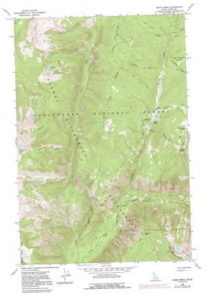
Cedar Ridge Topo Map Idaho
To zoom in, hover over the map of Cedar Ridge
USGS Topo Quad 46114c6 - 1:24,000 scale
| Topo Map Name: | Cedar Ridge |
| USGS Topo Quad ID: | 46114c6 |
| Print Size: | ca. 21 1/4" wide x 27" high |
| Southeast Coordinates: | 46.25° N latitude / 114.625° W longitude |
| Map Center Coordinates: | 46.3125° N latitude / 114.6875° W longitude |
| U.S. State: | ID |
| Filename: | o46114c6.jpg |
| Download Map JPG Image: | Cedar Ridge topo map 1:24,000 scale |
| Map Type: | Topographic |
| Topo Series: | 7.5´ |
| Map Scale: | 1:24,000 |
| Source of Map Images: | United States Geological Survey (USGS) |
| Alternate Map Versions: |
Cedar Ridge ID 1966, updated 1969 Download PDF Buy paper map Cedar Ridge ID 1966, updated 1981 Download PDF Buy paper map Cedar Ridge ID 1966, updated 1984 Download PDF Buy paper map Cedar Ridge ID 1966, updated 1991 Download PDF Buy paper map Cedar Ridge ID 1994, updated 1997 Download PDF Buy paper map Cedar Ridge ID 2011 Download PDF Buy paper map Cedar Ridge ID 2013 Download PDF Buy paper map |
| FStopo: | US Forest Service topo Cedar Ridge is available: Download FStopo PDF Download FStopo TIF |
1:24,000 Topo Quads surrounding Cedar Ridge
> Back to 46114a1 at 1:100,000 scale
> Back to 46114a1 at 1:250,000 scale
> Back to U.S. Topo Maps home
Cedar Ridge topo map: Gazetteer
Cedar Ridge: Lakes
Hoodoo Lake elevation 1763m 5784′Kidney Lake elevation 2069m 6788′
Cedar Ridge: Populated Places
Elk Summit elevation 1764m 5787′Cedar Ridge: Ridges
Cedar Ridge elevation 2096m 6876′Friday Ridge elevation 2275m 7463′
Goat Heaven Peaks elevation 2206m 7237′
Cedar Ridge: Springs
Diablo Spring elevation 2085m 6840′Cedar Ridge: Streams
Dolph Creek elevation 1046m 3431′Hoodoo Creek elevation 1690m 5544′
Horse Creek elevation 1749m 5738′
Muleshoe Creek elevation 1714m 5623′
Porphyry Creek elevation 1436m 4711′
Twomile Creek elevation 1514m 4967′
Cedar Ridge: Summits
Gateway Peak elevation 1915m 6282′Hoodoo Mountain elevation 2102m 6896′
Cedar Ridge digital topo map on disk
Buy this Cedar Ridge topo map showing relief, roads, GPS coordinates and other geographical features, as a high-resolution digital map file on DVD:


