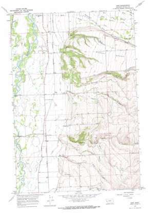
Bing Topo Map Montana
To zoom in, hover over the map of Bing
USGS Topo Quad 46114d1 - 1:24,000 scale
| Topo Map Name: | Bing |
| USGS Topo Quad ID: | 46114d1 |
| Print Size: | ca. 21 1/4" wide x 27" high |
| Southeast Coordinates: | 46.375° N latitude / 114° W longitude |
| Map Center Coordinates: | 46.4375° N latitude / 114.0625° W longitude |
| U.S. State: | MT |
| Filename: | o46114d1.jpg |
| Download Map JPG Image: | Bing topo map 1:24,000 scale |
| Map Type: | Topographic |
| Topo Series: | 7.5´ |
| Map Scale: | 1:24,000 |
| Source of Map Images: | United States Geological Survey (USGS) |
| Alternate Map Versions: |
Bing MT 1967, updated 1972 Download PDF Buy paper map Bing MT 1967, updated 1986 Download PDF Buy paper map Bing MT 1967, updated 1986 Download PDF Buy paper map Bing MT 1998, updated 2002 Download PDF Buy paper map Bing MT 2011 Download PDF Buy paper map Bing MT 2014 Download PDF Buy paper map |
| FStopo: | US Forest Service topo Bing is available: Download FStopo PDF Download FStopo TIF |
1:24,000 Topo Quads surrounding Bing
> Back to 46114a1 at 1:100,000 scale
> Back to 46114a1 at 1:250,000 scale
> Back to U.S. Topo Maps home
Bing topo map: Gazetteer
Bing: Benches
Sunset Bench elevation 1226m 4022′Bing: Canals
Union Ditch elevation 1025m 3362′Bing: Populated Places
Bell Crossing elevation 1016m 3333′Bing elevation 1020m 3346′
Cinnabar Court elevation 1019m 3343′
Etna (historical) elevation 1020m 3346′
Mountain Shadows Estates elevation 1021m 3349′
Victor Crossing elevation 1023m 3356′
Bing: Post Offices
Etna Post Office (historical) elevation 1020m 3346′Bing: Streams
Big Creek elevation 1008m 3307′Bunkhouse Creek elevation 1037m 3402′
North Birch Creek elevation 1037m 3402′
Robertson Creek elevation 1043m 3421′
South Burnt Fork Creek elevation 1145m 3756′
South Fork Willoughby Creek elevation 1179m 3868′
South Willoughby Creek elevation 1038m 3405′
Spooner Creek elevation 1031m 3382′
Willoughby Creek elevation 1003m 3290′
Bing: Valleys
Dry Gulch elevation 1037m 3402′Pine Hollow elevation 1058m 3471′
Treece Gulch elevation 1037m 3402′
Bing: Wells
07N20W02BDDA01 Well elevation 1083m 3553′07N20W03BA__01 Well elevation 1036m 3398′
07N20W04AA__01 Well elevation 1031m 3382′
07N20W09AB__01 Well elevation 1034m 3392′
08N19W06CC__01 Well elevation 1181m 3874′
08N19W07CBBD01 Well elevation 1188m 3897′
08N20W01DAAD01 Well elevation 1170m 3838′
08N20W01DABD01 Well elevation 1166m 3825′
08N20W02BB__01 Well elevation 1049m 3441′
08N20W03BA__01 Well elevation 1023m 3356′
08N20W03BD__02 Well elevation 1020m 3346′
08N20W05DC__01 Well elevation 1009m 3310′
08N20W10BB__01 Well elevation 1009m 3310′
08N20W14CB__01 Well elevation 1031m 3382′
08N20W15BA__01 Well elevation 1016m 3333′
08N20W16BADC01 Well elevation 1012m 3320′
08N20W21BA__01 Well elevation 1017m 3336′
08N20W23CDDD01 Well elevation 1082m 3549′
08N20W28AD__01 Well elevation 1023m 3356′
08N20W28BACD01 Well elevation 1020m 3346′
08N20W28BDBA01 Well elevation 1020m 3346′
08N20W28CC__01 Well elevation 1025m 3362′
08N20W28DC__01 Well elevation 1025m 3362′
09N19W31AA__02 Well elevation 1112m 3648′
09N20W34AB__01 Well elevation 1013m 3323′
09N20W34AB__04 Well elevation 1013m 3323′
09N20W34AC__01 Well elevation 1014m 3326′
Bing digital topo map on disk
Buy this Bing topo map showing relief, roads, GPS coordinates and other geographical features, as a high-resolution digital map file on DVD:


